- Fire Island Pines
-
Fire Island Pines 

Fire Island Pines Lage in New YorkBasisdaten Staat: Vereinigte Staaten Bundesstaat: New York County: Koordinaten: 40° 40′ N, 73° 4′ W40.665277777778-73.068333333333Koordinaten: 40° 40′ N, 73° 4′ W Zeitzone: Eastern Standard Time (UTC−5) Einwohner: 12 (Stand: 2004) Postleitzahl: 11782 Vorwahl: +1 631 Fire Island Pines ist ein Weiler in der Gemeinde Brookhaven in Suffolk County, New York. Es befindet sich auf Fire Island, einer Nehrungsinsel auf der Südseite von Long Island. Die Volkszählung im Jahr 2000 ergab für die Insel Fire Island eine Bevölkerungszahl von 310 Einwohnern. Dies stellt jedoch nur die Zahl der ganzjährigen Einwohner dar; als Ferienort ist die Zahl der Sommergäste (insbesondere an den Wochenenden) deutlich größer.
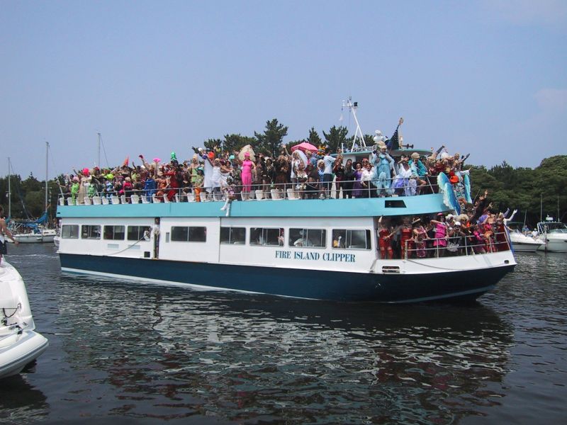
Fire Island Pines wird liebevoll „Chelsea mit Sand“ genannt. (Chelsea ist als Schwulenviertel in Manhattan bekannt.) Mit dem benachbarten Weiler Cherry Grove zusammen, bildet Fire Island Pines das Lesben- und Schwulenviertel von Fire Island. Die großen Häuser werden in der Regel von mehreren Parteien als Ferienwohnung angemietet, so dass zum Beispiel ein 5 ZKB Haus in der Regel von 8 Erwachsenen bewohnt wird. Der überwiegende Anteil der Bevölkerung setzt sich aus Schwulen zwischen 20 und 50 Jahren zusammen. Zwei der berühmtesten Ereignisse in den Pines sind die Pines Party, eine Tanzparty jeden August, die am Strand abgehalten wird, und die ganze Nacht durchgeht, sowie die Invasion of the Pines, eine Parade von Drag Queens, die jedes Jahr am 4. Juli (dem US-amerikanischen Nationalfeiertag) abgehalten wird.
-

Strand bei Fire Island Pines
-

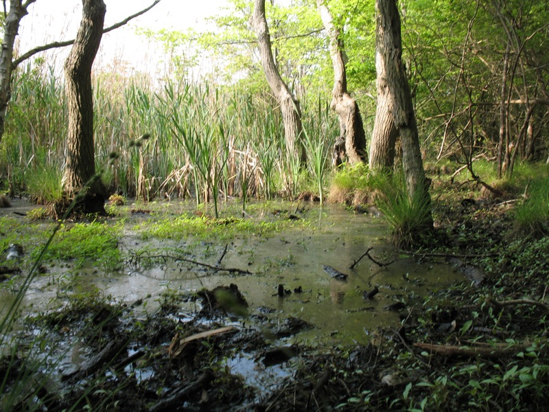
Versunkener Wald zwischen Pines und Cherry Grove
-

Invasion of the Pines 2001
Orte in der Town of BrookhavenVillages: Belle Terre | Bellport | Lake Grove | Old Field | Patchogue | Poquott | Port Jefferson | Shoreham
Hamlets: Blue Point | Brookhaven | Calverton | Canaan Lake | Center Moriches | Centereach | Cherry Grove | Coram | Crystal Brook | Cupsogue Beach | Davis Park | East Moriches | East Patchogue | East Setauket | East Shoreham | Eastport | Farmingville | Fire Island Pines | Gordon Heights | Hagerman | Holbrook | Holtsville | Lake Ronkonkoma | Manorville | Mastic | Mastic Beach | Medford | Middle Island | Miller Place | Moriches | Mount Sinai | North Bellport | North Patchogue | Ocean Bay Park | Point of Woods | Port Jefferson Station | Ridge | Rocky Point | Ronkonkoma | Selden | Setauket | Shirley | Sound Beach | South Haven | Stony Brook | Strongs Neck | Terryville | Upton | Wading River | Water Island | West Manor | Yaphank
Wikimedia Foundation.
Schlagen Sie auch in anderen Wörterbüchern nach:
Fire Island Pines — Cherry Grove Área no incorporada de los Estados Unidos Marina de Fire Island Pines … Wikipedia Español
Fire Island Pines, New York — Infobox Settlement official name = Fire Island Pines, New York settlement type = Hamlet nickname = motto = imagesize = 250px image caption = The marina from the west side shops area looking east caption= image pushpin pushpin label position =… … Wikipedia
Fire Island — Situation de Fire Island. Géographie Pays … Wikipédia en Français
Fire Island, New York — Infobox Settlement official name = Fire Island, New York settlement type = CDP nickname = motto = imagesize = image caption = image mapsize = 250x200px map caption = Fire Island mapsize1 = map caption1 = subdivision type = Country subdivision… … Wikipedia
Fire Island — Im Vordergrund Fire Island, im Hintergrund Long Island … Deutsch Wikipedia
Fire Island National Seashore — Infobox Protected area name = Fire Island National Seashore iucn category = V caption = locator x = 258 locator y = 63 location = Fire Island, New York, USA nearest city = Islip, New York lat degrees = 40 lat minutes = 41 lat seconds = 47 lat… … Wikipedia
Invasion of the Pines — During the summer of 1976, a restaurant in Fire Island Pines, New York, denied entry to a visitor in drag named Terry Warren. Fire Island Pines is a beach community on Fire Island east of New York City with a gay majority population that was at… … Wikipedia
Middle Island, New York — CDP U.S. Census Map … Wikipedia
List of references to Long Island places in popular culture — Below is a list of references to Long Island locations in popular culture. Books *F. Scott Fitzgerald s The Great Gatsby takes place on the North Shore of Long Island. *Several books by Nelson DeMille, including Plum Island , The Gold Coast , The … Wikipedia
Fire lookout tower — A fire lookout tower, fire tower or lookout tower, provides housing and protection for a person known as a fire lookout whose duty it is to search for fire in the wilderness. The fire lookout tower is a small building usually located on the… … Wikipedia
-
Fire Island Pines


18+
© Academic, 2000-2024
- Kontaktieren Sie uns: Unterstützung, Werbung
Wörterbücher Export, schritte mit PHP, Joomla, Drupal, WordPress, MODx.