Gilgandra Shire

Gilgandra Shire
Shire of Gilgandra
Australia-Map-NSW-LGA-Gilgandra.png
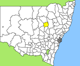
Lage des Gilgandra Shire in New South Wales
Gliederung
Staat: Australien Australien
Bundesstaat: Flag of New South Wales.svg New South Wales
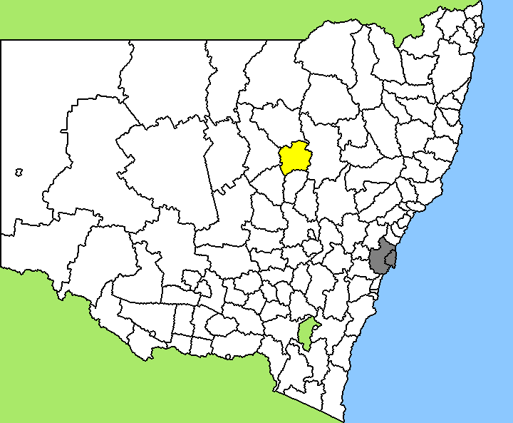
Verwaltungssitz: Gilgandra
Daten und Zahlen
Fläche: 4.836 km²
Einwohner: 4.522 (2006) [1]
Bevölkerungsdichte: 0,9 Einwohner je km²
-31.7148.68333333333

Gilgandra Shire ist ein lokales Verwaltungsgebiet (LGA) im australischen Bundesstaat New South Wales. Das Gebiet ist 4.836 km² groß und hat etwa 4.500 Einwohner.

Gilgandra liegt in der North-Western-Region des Staates etwa 440 km nordwestlich der Metropole Sydney. Das Gebiet umfasst 23 Ortsteile und Ortschaften: Armatree, Balladoran, Bearbong, Bearbung, Berida, Biddon, Boyben, Breelong, Bringle, Curban, Gilgandra, Innisfail, Kamber, Kickabil, New Merrigal, Pibbon, Tooraweenah, Wallumburrawong, Windurong, Woodlands und Teile von Collie, Gulargambone und Mendooran. Der Sitz des Shire Councils befindet sich in Gilgandra, wo etwa 2.700 Einwohner leben.

Verwaltung

Der Gilgandra Shire Council hat neun Mitglieder, die von den Bewohnern der LGA gewählt werden. Gilgandra ist nicht in Bezirke untergliedert. Aus dem Kreis der Councillor rekrutiert sich auch der Mayor (Bürgermeister) des Councils.

Weblinks

Einzelnachweise

  1. Australian Bureau of Statistics (25. Oktober 2007): Gilgandra (A) (Local Government Area) (Englisch). 2006 Census QuickStats. Abgerufen am 6. April 2010.

Wikimedia Foundation.

Игры ⚽ Поможем написать реферат

Schlagen Sie auch in anderen Wörterbüchern nach:

  • Gilgandra Shire Council — Infobox Australian Place | type = lga name = Gilgandra Shire state = nsw caption = Location in New South Wales pop = 4,712 density = 0.97 area = 4836 est = seat = Gilgandra (Warren Road) mayor = Warwick Moppett region = Orana url =… …   Wikipedia

  • Gilgandra — Hauptstraße Staat …   Deutsch Wikipedia

  • Gilgandra, New South Wales — Infobox Australian Place | type = town name = Gilgandra state = nsw caption = Cooee marchers of 1915 lga = Shire of Gilgandra postcode = 2827 pop = 2,718 (2001 census) est = 1888 elevation= 282 maxtemp = 24.7 mintemp = 9.9 rainfall = 557.2 dist1 …   Wikipedia

  • Gilgandra — /gɪlˈgændrə/ (say gil gandruh) noun a town and shire on the central western slopes of NSW on the Castlereagh River, north of Dubbo. {Australian Aboriginal} …  

  • Wakool Shire — Shire of Wakool New South Wales Location in New South Wales Population: 4,427(2009) …   Wikipedia

  • Coonamble Shire — New South Wales Location in New South Wales Population …   Wikipedia

  • Narromine Shire — Narromine New South Wales Location in New South Wales Population: 6,818(2009) …   Wikipedia

  • Muswellbrook Shire — New South Wales Location in New South Wales Population …   Wikipedia

  • Conargo Shire — New South Wales Location in New South Wales Population: 1,700(2009) …   Wikipedia

  • Cowra Shire — New South Wales Location in NSW Population: 12,945(2009) …   Wikipedia

Share the article and excerpts

Direct link
Do a right-click on the link above
and select “Copy Link”