Grafton County (New Hampshire)

Grafton County (New Hampshire)
Verwaltung
US-Bundesstaat: New Hampshire
Verwaltungssitz: Haverhill
Adresse des
Verwaltungssitzes:
Gründung: 1769
Gebildet aus: {{{GEBILDET_AUS}}}
Vorwahl:
Demographie
Einwohner: 81.743  (2000)
Bevölkerungsdichte: 18,4 Einwohner/km²
Geographie
Fläche gesamt: 4.533 km²
Wasserfläche: 95 km²
Karte
Karte von Grafton County innerhalb von New Hampshire

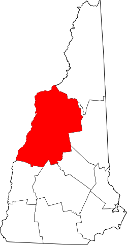
Grafton County ist ein County im US-Bundesstaat New Hampshire, Vereinigte Staaten. Hier leben 81.743 Menschen. Der Sitz der Countyverwaltung (County Seat) ist in North Haverhill.

Inhaltsverzeichnis

Geographie

Die County hat eine Fläche von 4533 km². Land sind 4438 km² und Wasser 95 km² (2,1 %)

Bevölkerungsentwicklung

1980 1990 2000 2005
65.731 74.929 81.743 84.708

Nachbarcountys

Städte und Gemeinden

Grafton County teilt sich in eine city und 37 towns, beide Begriffe werden ins Deutsche mit Stadt übersetzt.

cities

towns

  • Alexandria
  • Ashland
  • Bath
  • Benton
  • Bethlehem
  • Bridgewater
  • Bristol
  • Campton
  • Canaan
  • Dorchester
  • Easton
  • Ellsworth
  • Enfield
  • Franconia
  • Grafton
  • Hanover
  • Haverhill
  • Hebron
  • Holderness
  • Landaff
  • Lincoln
  • Lisbon
  • Littleton
  • Lyman
  • Lyme
  • Monroe
  • Orange
  • Orford
  • Piermont
  • Plymouth
  • Rumney
  • Sugar Hill
  • Thornton
  • Warren
  • Waterville Valley
  • Wentworth
  • Woodstock


43.93-71.847Koordinaten: 43° 56′ N, 71° 50′ W


Wikimedia Foundation.

Игры ⚽ Поможем решить контрольную работу

Schlagen Sie auch in anderen Wörterbüchern nach:

  • Grafton County, New Hampshire — Infobox U.S. County county = Grafton County state = New Hampshire map size = 100 founded year = 1769 seat wl = Haverhill largest city wl = Lebanon area total sq mi =1750 area total km2 = area land sq mi =1713 area land km2 = area water sq mi =37… …   Wikipedia

  • National Register of Historic Places listings in Grafton County, New Hampshire — Location of Grafton County in New Hampshire This is a list of the National Register of Historic Places listings in Grafton County, New Hampshire. This is intended to be a complete list of the properties and districts on the National Register of… …   Wikipedia

  • Historical U.S. Census Totals for Grafton County, New Hampshire — This article shows U.S. Census totals for Grafton County, New Hampshire, broken down by municipality, from 1900 to 2000.Most areas of New England are entirely divided into incorporated municipalities, with no unincorporated territory. In the… …   Wikipedia

  • List of Registered Historic Places in Grafton County, New Hampshire — List of Registered Historic Places in Grafton County, New Hampshire. ee also* List of Registered Historic Places in New HampshireReferences …   Wikipedia

  • Coös County, New Hampshire — Coos County, New Hampshire Location in the state of New Hampshire …   Wikipedia

  • Coos County, New Hampshire — Infobox U.S. County county = Coos County state = New Hampshire map size = 125 founded = 1803 seat = Lancaster | area total sq mi =1831 area land sq mi =1800 area water sq mi =31 area percentage = 1.70% census yr = 2000 pop = 33111 density km2 =7… …   Wikipedia

  • Carroll County (New Hampshire) — Verwaltung US Bundesstaat: New Hampshire Verwaltungssitz: Ossipee Gründung: 1840 Demographie Einwohner: 43.666 …   Deutsch Wikipedia

  • Coos County (New Hampshire) — Verwaltung US Bundesstaat: New Hampshire Verwaltungssitz: Lancaster Adresse des Verwaltungssitzes: Gründung …   Deutsch Wikipedia

  • Merrimack County, New Hampshire — Location in the state of New Hampshire …   Wikipedia

  • Belknap County (New Hampshire) — Verwaltung US Bundesstaat: New Hampshire Verwaltungssitz: Laconia Adresse des Verwaltungssitzes: Gründung …   Deutsch Wikipedia

Share the article and excerpts

Direct link
Do a right-click on the link above
and select “Copy Link”