- Hachimantai
-
Hachimantai-shi
八幡平市

Geographische Lage in Japan Region: Tōhoku Präfektur: Iwate Koordinaten: 39° 56′ N, 141° 6′ O39.926388888889141.09527777778Koordinaten: 39° 55′ 35″ N, 141° 5′ 43″ O Basisdaten Fläche: 862,25 km² Einwohner: 28.266
(1. Oktober 2011)Bevölkerungsdichte: 33 Einwohner je km² Gemeindeschlüssel: 03214-0 Rathaus Adresse: Hachimantai City Hall
35-62, Ōbuke
Hachimantai-shi
Iwate 028-7192Webadresse: http://www.city.hachimantai.lg.jp Lage Hachimantais in der Präfektur Iwate 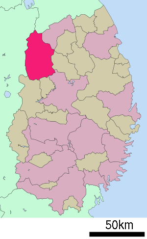
Hachimantai (jap. 八幡平市, -shi) ist eine Stadt in der Präfektur Iwate auf Honshū, der Hauptinsel von Japan.
Inhaltsverzeichnis
Geschichte
Die Stadt Hachimantai wurde am 1. September 2005 aus den ehemaligen Gemeinden Nishine, Matsuo und Ashiro gegründet.
Verkehr
- Straße:
- Zug:
- JR Hanawa-Linie
Angrenzende Städte und Gemeinden
Städtepartnerschaften
 Altenmarkt im Pongau, seit 1994[1][2]
Einzelnachweise
- ↑ Ursprünglich mit Matsuo.
- ↑ Japan-Austria 2009, Sister City. Österreichische Botschaft Tokio, abgerufen am 13. Januar 2009.
Weblinks
 Commons: Hachimantai – Sammlung von Bildern, Videos und Audiodateien
 Gemeinden und Landkreise in der Präfektur Iwate
Kreisfreie Städte (shi): Hachimantai | Hanamaki | Ichinoseki | Kamaishi | Kitakami | Kuji | Miyako | Morioka (Verwaltungssitz) | Ninohe | Ōfunato | Ōshū | Rikuzentakata | Tōno
Higashiiwai-gun: Fujisawa | Isawa-gun: Kanegasaki | Iwate-gun: Iwate | Kuzumaki | Shizukuishi | Takizawa | Kamihei-gun: Ōtsuchi | Kesen-gun: Sumita | Kunohe-gun: Karumai | Kunohe | Noda | Hirono | Ninohe-gun: Ichinohe | Nishiiwai-gun: Hiraizumi | Shimohei-gun: Fudai | Iwaizumi | Tanohata | Yamada | Shiwa-gun: Shiwa | Yahaba | Waga-gun: Nishiwaga
Wikimedia Foundation.
Schlagen Sie auch in anderen Wörterbüchern nach:
Hachimantai Rising Sun Hotel — (Hachimantai,Япония) Категория отеля: 3 звездочный отель Адрес: 028 730 … Каталог отелей
Hachimantai Royal Hotel — (Hachimantai,Япония) Категория отеля: 3 звездочный отель Адрес: 805 0002 Ива … Каталог отелей
Hachimantai, Iwate — Hachimantai (八幡平市; shi) is a city located in Iwate, Japan.The city was founded on September 1, 2005 from the merger of the towns of Ashiro and Nishine and the village of Matsuo, all from Iwate District.As of its founding, the city has an… … Wikipedia
Matsuo-Hachimantai Station — 松尾八幡平駅 Matsuo Hachimantai Station Location Prefecture … Wikipedia
Parc national de towada-hachimantai — 十和田八幡平国立公園 Catégorie II de la CMAP (Parc national) Emplacement Honshū (Japon) Coordonnées … Wikipédia en Français
Parc national de Towada-Hachimantai — 十和田八幡平国立公園 Catégorie UICN II (parc national) Emplacement Honshū (Japon) Coordonnées … Wikipédia en Français
11108 Hachimantai — Infobox Planet minorplanet = yes width = 25em bgcolour = #FFFFC0 apsis = name = Hachimantai symbol = caption = discovery = yes discovery ref = discoverer = T. Kobayashi discovery site = Oizumi discovered = October 27, 1995 designations = yes mp… … Wikipedia
Mount Hachimantai — 八幡平 … Wikipedia
Towada-Hachimantai National Park — Infobox protected area | name = Towada Hachimantai National Park iucn category = II caption = locator x = locator y = location = Honshū, Japan nearest city = lat degrees = lat minutes = lat seconds = lat direction = long degrees = long minutes =… … Wikipedia
Towada-Hachimantai-Nationalpark — [ hatʃi ], Nationalpark im Norden von Honshū, Japan, 834 km2; Bergland mit dem Calderavulkan Hakkōda (1 585 m über dem Meeresspiegel) und dem in einer Caldera gelegenen Towadasee (60 km2); heiße Quellen; Wintersportgebiet … Universal-Lexikon
Hachimantai


18+
© Academic, 2000-2024
- Kontaktieren Sie uns: Unterstützung, Werbung
Wörterbücher Export, schritte mit PHP, Joomla, Drupal, WordPress, MODx.