- Hagerman (New Mexico)
-
Hagerman 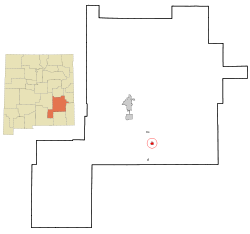 Lage in New Mexico
Basisdaten Staat: Vereinigte Staaten Bundesstaat: New Mexico County: Koordinaten: 33° 7′ N, 104° 20′ W33.112222222222-104.328888888891043Koordinaten: 33° 7′ N, 104° 20′ W Zeitzone: Mountain Standard Time (UTC−7) Einwohner: 1168 (Stand: 2000) Bevölkerungsdichte: 324,4 Einwohner je km² Fläche: 3,6 km² (ca. 1 mi²) Höhe: 1043 m Postleitzahl: 88232 Vorwahl: +1 505 FIPS: 35-31330 GNIS-ID: 0923608 Hagerman ist eine Ortschaft 25 km südlich von Roswell (New Mexico) im Chaves County des US-amerikanischen Bundesstaates New Mexico; von den etwa 1.150 Einwohnern (Stand 2003) sind zwei Drittel lateinamerikanischer Herkunft.
Hagerman entstand 1894 beim Bau der Pecos Valley and Northeaster Railroad am Rande der Trasse; ursprünglich nach dem nahegelegenen Felix River, einem Nebenfluss des Pecos Rivers, Felix genannt, wurde der Ort bald zu Ehren J. J. Hagermans, dem Erbauer der Eisenbahnlinie, umbenannt.
Hagerman liegt an der New Mexico State Route 2.
Persönlichkeiten
In Hagerman geboren wurde:
- John A. Samford (1905–1968), US-amerikanischer Militär und Direktor des NSA
Kategorie:- Ort in New Mexico

Wikimedia Foundation.