- Allardyce Range
-
Allardyce Range 
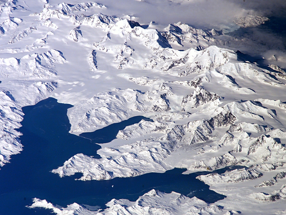
Zentralsüdgeorgien: Cumberland Bay; Thatcher-Halbinsel mit King Edward Cove (Grytviken); Allardyce Range mit dem Gipfel Mt. Paget (NASA-Bild).
Höchster Gipfel Mount Paget (2.935 m) Lage Südgeorgien 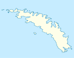

Koordinaten 54° 26′ S, 36° 33′ W-54.433011111111-36.5489388888892935Koordinaten: 54° 26′ S, 36° 33′ W Die Allardyce Range ist ein Gebirgszug, der sich südlich der Cumberland Bay erhebt und den mittleren Teil Südgeorgiens dominiert. Der höchste Gipfel ist der Mount Paget (2.935m), der gleichzeitig der höchste Punkt im ganzen Territorium des Vereinigten Königreichs ist. Ein weiterer bedeutender Gipfel ist der Mount Roots.
Obwohl weder James Cook (1775) noch Fabian Gottlieb von Bellingshausen (1819) die Berge in ihre Karten von Südgeorgien einzeichneten, haben die Forscher sie zweifellos gesehen. Benannt wurden sie um 1915 nach Sir William L. Allardyce, dem Gouverneur der Falklandinseln von 1904 bis 1914.
Kategorien:- Geographie (Südgeorgien und die Südlichen Sandwichinseln)
- Gebirge in Südamerika

Wikimedia Foundation.