Hirvensalo

Hirvensalo

Vorlage:Infobox Insel/Wartung/Bild fehltVorlage:Infobox Insel/Wartung/Höhe fehlt

Hirvensalo
Gewässer Schärenmeer
Geographische Lage 60° 24′ 20,62″ N, 22° 12′ 23,67″ O60.40572777777822.206575Koordinaten: 60° 24′ 20,62″ N, 22° 12′ 23,67″ O
Hirvensalo (Finnland)
Hirvensalo
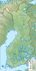
Fläche 12,8 km²
Lage von Hirvensalo in Turku

Hirvensalo [ˈhirvɛnsɑlɔ] ist eine 12,8 km² große Insel im Schärenmeer vor der Südwestküste Finnlands. Sie gehört zur Stadt Turku und ist unmittelbar deren Stadtzentrum vorgelagert. Von den Inseln Ruissalo im Norden sowie Satava und Kakskerta im Süden ist Hirvensalo ebenfalls nur durch schmale Sunde getrennt. Im Westen liegt die offene Seefläche Airisto.

Hirvensalo war lange dünn besiedelt und mit Laubwäldern bedeckt. Vor allem seit den 1980er Jahren sind auf der Insel neue Wohngebiete entstanden, so dass Hirvensalo einen vorstädtischen Charakter entwickelt hat und heute rund 7000 Einwohner zählt. Hirvensalo gehört zum Stadtbezirk Hirvensalo-Kakskerta und unterteilt sich in die Stadtteile Friskala, Haarla, Illoinen, Jänessaari, Kaistarniemi, Kukola, Lauttaranta, Maanpää, Moikoinen, Oriniemi, Papinsaari, Pikisaari, Särkilahti und Toijainen.

Die erste urkundliche Erwähnung von Hirvensalo stammt aus dem Jahr 1336. Ursprünglich gehörte die Insel als Exklave zur nördlich von Turku gelegenen Gemeinde Maaria. 1944 wurde Hirvensalo in Turku eingemeindet.


Wikimedia Foundation.

Игры ⚽ Нужно решить контрольную?

Schlagen Sie auch in anderen Wörterbüchern nach:

  • Hirvensalo — is an island in the Archipelago Sea, belonging to the city of Turku, Finland. It is divided into 14 districts, the largest ones being Moikoinen, Kukola and Haarla. Most of the island s economic activity is concentrated on the suburb of Moikoinen …   Wikipedia

  • Hirvensalo — 60° 24′ 21″ N 22° 12′ 24″ E / 60.4057, 22.2066 Hirvensalo est u …   Wikipédia en Français

  • Hirvensalo-Kakskerta — is a ward (Finnish suuralue , Swedish storområde ) of Turku, Finland, also known as Ward 2. The ward consists of the islands of Hirvensalo, Satava and Kakskerta, as well as some smaller islands, in the Archipelago Sea off the city s coastline.By… …   Wikipedia

  • Pääskyvuoren linkkitorni — Turun kaupunki Åbo stad Wappen Karte Basisdaten Staat …   Deutsch Wikipedia

  • Åbo — Turun kaupunki Åbo stad Wappen Karte Basisdaten Staat …   Deutsch Wikipedia

  • Oriniemi — on a map of Turku. Oriniemi is a district of the city of Turku, in Finland. It is located in the southwestern part of the island of Hirvensalo, off the city s coastline. The district also includes the island of Nepo between Hirvensalo and Satava …   Wikipedia

  • Turku — Turun kaupunki Åbo stad Wappen Karte Basisdaten Staat …   Deutsch Wikipedia

  • Turku — Infobox Settlement official name = City of Turku native name = Turun kaupunki – Åbo stad nickname = motto = imagesize = 320 px image caption = image shield = Turku.vaakuna.svg image dot dot x = 167 dot y = 88 dot map caption = Location of Turku… …   Wikipedia

  • Post correspondence problem — The Post correspondence problem is an undecidable decision problem that was introduced by Emil Post in 1946.[1] Because it is simpler than the halting problem and the Entscheidungsproblem it is often used in proofs of undecidability. Contents 1… …   Wikipedia

  • Maaria — ( S:t Marie in Swedish) is a former municipality of Finland in what is now the northern part of the city of Turku. The area has been inhabited since the Iron Age, and it became an important village in the 15th century with the construction of a… …   Wikipedia

Share the article and excerpts

Direct link
Do a right-click on the link above
and select “Copy Link”