Kräsuli

Kräsuli

Vorlage:Infobox Insel/Wartung/Bild fehltVorlage:Infobox Insel/Wartung/Höhe fehlt

Kräsuli
Gewässer Finnischer Meerbusen
Geographische Lage 59° 34′ 20″ N, 24° 47′ 10″ O59.57222222222224.786111111111Koordinaten: 59° 34′ 20″ N, 24° 47′ 10″ O
Lage von Kräsuli
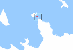
Fläche 0,17 km²

Kräsuli (schwedisch: Gräsö) ist eine Insel in der Ostsee, gelegen vor der Nordküste Estlands im Finnischen Meerbusen. Sie liegt zwischen der Halbinsel Viimsi und der Insel Aegna.

Der schwedische Name bedeutet Grasinsel. Als historische Formen sind Grääs Öen, Gräsör und Gräsgrund überliefert. Sie wird von Esten in direkter Übersetzung manchmal Rohusaar genannt.

Die Fläche beträgt 17 Hektar. Die Insel ist flach und bewaldet. Auf ihr befinden sich einige Sommerhäuser. Sie gehört verwaltungsmäßig zur Gemeinde Viimsi (Landkreis Harjumaa).

Weblinks

  • Bilder von Kräsuli und Aegna (estnisch)

Literatur

  • Heino Gustavson: Aegna. Tallinn, 1998

Wikimedia Foundation.

Игры ⚽ Поможем написать курсовую

Schlagen Sie auch in anderen Wörterbüchern nach:

  • Liste der Inseln Estlands — Die Liste der Inseln Estlands gibt einen Überblick über zahlreiche kleine und große Inseln. Vor der estnischen Ostseeküste liegen 1520 Inseln, von denen aber nur 19 bewohnt sind.Die größte ist Saaremaa. Die größten Inseln Estlands… …   Deutsch Wikipedia

  • Saaremaa — This article is about the island. For the village in Võru County, see Saaremaa, Võru County. Saaremaa …   Wikipedia

  • Hiiumaa — Tahkuna peninsula is the most northern part of Hiiumaa Geography …   Wikipedia

  • List of islands of Estonia — This is a list of islands of Estonia. There are 1521 islands. This is not a complete list. CompactTOC10|sections= A B C D E F G H I J K L M N O P Q R S Š Z Ž T U V W Õ Ä Ö Ü X YAAbruka Adralaid Aegna (Wulf) Ahelaid Aherahu (Atla) Aherahu Ahessäär …   Wikipedia

  • Vormsi — Estonia s fourth largest island, Vormsi (German: Worms, Swedish: Ormsö), is located between Hiiumaa and the mainland with a total area of 93 square kilometers. It is part of a rural municipality Vormsi Parish. From mainland, Vormsi is separated… …   Wikipedia

  • Muhu — (German: Mohn/Moon; in Estonian also called Muhumaa), is an island in the Baltic Sea. With an area of 198 km² it is the third largest island belonging to Estonia, after Saaremaa and Hiiumaa. Together with neighbouring smaller islands of… …   Wikipedia

  • Naissaar — from the air Viimsi parish Naissaar …   Wikipedia

  • Osmussaar — Limestone cliff on the east coast of Osmussaar Geography Location …   Wikipedia

  • Manilaid — Manija   village   Manilaid in the Gulf of Riga. Coord …   Wikipedia

  • Noogimaa — is a small, uninhabited Estonian island in the Baltic Sea. Its coordinates are: 58°22′09″N 21°54′45″E / 58.36917°N 21.9125°E / 58.36917; 21.9125. Noogimaa lies just south of the is …   Wikipedia

Share the article and excerpts

Direct link
Do a right-click on the link above
and select “Copy Link”