La Chapelle-des-Marais

La Chapelle-des-Marais
Wappen von La Chapelle-des-Marais
La Chapelle-des-Marais (Frankreich)
La Chapelle-des-Marais
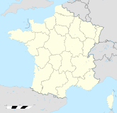
Region Pays de la Loire
Département Loire-Atlantique
Arrondissement Saint-Nazaire
Kanton Herbignac
Koordinaten 47° 27′ N, 2° 15′ W47.447222222222-2.24166666666674Koordinaten: 47° 27′ N, 2° 15′ W
Höhe 4 m (0–11 m)
Fläche 18,05 km²
Einwohner 3.514 (1. Jan. 2008)
Bevölkerungsdichte 195 Einw./km²
Postleitzahl 44410
INSEE-Code
Website http://www.chapelledesmarais.com/

La Chapelle-des-Marais ist eine französische Gemeinde mit 3514 Einwohnern (Stand 1. Januar 2008) im Département Loire-Atlantique in der Region Pays de la Loire. Die Gemeinde liegt im Regionalen Naturpark Brière (französisch Parc naturel régional de Brière).

Weblinks


Wikimedia Foundation.

Игры ⚽ Поможем решить контрольную работу

Schlagen Sie auch in anderen Wörterbüchern nach:

  • La Chapelle-des-Marais — Pour les articles homonymes, voir La Chapelle. 47° 26′ 53″ N 2° 14′ 25″ W …   Wikipédia en Français

  • La Chapelle-Des-Marais — Pour les articles homonymes, voir La Chapelle. La Chapelle des Marais …   Wikipédia en Français

  • La chapelle-des-marais — Pour les articles homonymes, voir La Chapelle. La Chapelle des Marais …   Wikipédia en Français

  • La Chapelle-des-Marais — Escudo …   Wikipedia Español

  • La Chapelle-des-Marais — Original name in latin La Chapelle des Marais Name in other language Chapel ar Geuniou, Chapel ar Geunio La Chapelle, La Chapelle des Marais, La Reunion, La Runion State code FR Continent/City Europe/Paris longitude 47.44845 latitude 2.23834… …   Cities with a population over 1000 database

  • La Chapelle-des-Marais — is a town and commune in the Loire Atlantique département of north western France.ee also*Communes of the Loire Atlantique department …   Wikipedia

  • Football Club de La Chapelle-des-Marais — Infobox club sportif FC La Chapelle des Marais Pas de logo ? Importez le logo de ce club. Généralités Nom complet Football Club de La …   Wikipédia en Français

  • Chapelle des Buis (monument) — 47° 13′ 06″ N 6° 02′ 47″ E / 47.218198, 6.046343 …   Wikipédia en Français

  • Chapelle des Carmes-Déchaussés — Présentation Date de construction XVIIIe siècle Propriétaire Propriété de la commune Protection &# …   Wikipédia en Français

  • Saint-Jean-des-Marais (Morbihan) — Saint Jean la Poterie Saint Jean la Poterie Administration Pays France Région Bretagne Département Morbihan Arrondissement Vannes Canton …   Wikipédia en Français

Share the article and excerpts

Direct link
Do a right-click on the link above
and select “Copy Link”