Lake Wairarapa

Lake Wairarapa
Lake Wairarapa
Blick von Westen in Richtung Aorangi Range
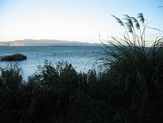
Geographische Lage South-Wairarapa-Distrikt, Wellington, Neuseeland
Zuflüsse Ruamahanga River
Abfluss Ruamahanga River
Größere Städte in der Nähe Masterton, Lower Hutt, Featherston
Daten
Koordinaten 41° 12′ 47″ S, 175° 14′ 32″ O-41.213055555556175.24222222222Koordinaten: 41° 12′ 47″ S, 175° 14′ 32″ O
Lake Wairarapa (Neuseeland)
Lake Wairarapa
Fläche 78 km²dep1f5
Maximale Tiefe 2,5 mdep1f10
Besonderheiten

drittgrößter See der Nordinsel (nach Lake Taupo und Lake Rotorua)

Lake Wairarapa ist ein See im Süden der Nordinsel Neuseelands im gleichnamigen Gebiet Wairarapa.
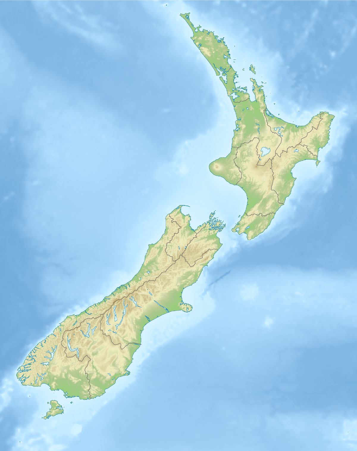
Lage des Sees

Er befindet sich im South-Wairarapa-Distrikt innerhalb der Region Wellington etwa 50 Kilometer östlich von Wellington. Mit einer Fläche von 78 km² ist er der drittgrößte See auf der Nordinsel. Die nächstgelegene Stadt ist Featherston und liegt etwa 5 Kilometer nördlich.

Der See wird durch mehrere Flüsse gespeist. Der wichtigste Zufluss war der Ruamahanga River der zugleich auch den bedeutendsten Abfluss darstellt. Er wurde jedoch um den Fluss herumgeleitet und fließt heute östlich des Sees. Nur etwa 10 Kilometer südlich des Sees mündet der Fluss an der Palliser Bay in die Cookstraße. Das Einzugsgebiet ist groß und umfasst auch Teile der Rimutaka und der Tararua Range.

Die Umgebung des Sees ist sumpfig und bildet einen Naturraum, der seltene Wasservögel und Fische umfasst. Die Maori nutzten dieses Gebiet seit langer Zeit um hier leicht Nahrung zu finden.

Weblink


Wikimedia Foundation.

Игры ⚽ Поможем написать курсовую

Schlagen Sie auch in anderen Wörterbüchern nach:

  • Lake Wairarapa — Infobox lake lake name = Lake Wairarapa image lake = caption lake = image bathymetry = caption bathymetry = location = South Wairarapa District, Wellington Region, North Island coords = coord|41|13|S|175|15|E|region:NZ… …   Wikipedia

  • Lake Rotorua — Geographische Lage Rotorua Distrikt, Bay of Plenty, Neuseeland Zuflüsse Ngongotaha River, Utahina, Awahou …   Deutsch Wikipedia

  • Wairarapa — for the electorate see Wairarapa (NZ electorate) Wairarapa pronounced Wy ra ra pa , (often known as The Wairarapa ) is a geographical region of New Zealand. It occupies the south eastern corner of the North Island, east of metropolitan Wellington …   Wikipedia

  • Wairarapa — geografische Region Wairarapa Karte Wairarapa ist der Name einer landschaftlichen Region im Süden der Nordinsel Neuseelands …   Deutsch Wikipedia

  • Wairarapa Line — Infobox rail line logo = name = Wairarapa Line image width = 250px caption = Woodside Railway Station on the Wairarapa Line type = Secondary line system = status = Open for passengers and freight locale = Wellington regions Manawatu Wanganui… …   Wikipedia

  • South Wairarapa District — Infobox Settlement name=South Wairarapa District settlement type=Territorial authority of New Zealand total type=Total mapsize=200px subdivision type= Country subdivision name= NZL subdivision type1= Region subdivision name1= Wellington… …   Wikipedia

  • South-Wairarapa-Distrikt — South Wairarapa District Council Karte Basisdaten Region …   Deutsch Wikipedia

  • North Island Fault System — Major active fault zones of New Zealand showing variation in displacement vector of Pacific Plate relative to Australian Plate along the boundary …   Wikipedia

  • Port Nick — Wellington Spitzname: Windy Wellington Lage …   Deutsch Wikipedia

  • WGN — Wellington Spitzname: Windy Wellington Lage …   Deutsch Wikipedia

Share the article and excerpts

Direct link
Do a right-click on the link above
and select “Copy Link”