- Lee County (Mississippi)
-
Verwaltung US-Bundesstaat: Mississippi Verwaltungssitz: Tupelo Adresse des
Verwaltungssitzes:County Courthouse
P.O. Box 1785
Tupelo, MS 38802-1785Gründung: 26. Oktober 1866 Gebildet aus: Itawamba County
Pontotoc CountyVorwahl: 001 662 Demographie Einwohner: 82.910 (2010) Bevölkerungsdichte: 71,2 Einwohner/km² Geographie Fläche gesamt: 1.174 km² Wasserfläche: 9 km² Karte 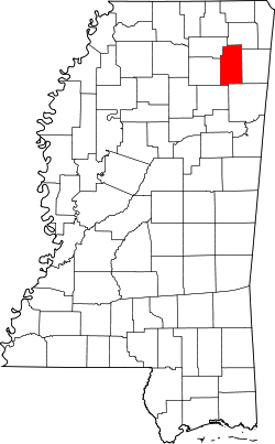
Das Lee County[2] ist ein County im Bundesstaat Mississippi in den Vereinigten Staaten von Amerika. Bei der Volkszählung im Jahr 2010 hatte das County 82.910 Einwohner und eine Bevölkerungsdichte von 71,2 Einwohnern pro Quadratkilometer. Der Verwaltungssitz (County Seat) ist Tupelo.
Inhaltsverzeichnis
Geografie
Das County liegt im Nordosten von Mississippi, ist im Osten etwa 40 km von Alabama, im Norden etwa 60 km von Tennessee entfernt und hat eine Fläche von 1174 Quadratkilometern, wovon 9 Quadratkilometer Wasserfläche sind. Es grenzt an folgende Countys:
Union County Prentiss County Pontotoc County 
Itawamba County Chickasaw County Monroe County Geschichte
 Robert E. Lee
Das Lee County wurde am 26. Oktober 1866 aus Teilen des Itawamba County und des Pontotoc County gebildet. Benannt wurde es nach Robert Edward Lee, einem Oberst der US-Armee und der erfolgreichste General der Streitkräfte der Konföderierten Staaten von Amerika. Sein bedeutendstes Kommando während des Sezessionskriegs war der Oberbefehl über die Nord-Virginia-Armee.
Demografische Daten
Historische Einwohnerzahlen Census Einwohner ± in % 1870 15.955 — 1880 20.470 30 % 1890 20.040 -2 % 1900 21.956 10 % 1910 28.894 30 % 1920 29.618 3 % 1930 35.313 20 % 1940 38.838 10 % 1950 38.237 -2 % 1960 40.589 6 % 1970 46.148 10 % 1980 57.061 20 % 1990 65.581 10 % 2000 75.755 20 % 2010 82.910 9 % Vor 1900[3] 1900–1990[4] 2000[5] 2010[6] Nach der Volkszählung im Jahr 2000 lebten im Lee County 75.755 Menschen in 29.200 Haushalten und 20.819 Familien. Die Bevölkerungsdichte betrug 65 Personen pro Quadratkilometer. Ethnisch betrachtet setzte sich die Bevölkerung zusammen aus 73,66 Prozent Weißen, 24,51 Prozent Afroamerikanern, 0,13 Prozent amerikanischen Ureinwohnern, 0,52 Prozent Asiaten, 0,01 Prozent Bewohnern aus dem pazifischen Inselraum und 0,43 Prozent aus anderen ethnischen Gruppen; 0,74 Prozent stammten von zwei oder mehr Ethnien ab. 1,16 Prozent der Bevölkerung waren spanischer oder lateinamerikanischer Abstammung, die verschiedenen der genannten Gruppen angehörten.
Von den 29.200 Haushalten hatten 36,1 Prozent Kinder unter 18 Jahren, die mit ihnen lebten. 52,6 Prozent waren verheiratete, zusammenlebende Paare, 14,6 Prozent waren allein erziehende Mütter und 28,7 Prozent waren keine Familien. 25,0 Prozent aller Haushalte waren Singlehaushalte und in 8,5 Prozent lebten Menschen im Alter von 65 Jahren oder darüber. Die durchschnittliche Haushaltsgröße lag bei 2,55 und die durchschnittliche Familiengröße bei 3,05 Personen.
27,7 Prozent der Bevölkerung war unter 18 Jahre alt, 8,5 Prozent zwischen 18 und 24, 30,5 Prozent zwischen 25 und 44, 21,8 Prozent zwischen 45 und 64 Jahre alt und 11,5 Prozent waren 65 Jahre oder älter. Das Durchschnittsalter betrug 35 Jahre. Auf 100 weibliche kamen statistisch 92,3 männliche Personen und auf 100 Frauen im Alter von 18 Jahren oder darüber kamen 87,5 Männer.
Das durchschnittliche Einkommen eines Haushaltes betrug 36.165 USD, das einer Familie 43.149 USD. Männer hatten ein durchschnittliches Einkommen von 31.039 USD, Frauen 22.235 USD. Das Pro-Kopf-Einkommen lag bei 18.956 USD. Etwa 10,5 Prozent der Familien und 13,4 Prozent der Bevölkerung lebten unterhalb der Armutsgrenze.[7]
Städte und Gemeinden
- Baldwyn1
- Tupelo
- Verona
- Guntown
- Nettleton2
- Plantersville
- Saltillo
- Shannon
- Sherman3
1 - teilweise im Prentiss County
2 - teilweise im Monroe County
3 - teilweise im Pontotoc und im Union CountyEinzelnachweise
- ↑ Auszug aus dem National Register of Historic Places - Nr. 92000161 Abgerufen am 4. Juli 2011
- ↑ GNIS-ID: 695764. Abgerufen am 22. Februar 2011 (englisch).
- ↑ U.S. Census Bureau _ Census of Population and Housing Abgerufen am 19. Februar 2011
- ↑ Auszug aus Census.gov Abgerufen am 19. Februar 2011
- ↑ Auszug aus factfinder.census.gov Abgerufen am 18. Februar 2011
- ↑ United States Census 2010 Abgerufen am 4. Juli 2011
- ↑ Lee County, Mississippi Datenblatt mit den Ergebnissen der Volkszählung im Jahre 2000 bei factfinder.census.gov
Weblinks
-
 Commons: Lee County, Mississippi – Sammlung von Bildern, Videos und Audiodateien
 - Local Governments - Lee County
- www.city-data.com

Liste der Countys in Mississippi
Adams | Alcorn | Amite | Attala | Benton | Bolivar | Calhoun | Carroll | Chickasaw | Choctaw | Claiborne | Clarke | Clay | Coahoma | Copiah | Covington | DeSoto | Forrest | Franklin | George | Greene | Grenada | Hancock | Harrison | Hinds | Holmes | Humphreys | Issaquena | Itawamba | Jackson | Jasper | Jefferson | Jefferson Davis | Jones | Kemper | Lafayette | Lamar | Lauderdale | Lawrence | Leake | Lee | Leflore | Lincoln | Lowndes | Madison | Marion | Marshall | Monroe | Montgomery | Neshoba | Newton | Noxubee | Oktibbeha | Panola | Pearl River | Perry | Pike | Pontotoc | Prentiss | Quitman | Rankin | Scott | Sharkey | Simpson | Smith | Stone | Sunflower | Tallahatchie | Tate | Tippah | Tishomingo | Tunica | Union | Walthall | Warren | Washington | Wayne | Webster | Wilkinson | Winston | Yalobusha | Yazoo
Wikimedia Foundation.
Schlagen Sie auch in anderen Wörterbüchern nach:
Lee County, Mississippi — Infobox U.S. County county = Lee County state = Mississippi map size = 150 founded = 1866 seat = Tupelo | largest city = Tupelo | area total sq mi =453 area land sq mi =450 area water sq mi =4 area percentage = 0.78% census yr = 2007 pop = 80,349 … Wikipedia
National Register of Historic Places listings in Lee County, Mississippi — Location of Lee County in Mississippi This is a list of the National Register of Historic Places listings in Lee County, Mississippi. This is intended to be a complete list of the properties and districts on the National Register of Historic… … Wikipedia
Lee County — is the name of twelve counties in the United States: Lee County, Alabama Lee County, Arkansas Lee County, Florida Lee County, Georgia Lee County, Illinois Lee County, Iowa Lee County, Kentucky Lee County, Mississippi Lee County, North Carolina… … Wikipedia
Lee County School District (Mississippi) — The Lee County School District is a public school district based in Lee County, Mississippi (USA).The district serves the towns of Saltillo, Verona, Shannon, Guntown, Plantersville, the community of Mooreville, and the Lee County portion of… … Wikipedia
Lee County — Es gibt in den Vereinigten Staaten zwölf Countys mit dem Namen Lee County: Lee County (Alabama) Lee County (Arkansas) Lee County (Florida) Lee County (Georgia) Lee County (Illinois) Lee County (Iowa) Lee County (Kentucky) Lee County (Mississippi) … Deutsch Wikipedia
Lee County, Illinois — Location in the state of Illinois … Wikipedia
Lee County (Iowa) — Lee County Courthouse in Fort Madison, gelistet im NRHP Nr. 76000777[1] Verwaltung … Deutsch Wikipedia
Lee County Courthouse — can refer to:* Lee County Courthouse (Alabama) * Lee County Courthouse (Arkansas) * Old Lee County Courthouse (Florida) * Lee County Courthouse (Georgia) * Lee County Courthouse (Iowa) * Lee County Courthouse (Mississippi) * Lee County Courthouse … Wikipedia
Lee County Courthouse — bezeichnet mehrere gleichnamige, im NRHP gelistete, Objekte: Lee County Courthouse (Alabama), ID Nr. 73000353 Lee County Courthouse (Arkansas), ID Nr. 95001090 Lee County Courthouse (Florida), ID Nr. 89000196 Lee County Courthouse (Georgia), ID… … Deutsch Wikipedia
Lee County School District — can refer to:*Lee County School District (Arkansas) *Lee County School District (Florida) *Lee County School District (Kentucky) *Lee County School District (Mississippi) … Wikipedia
Lee County (Mississippi)


18+
© Academic, 2000-2024
- Kontaktieren Sie uns: Unterstützung, Werbung
Wörterbücher Export, schritte mit PHP, Joomla, Drupal, WordPress, MODx.