Libertow

Libertow
Libertów
Wappen von ????
Libertów (Polen)
DEC
Libertów
Libertów
Basisdaten
Staat: Polen
Woiwodschaft: Kleinpolen
Landkreis: Kraków
Gmina: Mogilany
Geographische Lage: 49° 58′ N, 19° 54′ O49.97111111111119.8944444444447Koordinaten: 49° 58′ 16″ N, 19° 53′ 40″ O
Höhe: 230-325 m n.p.m
Einwohner: 1.500
Postleitzahl: 30-444
Telefonvorwahl: (+48) 12
Kfz-Kennzeichen: KRA
Wirtschaft und Verkehr
Nächster int. Flughafen: Krakau-Balice
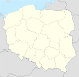
Landkarte von Libertów

Libertów (deutsch Libertow) ist ein Dorf in der Wojewodschaft Kleinpolen in der Republik Polen, Gemeinde Mogilany, Powiat Krakowski. Libertów hat 1952 Einwohner (2006).


Wikimedia Foundation.

Игры ⚽ Нужно решить контрольную?

Schlagen Sie auch in anderen Wörterbüchern nach:

  • Libertów — Libertów …   Deutsch Wikipedia

  • Libertów — Infobox Settlement name = Libertów settlement type = Village total type = image shield = subdivision type = Country subdivision name = POL subdivision type1 = Voivodeship subdivision name1 = Lesser Poland subdivision type2 = County subdivision… …   Wikipedia

  • Libertow — Original name in latin Libertw Name in other language State code PL Continent/City Europe/Warsaw longitude 49.97242 latitude 19.89461 altitude 314 Population 1952 Date 2010 11 03 …   Cities with a population over 1000 database

  • Gmina Mogilany — Mogilany Commune   Gmina   …   Wikipedia

  • Chorowice —   Village   Neo Gothic chapel …   Wikipedia

  • Mogilany —   Village   Saint Bartholomew Church …   Wikipedia

  • Droga ekspresowa S7 — Vorlage:Infobox hochrangige Straße/Wartung/PL S Droga ekspresowa S7 in Polen …   Deutsch Wikipedia

Share the article and excerpts

Direct link
Do a right-click on the link above
and select “Copy Link”