- Lincoln County (Maine)
-
Verwaltung US-Bundesstaat: Maine Verwaltungssitz: Wiscasset Gründung: Demographie Einwohner: 35.240 (2005) Bevölkerungsdichte: 29,8 Einwohner/km² Geographie Fläche gesamt: 1.812 km² Wasserfläche: 631 km² Karte 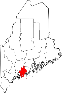
Website: co.lincoln.me.us Lincoln County[1] ist ein County im Bundesstaat Maine der Vereinigten Staaten von Amerika. Bei der Volkszählung im Jahr 2000 hatte das County 33.616 Einwohner und eine Bevölkerungsdichte von 28 Einwohnern pro Quadratkilometer. Der Sitz der Countyverwaltung (County Seat) befindet sich in Wiscasset.
Inhaltsverzeichnis
Geographie
Nach Angaben dem U.S. Census Bureau hat das County eine Gesamtfläche von 1812 Quadratkilometern. Davon sind 631 Quadratkilometer, entsprechend 34,84 Prozent, Wasserflächen. Das County grenzt im Uhrzeigersinn an die Countys: Kennebec County, Waldo County, Knox County und Sagadahoc County.
Demografische Daten
Historische Einwohnerzahlen Census Einwohner ± in % 1790 29.236 — 1800 30.225 3 % 1810 42.992 40 % 1820 53.180 20 % 1830 57.192 8 % 1840 63.517 10 % 1850 74.875 20 % 1860 27.860 -60 % 1870 25.597 -8 % 1880 24.821 -3 % 1890 21.996 -10 % 1900 19.669 -10 % 1910 18.216 -7 % 1920 15.976 -10 % 1930 15.498 -3 % 1940 16.294 5 % 1950 18.004 10 % 1960 18.497 3 % 1970 20.537 10 % 1980 25.691 30 % 1990 30.357 20 % 2000 33.616 10 % Vor 1900[2]  Alterspyramide des Lincoln Countys (Stand: 2000)
 Der Sheepscot River
Nach der Volkszählung im Jahr 2000 lebten im County 33.616 Menschen. Es gab 14.158 Haushalte und 9.542 Familien. Die Bevölkerungsdichte betrug 28 Einwohner pro Quadratkilometer. Ethnisch betrachtet setzte sich die Bevölkerung zusammen aus 98,46% Weißen, 0,17% Afroamerikanern, 0,26% amerikanischen Ureinwohnern, 0,37% Asiaten, 0,02% Bewohnern aus dem pazifischen Inselraum und 0,10% aus anderen ethnischen Gruppen; 0,61% stammten von zwei oder mehr ethnischen Gruppen ab. 0,46% der Bevölkerung waren spanischer oder lateinamerikanischer Abstammung.
Von den 14.158 Haushalten hatten 28,20% Kinder und Jugendliche unter 18 Jahre, die bei ihnen lebten. 56,10% waren verheiratete, zusammenlebende Paare, 7,70% waren allein erziehende Mütter. 32,60% waren keine Familien. 26,70% waren Singlehaushalte und in 12,10% lebten Menschen im Alter von 65 Jahren oder darüber. Die Durchschnittshaushaltsgröße betrug 2,35 und die durchschnittliche Familiengröße lag bei 2,82 Personen.
Auf das gesamte County bezogen setzte sich die Bevölkerung zusammen aus 22,70% Einwohnern unter 18 Jahren, 5,50% zwischen 18 und 24 Jahren, 25,60% zwischen 25 und 44 Jahren, 28,10% zwischen 45 und 64 Jahren und 18,20% waren 65 Jahre alt oder darüber. Das Durchschnittsalter betrug 43 Jahre. Auf 100 weibliche Personen kamen 95,10 männliche Personen, auf 100 Frauen im Alter ab 18 Jahren kamen statistisch 92,00 Männer.
Das jährliche Durchschnittseinkommen eines Haushalts betrug 38.686 USD, das Durchschnittseinkommen der Familien betrug 45.427 USD. Männer hatten ein Durchschnittseinkommen von 31.209 USD, Frauen 23.161 USD. Das Prokopfeinkommen betrug 20.760 USD. 10,10% der Bevölkerung und 6,60% der Familien lebten unterhalb der Armutsgrenze. 12,80% davon waren unter 18 Jahre und 9,50% waren 65 Jahre oder älter.
Städte und Ortschaften
Einzelnachweise
- ↑ GNIS-ID: 581293. Abgerufen am 22. Februar 2011 (englisch).
- ↑ U.S. Census Bureau - Census of Population and Housing. Abgerufen am 15. März 2011
- ↑ Auszug aus Census.gov. Abgerufen am 28. Februar 2011
- ↑ Auszug aus factfinder.census.gov Abgerufen am 28. Februar 2011
- ↑ Auszug aus dem National Register of Historic Places. Abgerufen am 13. März 2011
- ↑ Auszug aus dem National Register of Historic Places. Abgerufen am 13. März 2011
Weblinks
 Commons: Lincoln County, Maine – Sammlung von Bildern, Videos und Audiodateien
Liste der Countys in Maine
Androscoggin | Aroostook | Cumberland | Franklin | Hancock | Kennebec | Knox | Lincoln | Oxford | Penobscot | Piscataquis | Sagadahoc | Somerset | Waldo | Washington | York
Wikimedia Foundation.
Schlagen Sie auch in anderen Wörterbüchern nach:
Lincoln County, Maine — Infobox U.S. County county = Lincoln County state = Maine map size = 160 census founded = 1760 seat = Wiscasset | area total sq mi =700 area land sq mi =456 area water sq mi =244 area percentage = 34.84% census yr = 2000 pop = 33616 density km2=… … Wikipedia
Historical U.S. Census Totals for Lincoln County, Maine — This article shows U.S. Census totals for Lincoln County, Maine, broken down by municipality, from 1900 to 2000.There are two types of incorporated municipalities in Maine, towns and cities. The tables below differentiate between towns and cities … Wikipedia
National Register of Historic Places listings in Lincoln County, Maine — Location of Lincoln County in Maine This is a list of the National Register of Historic Places listings in Lincoln County, Maine. This is intended to be a complete list of the properties and districts on the National Register of Historic Places… … Wikipedia
Lincoln County — is the name of several locations.Canada* Lincoln County, Ontario, one of the historic counties of Ontario United Kingdom* The archaic term County of Lincoln refers to Lincolnshire in modern usage.United StatesLincoln County is the name of twenty… … Wikipedia
Lincoln County Sheriff's Office — could refer to several sheriffs departments in the United States, including:*Lincoln County, Arkansas Sheriff s Office *Lincoln County, Colorado Sheriff s Office *Lincoln County, Georgia Sheriff s Office *Lincoln County, Idaho Sheriff s Office… … Wikipedia
Lincoln Plantation, Maine — Lincoln Plantation is a plantation in Oxford County, Maine, United States. The population was 46 at the 2000 census.GeographyAccording to the United States Census Bureau, the plantation has a total area of 36.8 square miles (95.4 km²), of which,… … Wikipedia
Lincoln County — Es gibt in den Vereinigten Staaten 24 Countys oder Parishes mit dem Namen Lincoln: Lincoln County (Arkansas) Lincoln County (Colorado) Lincoln County (Georgia) Lincoln County (Idaho) Lincoln County (Kansas) Lincoln County (Kentucky) Lincoln… … Deutsch Wikipedia
Lincoln (CDP), Maine — Infobox Settlement official name = Lincoln, Maine settlement type = CDP nickname = motto = imagesize = image caption = image |pushpin pushpin label position =left pushpin map caption =Location within the state of Maine pushpin mapsize = |mapsize … Wikipedia
Lincoln, Penobscot County, Maine — Lincoln, Maine redirects here. For Lincoln Plantation in Oxford County, see Lincoln Plantation, Maine. Infobox Settlement official name = Lincoln, Maine settlement type = Town nickname = motto = imagesize = image caption = image |pushpin pushpin… … Wikipedia
Lincoln County Courthouse — bezeichnet mehrere gleichnamige, im NRHP gelistete, Objekte: Lincoln County Courthouse (Arkansas), ID Nr. 94000141 Lincoln County Courthouse (Georgia), ID Nr. 80001106 Lincoln County Courthouse (Kansas), ID Nr. 76000825 Lincoln County Courthouse… … Deutsch Wikipedia
Lincoln County (Maine)


18+
© Academic, 2000-2024
- Kontaktieren Sie uns: Unterstützung, Werbung
Wörterbücher Export, schritte mit PHP, Joomla, Drupal, WordPress, MODx.