- Pilsko
-
Pilsko 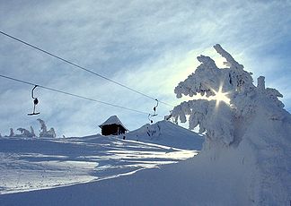
Endstation des Schleppliftes auf dem Pilsko
Höhe 1.557 m Lage Polen/Slowakei Gebirge Saybuscher Beskiden, Oravské Beskydy, Karpaten Geographische Lage 49° 31′ 38″ N, 19° 19′ 6″ O49.52722222222219.3183333333331557Koordinaten: 49° 31′ 38″ N, 19° 19′ 6″ O 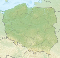

Der Pilsko ist ein 1557 m hoher Berg und somit der zweithöchste Berg der Beskid Żywiecki (Saybuscher Beskiden) und in Slowakei Oravské Beskydy (Arwa Beskiden). Er liegt auf der Grenze zwischen Polen und der Slowakei.
Der Pilsko wird im Sommer als Wander- und im Winter als Skigebiet genutzt.
Kategorien:- Eintausender
- Berg in den Beskiden
- Geographie (Woiwodschaft Schlesien)
- Berg in Polen
- Berg in der Slowakei
- Berg in Europa
- Karpaten


Wikimedia Foundation.