Besboro Island

Besboro Island

Vorlage:Infobox Insel/Wartung/Bild fehltVorlage:Infobox Insel/Wartung/Fläche fehlt

Besboro Island
Gewässer Pazifischer Ozean
Geographische Lage 64° 13′ 34″ N, 161° 0′ 40″ W64.226203-161.011054248Koordinaten: 64° 13′ 34″ N, 161° 0′ 40″ W
Besboro Island (Alaska)
Besboro Island
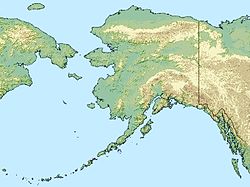
Länge 3 km
Höchste Erhebung 248 m
Einwohner (unbewohnt)

Besboro Island ist eine unbewohnte Insel der Bering-See, die im Nortonsund liegt, der zu Alaska gehört. Das zerklüftete Eiland liegt ca. 18 km vom Festland und 61 km vom Christmas Mountain (Nulato Hills) entfernt.

Besboro ist 3 km lang und erreicht seinen höchsten Punkt bei 248 m. Administrativ gehört die Insel zur Nome Census Area. Die Insel ist Teil des Alaska Maritime National Wildlife Refuge.

Die Insel wurde am 12. September 1778 von James Cook erstmalig gesichtet und von ihm als „Besborough Island“ in den Seekarten verzeichnet.

Weblinks


Wikimedia Foundation.

Игры ⚽ Нужно решить контрольную?

Schlagen Sie auch in anderen Wörterbüchern nach:

  • Besboro Island — Location map Alaska label= lat=64.226203 long= 161.011054 position=right width=250 float=right caption=Location in AlaskaBesboro Island is a small island in the in the Norton Sound, Bering Sea, off the shores of Alaska. It is located… …   Wikipedia

  • USS Besboro (AG-66) — was a cargo ship acquired by the U.S. Navy during World War II. She was heavily armed and converted to troopship and cargo ship use in the North Pacific Ocean. Post war she was sold so that she could return to her civilian career.Constructed in… …   Wikipedia

  • Nunivak Island — Nunivak Maskette – Nunivak …   Wikipedia

  • Medny Island — Map showing position of Commander Islands to the east of Kamchatka. The smaller island in the east is Medny and the larger island is Bering Island. Medny Island (also spelled Mednyy, Russian: остров Медный, sometimes called Copper Island in… …   Wikipedia

  • Unalaska Island — Unalaska Native name: Nawan Alaxsxa[1] Map of the island …   Wikipedia

  • Nelson Island (Alaska) — Nelson Native name: Qaluyaaq …   Wikipedia

  • Chagulak Island — Location in Alaska …   Wikipedia

  • Chuginadak Island — Mount Cleveland erupts in 2006. Taken from the International Space Station Geography Location Aleutian Islands, Alaska, USA Coordinates …   Wikipedia

  • Oglodak Island —   Island   …   Wikipedia

  • Otter Island (Alaska) — Location in Alaska Otte …   Wikipedia

Share the article and excerpts

Direct link
Do a right-click on the link above
and select “Copy Link”