- Bongabong
-
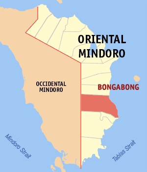
Municipality of Bongabong Lage von Bongabong in der Provinz Oriental Mindoro 
Basisdaten Bezirk: MIMARO Provinz: Oriental Mindoro Barangays: 36 Distrikt: 2. Distrikt von Oriental Mindoro PSGC: 175203000 Einkommensklasse: 1. Einkommensklasse Haushalte: 12.020 Zensus 1. Mai 2000Einwohnerzahl: 61.127 Zensus 1. August 2007Koordinaten: 12° 43′ N, 121° 22′ O12.716666666667121.36666666667Koordinaten: 12° 43′ N, 121° 22′ O Postleitzahl: 5211 Bürgermeister: Hercules A. Umali Offizielle Webpräsenz: Bongabong Geographische Lage auf den Philippinen 

Bongabong Bongabong ist eine philippinische Stadtgemeinde in der Provinz Oriental Mindoro. Nach dem Zensus vom 1. Mai 2000 hat sie 59.477 Einwohner in 12.020 Haushalten.
Baranggays
Bongabong ist politisch in 36 Baranggays unterteilt.
- Anilao
- Batangan
- Bukal
- Camantigue
- Carmund
- Cawaya
- Dayhaga
- Formon
- Haga
- Hagupi
- Kaligtasan
- Labasan
- Labonan
- Libertad
- Lisap
- Luna
- Malitbog
- Mapang
- Masaguisi
- Morente
- Ogbot
- Orconuma
- Polusahi
- Sagana
- San Isidro
- San Jose
- San Juan
- Santa Cruz
- Sigange
- Tawas
- Poblacion
- Aplaya
- Bagumbayan I
- Bagumbayan II
- Ipil
- Mina de Oro
Städte und Stadtgemeinden in der Provinz Oriental MindoroStädte: Calapan City
Stadtgemeinden: Baco | Bansud | Bongabong | Bulalacao | Gloria | Mansalay | Naujan | Pinamalayan | Pola | Puerto Galera | Roxas | San Teodoro | Socorro | Victoria
Wikimedia Foundation.
Schlagen Sie auch in anderen Wörterbüchern nach:
Bongabong, Oriental Mindoro — Infobox Philippine municipality infoboxtitle = Municipality of Bongabong sealfile = Ph seal oriental mindoro bongabong.png locatormapfile = Ph locator oriental mindoro bongabong.png caption = Map of Oriental Mindoro showing the location of… … Wikipedia
Oriental Mindoro — Province Seal … Wikipedia
Fresno (Kalifornien) — Fresno Spitzname: Fresno, the All American City Raisin Capital of the World Skyline von Fresno … Deutsch Wikipedia
Lito Camo — Este artículo está huérfano, pues pocos o ningún artículo enlazan aquí. Por favor, introduce enlaces hacia esta página desde otros artículos relacionados … Wikipedia Español
List of universities and colleges in the Philippines — Contents: Top · 0–9 · A B C D E F G H I J K L M N O P Q R S T U V W X Y Z Partial list of colleges and … Wikipedia
Tamaraw — Conservation status Critically Endangered (IUCN 3.1) … Wikipedia
Occidental Mindoro — Province Seal … Wikipedia
Mansalay, Oriental Mindoro — Mansalay is a 3rd class municipality in the province of Oriental Mindoro, Philippines. According to the 2000 census, it has a population of 39,041 people in 7,316 households. Contents 1 History 2 Geography and People … Wikipedia
Kapatagan, Lanao del Sur — Kapatagan is a 5th class municipality in the province of Lanao del Sur, Philippines. According to the 2000 census, it has a population of 7,804 people in 1,407 households.BarangaysKapatagan is politically subdivided into 15 barangays.* Bakikis *… … Wikipedia
Banton, Romblon — Banton is a 5th class municipality in the province of Romblon, Philippines. According to the 2000 census, it has a population of 6,769 people in 1,478 households.The original name of the island was Batoon, the most rugged, stony and rocky island… … Wikipedia
Bongabong

18+
© Academic, 2000-2024
- Kontaktieren Sie uns: Unterstützung, Werbung
Wörterbücher Export, schritte mit PHP, Joomla, Drupal, WordPress, MODx.