Aultbea

Aultbea
Aultbea
Koordinaten 57° 50′ N, 5° 35′ W57.841111111111-5.5863888888889Koordinaten: 57° 50′ N, 5° 35′ W
Aultbea (Schottland)
Aultbea
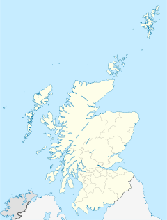
Aultbea
Verwaltung
Post town ACHNASHEEN
Postleitzahlen­abschnitt IV22
Vorwahl 01445
Landesteil Scotland
Unitary authority Highland
Britisches Parlament Ross, Skye and Lochaber
Schottisches Parlament Caithness, Sutherland and Ross
Ansicht von Aultbea

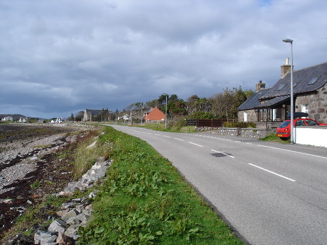
Aultbea ist eine kleine Ortschaft in der schottischen Region Highland. Die Ortschaft liegt direkt am Ufer des Loch Ewe, über welches sie direkt mit dem offenen Meer verbunden ist, gegenüber der Isle of Ewe. Poolewe liegt etwa 13 km südlich, Ullapool etwa 22 km östlich.

Während der beiden Weltkriege wurde Aultbea als geschützter Hafen genutzt; im Zweiten Weltkrieg wurden dort Konvois für die Überfahrt nach Russland durch den Arktischen Ozean zusammengestellt. Seit Kriegsende nutzt die Marine den Hafen zum Betanken ihrer Schiffe.[1]

Seit 2004 ist Aultbea der Standort der kleinen Whiskybrennerei Loch Ewe.[2]

Einzelnachweise

  1. Eintrag im Gazetteer for Scotland
  2. Netzpräsenz der Loch-Ewe-Brennerei

Wikimedia Foundation.

Игры ⚽ Нужен реферат?

Schlagen Sie auch in anderen Wörterbüchern nach:

  • Aultbea — infobox UK place country = Scotland official name= Aultbea scots name= gaelic name= An t Allt Beithe population= os grid reference=NG856886 map type=Scotland latitude=57.83625 longitude= 5.61176 unitary scotland= Highland lieutenancy scotland=… …   Wikipedia

  • Loch Ewe — Infobox lake lake name = Loch Ewe image lake = Loch Ewe.jpg caption lake = Creel boat steaming to the fishing grounds on Loch Ewe at dawn image bathymetry = caption bathymetry = location = Northwest Highlands, Scotland coords =… …   Wikipedia

  • Scottish Highlands — The Scottish Highlands (Scottish Gaelic: A Ghàidhealtachd , Scots: Hielans ) include the rugged and mountainous regions of Scotland north and west of the Highland Boundary Fault, although the exact boundaries are not clearly defined, particularly …   Wikipedia

  • Emma Maree Urquhart — Infobox Writer imagesize = 150px name = Emma Maree Urquhart caption = birthdate = Birth date and age|1991|10|2|mf=y birthplace = Inverness (Scotland) deathdate = deathplace = occupation = Novelist / Student nationality = British genre = Fantasy… …   Wikipedia

  • Wester Ross — ( gd. Taobh Siar Rois ) is a western area of Ross shire, notably containing the villages on the west coast such as:* Lochcarron * Applecross * Shieldaig * Torridon * Kinlochewe (inland) * Gairloch * Poolewe * Aultbea * Laide * Ullapool *… …   Wikipedia

  • Muc-sheilch — Creature Grouping Cryptid Sub grouping Lake monster Data Country Scotland Region Loch Maree Hab …   Wikipedia

  • Torridonian — In geology, Torridonian describes a series of proterozoic arenaceous sedimentary rocks, extensively developed in the Northwest Highlands of Scotland, and particularly in the district of upper Loch Torridon, a circumstance which suggested the name …   Wikipedia

  • Isle of Ewe — Infobox Scottish island | latitude=57.83 longitude= 5.61 GridReference=NG855885 celtic name=Eilean Iùbh norse name= meaning of name=yew area=309 ha area rank= 88= highest elevation=Creag Streap 72 m Population=12 population rank= 70 main… …   Wikipedia

  • List of Sites of Special Scientific Interest in South Wester Ross and Cromarty — The following is a list of Sites of Special Scientific Interest in the South Wester Ross and Cromarty Area of Search. For other areas, see List of SSSIs by Area of Search.* Abhainn Alligin * Allt nan Carnan * An Teallach * Ardlair Letterewe *… …   Wikipedia

  • List of community council areas in Scotland — This is a list of community council areas established in each of the council areas of Scotland.Aberdeen CityThere are 31 community council areas in the council area. Those marked with an asterisk have a community council. [… …   Wikipedia

Share the article and excerpts

Direct link
Do a right-click on the link above
and select “Copy Link”