Ilha das Galinhas

Ilha das Galinhas

Vorlage:Infobox Insel/Wartung/Höhe fehlt

Ilha das Galinhas
Karte der Bissagos-Inseln
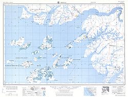
Gewässer Atlantischer Ozean
Inselgruppe Bissagos-Archipel
Geographische Lage 11° 28′ 0″ N, 15° 41′ 0″ W11.4666667-15.683333333333Koordinaten: 11° 28′ 0″ N, 15° 41′ 0″ W
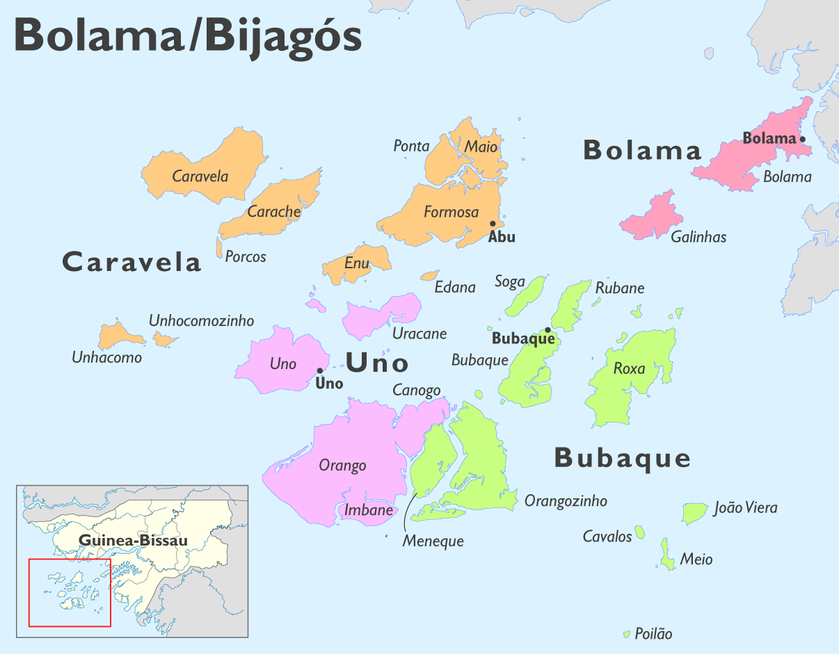
Ilha das Galinhas (Guinea-Bissau)
Ilha das Galinhas
Länge 10 km
Breite 6 km
Fläche 50 km²dep1
Einwohner 1.500 w3
Hauptort Ametite
Galinhas im Sektor Bolama

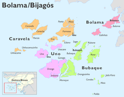
Die Ilha das Galinhas, auch Ilha de Galinhas oder kurz Galinhas, ist eine Insel des zu Guinea-Bissau gehörenden Archipels der Bissagos-Inseln im Atlantischen Ozean.

Die Landeshauptstadt Bissau liegt etwa 60 km nordöstlich. Nachbarinseln sind im Osten Bolama, im Westen die größte des Archipels Formosa und im Süden unter anderen Roxa. Auf der 50 km² großen Insel leben 1500 Menschen. Ansiedlungen sind Ambancana, Acampamento und Ametite, diese mit Schulen, sowie Ancano und Anchorupe. Eine der unsicheren Lebensgrundlagen ist die Ernte von Cashewkernen, die hauptsächlich nach Indien exportiert werden.


Wikimedia Foundation.

Игры ⚽ Нужно сделать НИР?

Schlagen Sie auch in anderen Wörterbüchern nach:

  • Isla de las Gallinas — Ilha das Galinhas Localización País  Guinea Bissau Región Regi …   Wikipedia Español

  • List of postal codes in Portugal — Aveiro districtMealhada municipality*3050 Antes *3050 Barcouço *3050 Casal Comba *3050 Luso *3050 Mealhada *3050 Pampilhosa *3050 Vacariça *3050 Ventosa do BairroMurtosa municipality*3870 Bunheiro *3870 Monte *3870 Murtosa *3870 TorreiraOliveira… …   Wikipedia

  • List of beaches — Following is a list of famous beaches of the world:Argentina* Mar del Plata * Cariló * Claromecó * Mar de Ajó * Mar de las Pampas * Miramar * Monte Hermoso * Necochea * Orense * Ostende * Pinamar * Reta * San Bernardo * San Clemente del Tuyú *… …   Wikipedia

  • Recife —   Municipality   The Municipality of Recife From upper left: Old centre of Recife; Recife …   Wikipedia

  • Pernambuco — Infobox Brazilian State name = State of Pernambuco motto = anthem = capital = Recife latd= |latm= |latNS= |longd= |longm= |longEW= largest city = Recife demonym = Pernambucano leader name1 = Eduardo Campos leader name2 = João Lyra Neto area =… …   Wikipedia

  • Recife — Saltar a navegación, búsqueda Recife …   Wikipedia Español

  • Freguesias de Portugal — Anexo:Freguesias de Portugal Saltar a navegación, búsqueda Contenido 1 A 1.1 Abrantes 1.2 Águeda 1.3 …   Wikipedia Español

  • Anexo:Freguesias de Portugal — Contenido 1 A 1.1 Abrantes 1.2 Águeda 1.3 Aguiar da Beira 1.4 …   Wikipedia Español

  • Recife — 8.0555555555556 34.8911111111114 Koordinaten: 8° 3′ S, 34° 53′ W Reci …   Deutsch Wikipedia

Share the article and excerpts

Direct link
Do a right-click on the link above
and select “Copy Link”