- Revillagigedo Island
-
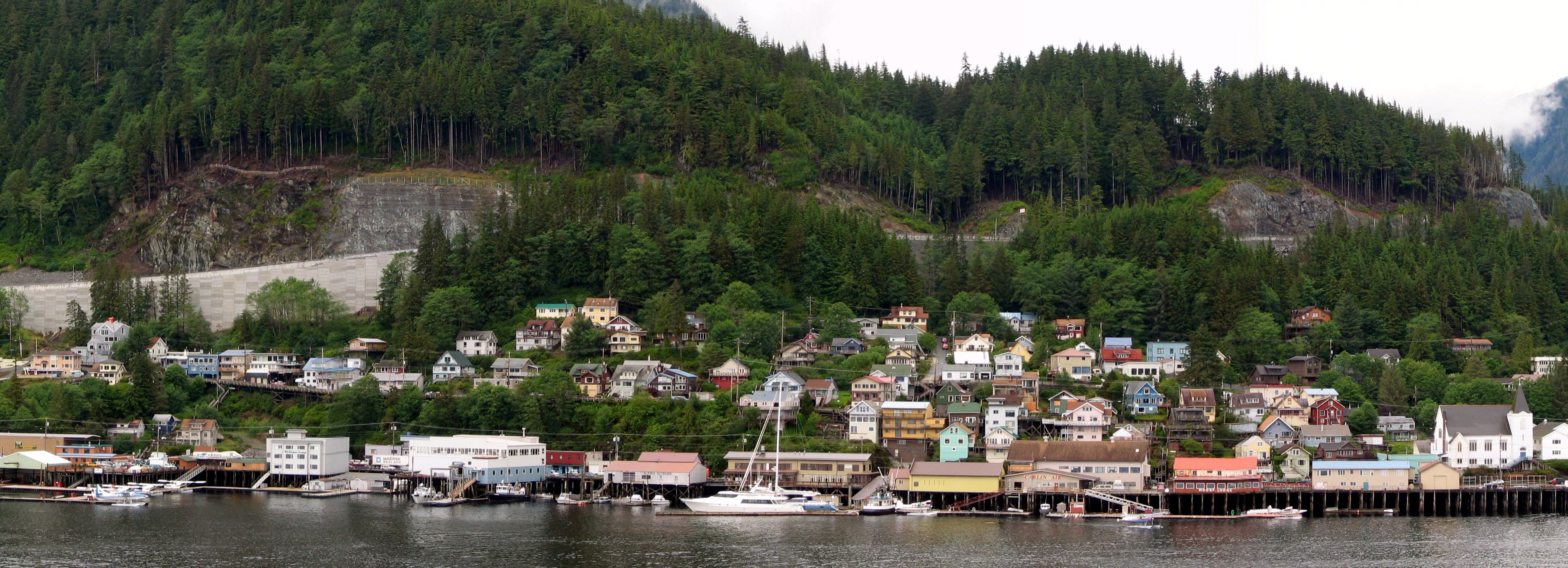
Revillagigedo Island Blick auf Ketchikan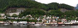
Gewässer Pazifischer Ozean Inselgruppe Alexanderarchipel Geographische Lage 55° 35′ N, 131° 22′ W55.583333333333-131.366666666671400Koordinaten: 55° 35′ N, 131° 22′ W 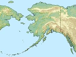

Länge 89 km Breite 48 km Fläche 2.754 km² Höchste Erhebung Mount Reid
1.400 mEinwohner 13.950 (2000)
5,1 Einw./km²Hauptort Ketchikan Kartenblatt mit Revillagigedo Island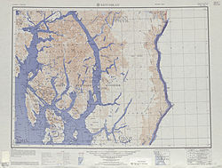
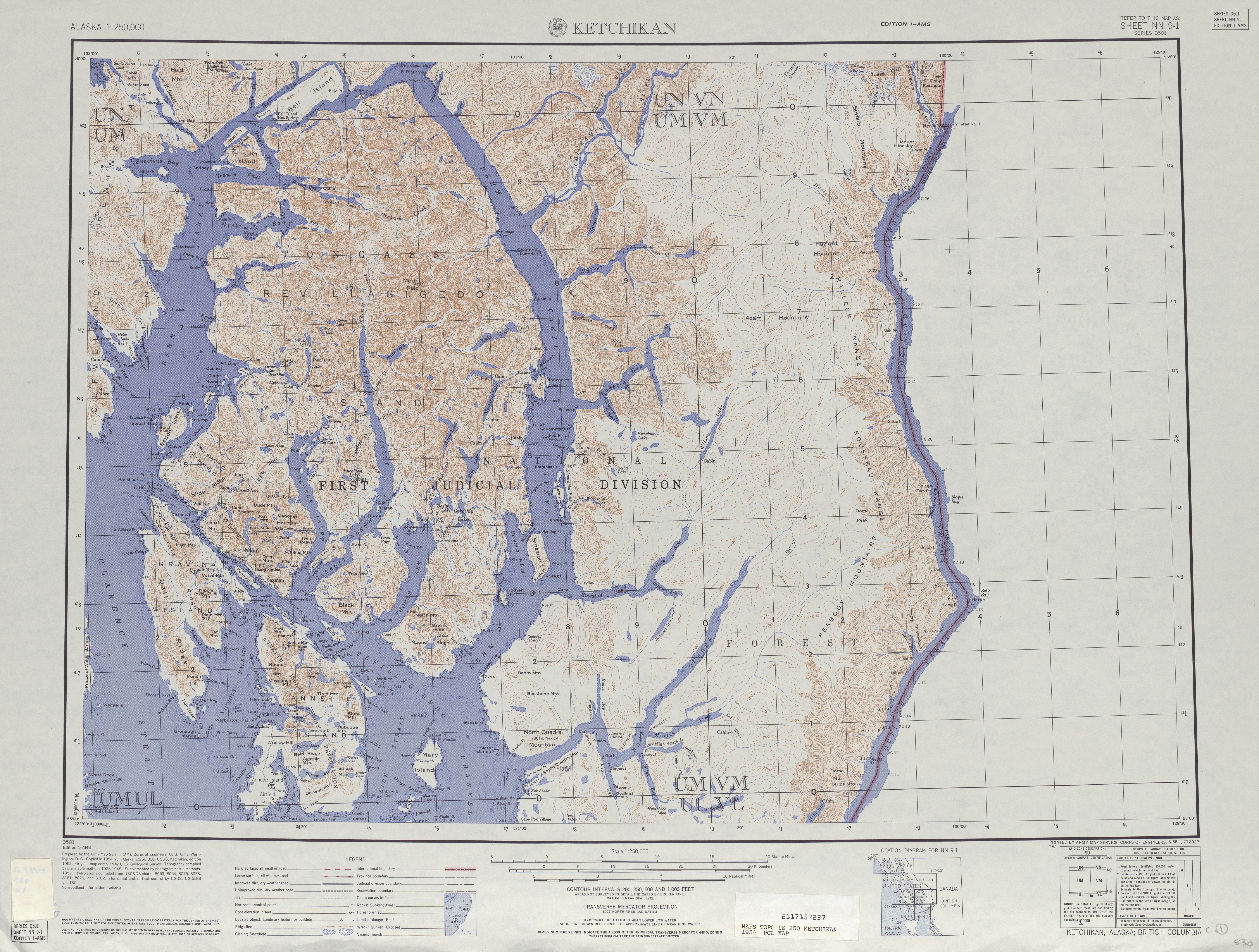
Revillagigedo Island ist eine im Südosten von Alaska (Panhandle) gelegene Insel des Alexanderarchipels im Pazifischen Ozean. Die Insel ist etwa 2754 km² groß, 89 km lang und bis zu 48 km breit. Sie gehört verwaltungsmäßig zum Ketchikan Gateway Borough. Höchste Erhebung ist der 1400 m hohe Mount Reid im unbewohnten Nordosten der Insel.[1]
Sie wird durch die Clarence Strait von der Prince-of-Wales-Insel im Westen und durch den Behm Canal im Osten von Festland Alaskas getrennt. An der Südspitze liegen zwischen Revillagigedo und Anette Island der Revillagigedo Channel und die Nichols Passage.
Die Insel wurde im 18. Jahrhundert von russischen, britischen und spanischen Seefahrern entdeckt und später nach Juan Vicente de Güemes Pacheco y Padilla, Conde de Revillagigedo II, dem 53. Vizekönig von Neuspanien benannt.
Auf der Insel leben etwa 13.950 Einwohner, vornehmlich in den Städten Ketchikan und Saxman und in dem Ort Ward Cove an der Südwestküste. Die Bewohner leben im Wesentlichen vom Fischfang, dem Holzeinschlag und Tourismus.
Weblinks
- Revillagigedo Island im Geographic Names Information System des United States Geological Survey
- Topographische Karte (PDF)
Einzelnachweise
- ↑ Mount Reid bei Peakbagger.com (englisch)
Inseln im AlexanderarchipelAdmiralty Island | Annette Island | Baranof Island | Chichagof Island | Dall Island | Etolin Island | Kuiu Island | Kupreanof Island | Prince-of-Wales-Insel | Revillagigedo Island | Wrangell Island
Wikimedia Foundation.
Schlagen Sie auch in anderen Wörterbüchern nach:
Revillagigedo Island — Infobox Islands name = Revillagigedo image caption = image size = locator Location map|Alaska|lat=55.566667|long= 131.133333 map custom = yes native name = native name link = nickname = location = coordinates =… … Wikipedia
Revillagigedo Island — Sp Revilagigido salà Ap Revillagigedo Island L Aleksandro ss., JAV (Aliaska) … Pasaulio vietovardžiai. Internetinė duomenų bazė
Revillagigedo Island — geographical name island SE Alaska in SE Alexander Archipelago E of Prince of Wales Island … New Collegiate Dictionary
Revillagigedo Channel — is an ocean channel in the Alexander Archipelago of the U.S. state of Alaska. Extending 56 km (35 mi) northwest from the Dixon Entrance, it lies between the mainland to the east, Revillagigedo Island to the north, and Duke Island and Annette… … Wikipedia
Revillagigedo-Inseln — Gewässer Pazifischer Ozean Geographische Lage … Deutsch Wikipedia
Revillagigedo — ist der Name einer mexikanischen Inselgruppe im Pazifik, siehe Revillagigedo Inseln einer Insel im Alexander Archipel in Alaska, siehe Revillagigedo Island Diese Seite ist eine Begriffsklärung zur Unterscheidung mehr … Deutsch Wikipedia
Revillagigedo-Inseln (Mexiko) — w1 Revillagigedo Inseln Lage der Revillagigedo Inseln im Pazifik Gewässer Pazifischer Ozean Anzahl der Inseln … Deutsch Wikipedia
Revillagigedo Islands — The Revillagigedo Islands (also Revillagigedo Archipelago or Islas Revillagigedo) are a group of four volcanic islands islands in the Pacific Ocean, known for their unique ecosystem. They have been part of Manzanillo municipality of the Mexican… … Wikipedia
Revillagigedo Islands — ▪ archipelago, Mexico archipelago in the Pacific Ocean, approximately 300 miles (500 km) south southwest of the tip of the Baja California peninsula and 370 miles (595 km) west southwest of Cape Corrientes on the Mexican mainland. The islands… … Universalium
Isla de Revillagigedo — Para el archipiélago de México, véase islas Revillagigedo. Isla Revillagigedo Revillagigedo Island Vista de satélite del archipiélago Alexander Localización País … Wikipedia Español
Revillagigedo Island

18+
© Academic, 2000-2024
- Kontaktieren Sie uns: Unterstützung, Werbung
Wörterbücher Export, schritte mit PHP, Joomla, Drupal, WordPress, MODx.