- Croaghaun
-
 Klippen von Croaghaun
 3-D-Karte
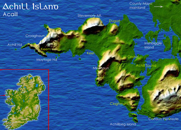
 Lage von Achill Island
Croaghaun (irisch: Cruachán) ist ein Berg auf Achill Island im County Mayo in Irland, dessen nördliche Ausläufer mit 664 Metern zugleich die höchsten Klippen Europas bilden.
Croaghaun befindet sich auf dem westlichsten Teil von Achill Island.
53.977777777778-10.194444444444664Koordinaten: 53° 59′ N, 10° 12′ WKategorien:- Geographie (Irland)
- Berg in Europa
- Berg in Irland
- Kliff
- County Mayo


Wikimedia Foundation.