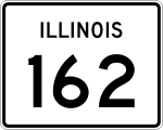
- Illinois State Route 162
-
Basisdaten Gesamtlänge: 16 mi/26 km Eröffnung: 1954 Anfangspunkt:  IL 203 in Granite City
Endpunkt:  US 40 bei Troy
County: Madison County Wichtige Städte: Glen Carbon
MaryvilleDie Illinois State Route 162 (kurz IL 162) ist eine State Route im US-Bundesstaat Illinois, die in Ost-West-Richtung verläuft.
Die State Route beginnt an der Illinois State Route 203 in Granite City und endet nach 26 Kilometern östlich von Troy am U.S. Highway 40.
Verlauf
Ab Granite City führt die Straße in nordöstlicher Richtung und trifft im Süden von Pontoon Beach auf die Illinois State Route 111 und im Osten der Stadt auf die Interstate 255. Im Westen der Stadt Maryville kreuzt sie die Illinois State Route 157 und im Ortszentrum die Illinois State Route 159. Westlich von Troy trifft die IL 162 auf die Interstates 55 und 70.
Siehe auch
Weblinks
- Illinois Highway Ends (englisch)
- Illinois Highways (englisch)
Kategorie:- Illinois State Route

Wikimedia Foundation.