- Kisoro
-
Karte 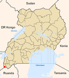
Lage von Kisoro innerhalb Ugandas
Basisdaten Distrikt Kisoro Geographische Lage 1° 21′ S, 29° 42′ O-1.3529.72356Koordinaten: 1° 21′ S, 29° 42′ O Fläche ? Einwohnerzahl 11.328 (2002) Bevölkerungsdichte ? Einwohner/km² mittlere Höhe 2.356 m Niederschlag ? mm/a Zeitzone UTC +3 UN/LOCODE UG – Telefonvorwahl (+256) ? Kisoro ist eine Stadt im Südwesten Ugandas am Fuße der Virunga-Vulkane nahe der Grenze zu Ruanda und der Demokratischen Republik Kongo mit 11.328 Einwohnern. Sie ist die Hauptstadt des gleichnamigen Distrikts Kisoro.
Die Stadt besitzt einen kleinen Flugplatz. Wirtschaftlich bedeutend ist der Tourismus zu den Berggorillas im Mgahinga-Gorilla-Nationalpark in den Virunga-Bergen.
Fernstraßenverbindungen bestehen nach Muko, Ruhengeri in Ruanda und Rutushuru in der Demokratischen Republik Kongo.
Kategorie:- Ort in Uganda

Wikimedia Foundation.