- Maripipi
-
Municipality of Maripipi Lage von Maripipi in der Provinz Biliran 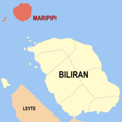
Basisdaten Bezirk: Eastern Visayas Provinz: Biliran Barangays: 15 Distrikt: 1. Distrikt von Biliran PSGC: 087807000 Einkommensklasse: 5. Einkommensklasse Haushalte: 1562 Zensus 1. Mai 2000Einwohnerzahl: 6.946 Zensus 1. August 2007Koordinaten: 11° 47′ N, 124° 21′ O11.783333333333124.35Koordinaten: 11° 47′ N, 124° 21′ O Postleitzahl: 6546 Offizielle Webpräsenz: Maripipi Geographische Lage auf den Philippinen 

Maripipi Maripipi ist eine philippinische Stadtgemeinde in der Provinz Biliran. Sie hat 8319 Einwohner in 1562 Haushalten (Zensus 1. Mai 2000).
Baranggays
Maripipi ist politisch unterteilt in 15 Baranggays.
- Agutay
- Banlas
- Bato
- Binalayan West
- Binalayan East
- Burabod
- Calbani
- Canduhao
- Casibang
- Danao
- Ol-og
- Binongto-an (Poblacion Norte
- Ermita (Poblacion Sur)
- Trabugan
- Viga
Weblinks
Schlagen Sie auch in anderen Wörterbüchern nach:
Maripipi — Géographie Pays Philippines Archipel Visayas Localisation … Wikipédia en Français
Maripipi — Maripipi, eine Philippineninsel (Südostasien) … Pierer's Universal-Lexikon
Maripipi — Mapa de Bilirán mostrando la ubicación de Maripipi. Maripipi es un municipio de quinta clase ubicado al norte de la provincia de Biliran, Filipinas. Conforme al censo de 2000, tenía una población de 8.319 habitantes distribuidos en 1.562… … Wikipedia Español
Maripipi — Original name in latin Maripipi Name in other language Maripipi State code PH Continent/City Asia/Manila longitude 11.77917 latitude 124.34917 altitude 20 Population 0 Date 2011 07 31 … Cities with a population over 1000 database
Maripipi, Biliran — Map of Biliran showing the location of Maripipi Maripipi is a 5th class municipality in the province of Biliran, Philippines. According to the 2000 census, it has a population of 8,319 people in 1,562 households. Barangays Maripipi is politically … Wikipedia
Biliran — This article is about the province. For the municipality, see Biliran, Biliran. For the Island see Biliran Island. Infobox Philippine province name = Biliran sealfile = Ph seal biliran.png region = Eastern Visayas (Region VIII) capital = Naval… … Wikipedia
Legislative districts of Leyte — Philippines This article is part of the series: Politics and government of the Philippines … Wikipedia
Philippine Tarsier — ] status = NT status ref =IUCN2006 | assessors = Eudey, A. Members of the Primate Specialist Group | year = 2000 | title = Tarsius syrichta | id = 21492 | downloaded = 2006 05 12] trend = unknown status system = iucn3.1 image width = 299px regnum … Wikipedia
PH-BIL — Lage der Provinz Biliran Biliran ist eine Insel und seit 1992 eine eigenständige Provinz der Philippinen. Die Provinzhauptstadt ist Naval. Vor ihrer politischen Eigenständigkeit gehörte die Insel zur Provinz Leyte. Die Insel liegt in den… … Deutsch Wikipedia
Biliran — 11° 29′ 00″ N 124° 28′ 59″ E / 11.4833, 124.483 … Wikipédia en Français
Maripipi


18+
© Academic, 2000-2024
- Kontaktieren Sie uns: Unterstützung, Werbung
Wörterbücher Export, schritte mit PHP, Joomla, Drupal, WordPress, MODx.