Pielnica

Pielnica
Pielnica
Podkarpackie mapa fizyczna wislok.png
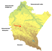
Länge 63 km
Einzugsgebiet 940 km2
Quellgebiet Niederbeskiden
Mündung In den Wisłok
Staat Polen
Pielnica, Gebirgsbach unterhalb von Nowotaniec, 2005

Die Pielnica [pʲɛlˈɲitsa] ist ein Gebirgsbach in der Woiwodschaft Karpatenvorland im südöstlichen Polen.

Sie entspringt in den Niederbeskiden am Berg Skibce (776 m) im Gebiet der Orte Nowotaniec, Nagorzany, Nadolany, Wola Sękowa, Odrzechowa und Długie, durchfließt Pielnia und Nowosielce und mündet bei Besko, nach einem Lauf von 63 km, in die Wisłok.

Geschichte

Sie wurde erstmals im Jahre 1390 als Pele erwähnt, eine Vorform des heutigen Namens. Weitere frühere Varianten sind Pella 1419, Pielica 1441, Pielnyka 1512. Die deutsche Namensform Piella ist schon lange ungebräuchlich.


Wikimedia Foundation.

Игры ⚽ Нужен реферат?

Schlagen Sie auch in anderen Wörterbüchern nach:

  • Pielnica — The Pielnica [IPA|pʲɛlˈɲitsa] ( de. Pella or Piella 1419, Pielica 1441, Pielnyka 1512.) is a river in South Eastern Poland. Its name comes from the ancient german dialect word piella . It begins in the Bieszczady mountains and flows through… …   Wikipedia

  • Nowotaniec — Coordinates: 49°30′42″N 22°02′11″E / 49.51167°N 22.03639°E / 49.51167; 22.03639 …   Wikipedia

  • Dlugie — Długie Hilfe zu Wappen …   Deutsch Wikipedia

  • Piella — Pielnia Hilfe zu Wappen …   Deutsch Wikipedia

  • Wislok — Vorlage:Infobox Fluss/DGWK fehltVorlage:Infobox Fluss/QUELLHÖHE fehltVorlage:Infobox Fluss/MÜNDUNGSHÖHE fehltVorlage:Infobox Fluss/HÖHENUNTERSCHIED fehltVorlage:Infobox Fluss/ABFLUSS fehltVorlage:Infobox Fluss/KARTE fehlt Wisłok …   Deutsch Wikipedia

  • Wisłok — is a river in south eastern Poland, a tributary of the San River, with a length of 205 kilometres (18th longest) and the basin area of 3,528 sq. km. (all in Poland). The root of the name Vis lok is Indo European or pre Indo European.HistoryThe… …   Wikipedia

  • Nagórzany — Coordinates: 49°31′N 22°05′E / 49.517°N 22.083°E / 49.517; 22.083 …   Wikipedia

  • Wola Piotrowa — Geobox|Settlement name = Wola Piotrawa category = Village etymology = Its name comes from the west slavic dialect word Wola and Piotr, meaning exactly little village of Peter official name = motto = nickname = image caption = The Pogórze… …   Wikipedia

  • Pogórze Bukowskie — Geobox|Range name=Bukowskie Upland other name= pl. Pogórze Bukowskie image caption=A view from Bukowica Peak in western Nowotaniec. country= Poland| country1=| parent=Doły Jasielsko Sanockie in Gmina Bukowsko, Gmina Besko, Gmina Sanok, Gmina… …   Wikipedia

  • Długie — Hilfe zu Wappen …   Deutsch Wikipedia

Share the article and excerpts

Direct link
Do a right-click on the link above
and select “Copy Link”