- Renmark Paringa Council
-
Council of Renmark Paringa 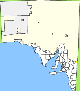
Lage des Renmark Paringa Council in South AustraliaGliederung Staat:  Australien
Bundesstaat:  South Australia
Verwaltungssitz: Renmark Daten und Zahlen Fläche: 916 km² Einwohner: 9.449 (2006) [1] Bevölkerungsdichte: 10 Einwohner je km² -34.17140.74888888889Koordinaten: 34° 10′ S, 140° 45′ ODer District Council of Renmark Paringa ist ein lokales Verwaltungsgebiet (LGA) im australischen Bundesstaat South Australia. Das Gebiet ist 916 km² groß und hat etwa 9.400 Einwohner.
Renmark Paringa liegt am Murray River an der Ostgrenze von South Australia zum Bundesstaat Victoria und ist etwa 220 km in östlicher Richtung von der Metropole Adelaide entfernt. Das Gebiet beinhaltet 14 Ortsteile und Ortschaften: Calperum, Chaffey, Cooltong, Gurra Gurra, Lock No. 5, Lock No. 6, Lyrup, Murtho, Paringa, Pike River, Renmark, Renmark South, Renmark West und Wonuarra. Der Verwaltungssitz des Councils befindet sich in Renmark im Zentrum der LGA.
Verwaltung
Der Council von Renmark Paringa hat neun Mitglieder, die acht Councillor und der Vorsitzende und Mayor (Bürgermeister) des Councils werden von den Bewohnern der LGA gewählt. Renmark Paringa ist nicht in Bezirke untergliedert.
Weblinks
Einzelnachweise
- ↑ Australian Bureau of Statistics (25. Oktober 2007): Renmark Paringa (DC) (Local Government Area) (Englisch). 2006 Census QuickStats. Abgerufen am 6. April 2010.
Kategorie:- Local Government Area in South Australia

Wikimedia Foundation.