Berri Barmera Council

Berri Barmera Council
District Council of Berri Barmera
Australia-Map-SA-LGA-BerriBarmera.png
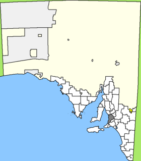
Lage des Berri Barmera Council in South Australia
Gliederung
Staat: Australien Australien
Bundesstaat: Flag of South Australia.svg South Australia
Verwaltungssitz: Berri
Daten und Zahlen
Fläche: 508 km²
Einwohner: 10.932 (2006) [1]
Bevölkerungsdichte: 22 Einwohner je km²
-34.283333333333140.6

Der District Council of Berri Barmera ist ein lokales Verwaltungsgebiet (LGA) im australischen Bundesstaat South Australia. Das Gebiet ist 508 km² groß und hat etwa 11.000 Einwohner.

Berri Barmera liegt im Osten von South Australia am Nordrand der Murray Lands nahe der Grenze zu Victoria etwa 200 km östlich der Metropole Adelaide. Das Gebiet beinhaltet acht Ortsteile und Ortschaften: Barmera, Berri, Cobdogla, Glossop, Loveday, Monash, Overland Corner und Winkie. Der Verwaltungssitz des Councils befindet sich in Berri im Osten der LGA am Murray River.

Verwaltung

Der Council von Berri Barmera hat elf Mitglieder, die zehn Councillor und der Vorsitzende und Mayor (Bürgermeister) des Councils werden von den Bewohnern der LGA gewählt. Berri Barmera ist nicht in Bezirke untergliedert.

Weblinks

Einzelnachweise

  1. Australian Bureau of Statistics (25. Oktober 2007): Berri and Barmera (DC) (Local Government Area) (Englisch). 2006 Census QuickStats. Abgerufen am 6. April 2010.

Wikimedia Foundation.

Игры ⚽ Нужно решить контрольную?

Schlagen Sie auch in anderen Wörterbüchern nach:

  • Berri Barmera Council — South Australia Location of the Berri Barmera Council in SA Population …   Wikipedia

  • Berri (Australien) — Berri Blick über Berri und den Murray River Staat …   Deutsch Wikipedia

  • Barmera, South Australia — Infobox Australian Place | type = town name = Barmera state = South Australia caption = lga = Berri Barmera Council postcode = est = 1859 pop = 1,928 2006 Census Census 2006 AUS id=UCL402000 name=Barmera (Urban Centre/Locality) accessdate=2008 06 …   Wikipedia

  • Berri, South Australia — Infobox Australian Place | type = town name = Berri state = sa caption = The Berri bridge was built on one bank and pushed across the river onto the pylons lga = Berri Barmera Council postcode = 5343 pop = 4,008 2006 Census Census 2006 AUS… …   Wikipedia

  • Renmark Paringa Council — South Australia Location of the Renmark Paringa Council Population …   Wikipedia

  • Conseil de Berri et Barmera — 34° 17′ 00″ S 140° 36′ 00″ E / 34.28333, 140.6 …   Wikipédia en Français

  • District Council of Grant — South Australia Location of the District Council of Grant Population: 8,652( …   Wikipedia

  • Wakefield Regional Council — South Australia Location of Wakefield Regional Council Population …   Wikipedia

  • District Council of Karoonda East Murray — South Australia Location of the District Council of Karoonda East Murray …   Wikipedia

  • District Council of Lower Eyre Peninsula — South Australia Location of the District Council of Lower Eyre Peninsula …   Wikipedia

Share the article and excerpts

Direct link
Do a right-click on the link above
and select “Copy Link”