- Bitter Springs (Arizona)
-
Bitter Springs 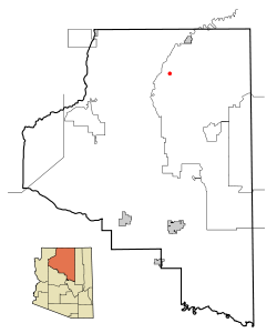 Lage in Arizona
Basisdaten Staat: Vereinigte Staaten Bundesstaat: Arizona County: Koordinaten: 36° 37′ N, 111° 39′ W36.620833333333-111.656388888891559Koordinaten: 36° 37′ N, 111° 39′ W Zeitzone: Mountain Standard Time (UTC−7) Einwohner: 547 (Stand: 2000) Bevölkerungsdichte: 25,6 Einwohner je km² Fläche: 21,5 km² (ca. 8 mi²)
davon 21,4 km² (ca. 8 mi²) LandHöhe: 1559 m FIPS: 04-06470 GNIS-ID: 0025249 Bitter Springs ist ein Census-designated place im Coconino County im US-Bundesstaat Arizona. Sie hat 547 Einwohner (Stand 2000) auf einer Fläche von 21,4 km². Die Bevölkerungsdichte beträgt 25,5/km². Die Stadt liegt 1561 Meter über dem Meeresspiegel. Der Ort befindet sich am U.S. Highway 89.
 Orte im Coconino County
Bitter Springs | Cameron | Flagstaff | Fredonia | Grand Canyon Village | Kachina Village | Kaibito | Lechee | Leupp | Moenkopi | Mountainaire | Munds Park | Page | Parks | Sedona | Supai | Tonalea | Tuba City | Tusayan | Valle | Williams
Wikimedia Foundation.
Schlagen Sie auch in anderen Wörterbüchern nach:
Bitter Springs, Arizona — Infobox Settlement official name = Bitter Springs, Arizona settlement type = CDP imagesize = image caption = image imagesize = image caption = image mapsize = map caption = Location in Coconino County and the state of Arizona mapsize1 = map… … Wikipedia
Bitter Springs — can refer to:*Bitter Springs, Arizona, a place in Arizona *Bitter Springs (film), a 1950 film directed by Ralph Smart *Bitter Springs (fossil locality), a fossil locality in Australia, preserving organisms by silicification, or * the Bitter… … Wikipedia
Bitter Springs — Bitter Springs, AZ U.S. Census Designated Place in Arizona Population (2000): 547 Housing Units (2000): 127 Land area (2000): 8.279057 sq. miles (21.442657 sq. km) Water area (2000): 0.000000 sq. miles (0.000000 sq. km) Total area (2000):… … StarDict's U.S. Gazetteer Places
Bitter Springs, AZ — U.S. Census Designated Place in Arizona Population (2000): 547 Housing Units (2000): 127 Land area (2000): 8.279057 sq. miles (21.442657 sq. km) Water area (2000): 0.000000 sq. miles (0.000000 sq. km) Total area (2000): 8.279057 sq. miles… … StarDict's U.S. Gazetteer Places
Arizona locations by per capita income — Arizona has the twenty ninth highest per capita income in the United States of America, at $20,275 (2000). Its personal per capita income is $26,838 (2003). Arizona counties ranked by per capita income There are fifteen counties located in… … Wikipedia
Liste der Städte in Arizona — Die folgende Liste zeigt alle Kommunen und Siedlungen in Arizona. Sie enthält sowohl Citys, Towns und Villages als auch Census designated places (CDP). Die obere Tabelle enthält die Städte mit mehr als 40.000 Einwohnern: Karte von Arizona … Deutsch Wikipedia
Arizona — Arizonan, Arizonian /ar euh zoh nee euhn/, adj., n. /ar euh zoh neuh/, n. a state in SW United States. 2,717,866; 113,909 sq. mi. (295,025 sq. km). Cap.: Phoenix. Abbr.: AZ (for use with zip code), Ariz. * * * State (pop., 2000: 5,130,632),… … Universalium
National Register of Historic Places listings in Coconino County, Arizona — Location of Coconino County in Arizona This is a list of the National Register of Historic Places listings in Coconino County, Arizona. It is intended to be a complete list of the properties and districts on the National Register of Historic… … Wikipedia
Coconino County, Arizona — Coconino County, Arizona … Wikipedia
U.S. Route 89A (Arizona) — U.S. Route 89A Arizona, … Wikipedia Español
Bitter Springs (Arizona)


18+
© Academic, 2000-2024
- Kontaktieren Sie uns: Unterstützung, Werbung
Wörterbücher Export, schritte mit PHP, Joomla, Drupal, WordPress, MODx.