- Central Highlands Municipality
-
Central Highlands Municipality 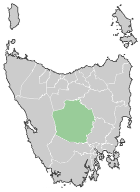
Lage der Central Highlands in TasmanienGliederung Staat:  Australien
Bundesstaat:  Tasmanien
Verwaltungssitz: Hamilton Daten und Zahlen Fläche: 7.976 km² Einwohner: 2.242 (2006) [1] Bevölkerungsdichte: 0,3 Einwohner je km² -42.55146.83333333333Koordinaten: 42° 33′ S, 146° 50′ ODie Central Highlands sind ein lokales Verwaltungsgebiet (LGA) im australischen Bundesstaat Tasmanien. Das Gebiet ist 7.976 km² groß und hat etwa 2.200 Einwohner.
Die Central Highlands liegen im Zentrum der Insel etwa 60 km nordwestlich der Hauptstadt Hobart. Das Gebiet umfasst 31 Ortsteile und Ortschaften: Arthurs Lake, Bothwell, Bradys Lake, Brandurn, Bronte Park, Buders Gorge, Cramps Bay, Dee, Derwent Bridge, Ellendale, Fentonbury, Gretna, Hamilton, Hermitage, Hollow Tree, Interlaken, Lake St Clair, Liawenee, Meadowbank, Miena, Osterley, Ouse, Pelharn, Reynolds Neck, Rintstone, Shannon, Tarraleah, Tods Corner, Victoria Valley, Wayatinah und Waddamana[2]. Der Sitz des City Councils befindet sich in Hamilton im Südosten der LGA, wo etwa 300 Einwohner leben.[3]
Verwaltung
Der Central Highlands Council hat neun Mitglieder. Der Mayor (Bürgermeister), sein Deputy (Stellvertreter) und sieben Councillor werden direkt von den Bewohnern der LGA gewählt. Central Highlands ist nicht in Bezirke untergliedert.
Quellen
- ↑ Australian Bureau of Statistics (25. Oktober 2007): Central Highlands (LGA) (Englisch). 2006 Census QuickStats. Abgerufen am 6. April 2010.
- ↑ Localities by Council, Local Government Association of Tasmania
- ↑ Australian Bureau of Statistics (25. Oktober 2007): Hamilton (State Suburb) (Englisch). 2006 Census QuickStats. Abgerufen am 23. März 2010.
Weblinks
Kategorie:- Local Government Area in Tasmanien

Wikimedia Foundation.