- Winooski River
-
Winooski River 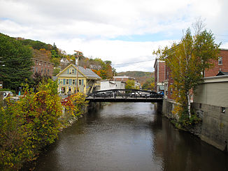
Der Winooski River in Montpelier
Daten Gewässerkennzahl US: 1460304 Lage Vermont, Vereinigte Staaten Flusssystem Sankt-Lorenz-Strom Abfluss über Lake Champlain → Rivière Richelieu → Sankt-Lorenz-Strom → Sankt-Lorenz-Golf → Atlantik Quelle nördlich Cabot im Washington County
44° 27′ 14″ N, 72° 18′ 46″ W44.4539443-72.3128815Mündung in Malletts Bay (Chittenden County) in den Lake Champlain 44.5303255-73.2745738Koordinaten: 44° 31′ 49″ N, 73° 16′ 28″ W
44° 31′ 49″ N, 73° 16′ 28″ W44.5303255-73.2745738Länge 144,8 km Einzugsgebiet 2.797 km² (1080 Quadratmeilen)[1] 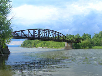
Die Winooski River Bike Bridge. Sie verbindet Burlington mit Colchester
Der Winooski River ist ein 144,8 Kilometer langer Fluss im Chittenden County im US-Bundesstaat Vermont. Er entspringt etwa sechs Kilometer nördlich von Cabot. Von dort fließt er nach Süden und durchquert dabei den Lower Tabot Town Forest. Ab Marshfield schlängelt er sich größtenteils entlang des U.S. Highway 2 in südwestliche Richtung.[2]
Westlich von Plainfield beim Cate Cemetery mündet der Kingsbury Branch in den Winooski. Ab Montpelier fließt er entlang des Interstate 89 (auch bekannt als Vietnam Veterans Memorial Highway). Unweit von Middlesex stößt der Mad River als linker Nebenfluss hinzu. Weitere Städte entlang des Winooski sind Burlington, Colchester, Waterbury, North Duxbury, Bolton, Jonesville, Essex Junction, Richmond und Winooski. In Malletts Bay mündet der Winooski in den Lake Champlain. Das Einzugsgebiet beträgt 2797 Quadratkilometer.[2][1]
Countys die der Fluss durchläuft sind:[1]
Die sieben größten Nebenflüsse des Winooski River sind:[1]
- Little River
- Kingsbury Branch
- North Branch
- Stevens Branch
- Dog River
- Mad River
- Huntington River
Weitere Namen
Weitere Bezeichnungen des Flusses sind:
Weblinks
- Winooski River Basin Planning
- Decision Card 1906 (PDF-Datei)
Einzelnachweise
- ↑ a b c d Vermont Water Quality Planning Section - Winooski River Basin
- ↑ a b Winooski River im Geographic Names Information System des United States Geological Survey
- ↑ Meeks, Hearld A. Time and Change in Vermont, A Human Geography. Chester, Connecticut, The Globe Pequot Press, 1986. ".. mainly a historical geography, but with a modern component..arranged by subject and time rather than by geographic regions." p453
- ↑ Hill, Ralph Nading Hill. The Winooski. (Rivers of America Series) New York: Rinehart and Company, 1949. p3
- ↑ U.S. Geological Survey. Geographic Names Phase I data compilation (1976-1981). 31-Dec-1981. Primarily from U.S. Geological Survey 1:24,000-scale topographic maps (or 1:25K, Puerto Rico 1:20K) and from U.S. Board on Geographic Names files. In some instances, from 1:62,500 scale or 1:250,000 scale maps.
- ↑ DuGard, Rene C. Dictionary of French Place Names in the U.S.A. Editions Des Deux Mondes Et Slavuta, 1986, 431 pp. p365
- ↑ Huden, John C. Historical Champlain Maps. Vermont History 27(January-July 1959):34-40. p87
- ↑ Meeks, Hearld A. Time and Change in Vermont, A Human Geography. Chester, Connecticut, The Globe Pequot Press, 1986. ".. mainly a historical geography, but with a modern component..arranged by subject and time rather than by geographic regions." p452
- ↑ Meeks, Hearld A. Time and Change in Vermont, A Human Geography. Chester, Connecticut, The Globe Pequot Press, 1986. ".. mainly a historical geography, but with a modern component..arranged by subject and time rather than by geographic regions." p452
- ↑ Huden, John C. Historical Champlain Maps. Vermont History 27(January-July 1959):34-40. p37
- ↑ Crockett, Walter Hill. Vermont The Green Mountain State. Volumes 1-4. New York: The Century History Company, 1921. Use form a1 VT-T47/vol/p. v1/p125
- ↑ A Trip Through The Lake Champlain Islands. http://www.geocities.com/jmillard/Explore/islands.html.
- ↑ Huden, John C. Historical Champlain Maps. Vermont History 27(January-July 1959):34-40. p87
- ↑ Hill, Ralph Nading Hill. The Winooski. (Rivers of America Series) New York: Rinehart and Company, 1949. p3
- ↑ Meeks, Hearld A. Time and Change in Vermont, A Human Geography. Chester, Connecticut, The Globe Pequot Press, 1986. ".. mainly a historical geography, but with a modern component..arranged by subject and time rather than by geographic regions." p452
- ↑ Hayward, John. A Gazetteer of Vermont. (Reprint) Bowie, Maryland: Heritage Books, 1990. p24
Kategorien:- Flusssystem Sankt-Lorenz-Strom
- Fluss in Vermont
- Fluss in Nordamerika


Wikimedia Foundation.