- Tarnica
-
Tarnica 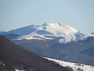
Westansicht der Tarnica (Januar 2008)
Höhe 1.346 m Lage Powiat Bieszczadzki, Woiwodschaft Karpatenvorland, Polen Gebirge Bieszczady Schartenhöhe 494 m Geographische Lage 49° 4′ 29″ N, 22° 43′ 35″ O49.07471666666722.726251346Koordinaten: 49° 4′ 29″ N, 22° 43′ 35″ O 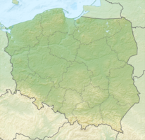

Die Tarnica ist mit 1346 m der höchste Berg der polnischen Bieszczady im äußersten Südosten des Landes im Powiat Bieszczadzki der Woiwodschaft Karpatenvorland nahe der Grenze zur Ukraine.
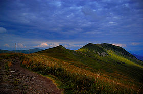 Wanderweg zum Gipfel
Der Gipfel der Tarnica (Tarnica heißt auf Rumänisch Sattel, siehe seine Form) überragt das Tal des Gebirgsflusses Wołosaty um knapp 500 Meter. Von den benachbarten Bergen ist er durch seine Gestalt gut zu unterscheiden. Der Berg hat zwei separate Gipfel, deren einer 1339 und der andere 1346 Meter hoch ist. Der Südhang besteht aus einer steilen Felswand, die gegenüberliegende Seite aus weniger steilen Gras- und Geröllfeldern.
Die Tarnica liegt nahe am Europäischen Fernwanderweg E8 im Bieszczady-Nationalpark und ist von Ustrzyk Górne beziehungsweise von Wołosate aus zu erreichen. In den Bergketten benachbart sind die übrigen höchsten Gipfel der Bieszczady wie der Krzemień (1335 m) und der Halicz (1333 m).
Weblinks
 Commons: Tarnica – Sammlung von Bildern, Videos und Audiodateien
- Kurzbeschreibung und Lagekarte (englisch)
Kategorien:- Eintausender
- Berg in Polen
- Karpaten
- Berg in Europa
- Geographie (Woiwodschaft Karpatenvorland)


Wikimedia Foundation.