- Dillingham Census Area
-
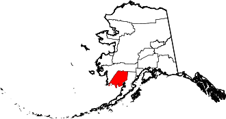
Der Dillingham Census Area ist ein Census Area im US-Bundesstaat Alaska an der Nordküste der Bristol Bay, westlich der Alaska-Halbinsel.
Im Jahr 2010 betrug die Bevölkerungszahl 4.847. Dillingham gehört zum Unorganized Borough und hat somit keinen Verwaltungssitz. Der Census Area hat eine Fläche von 54.204 km², wovon 48.367 km² auf Land und 5837 km² auf Wasser entfallen. Die größte Stadt der Region ist Dillingham.
Teile des Togiak National Wildlife Refuges sowie die zum Alaska Maritime National Wildlife Refuge gehörende Insel Hagemeister liegen im Dillingham Census Area.
Weblinks
 Commons: Dillingham Census Area – Sammlung von Bildern, Videos und Audiodateien
- QuickFacts auf census.gov (englisch)
 Politische Gliederung Alaskas
Regionen: Alaskan Bush | Interior | North Slope | Panhandle | South Central | Tanana Valley
Boroughs: Aleutians East | Anchorage | Bristol Bay | Denali | Fairbanks North Star | Haines | Juneau | Kenai Peninsula | Ketchikan Gateway | Kodiak Island | Lake and Peninsula | Matanuska-Susitna | North Slope | Northwest Arctic | Skagway | Sitka | Wrangell | Yakutat | Unorganized Borough
Census Areas: Aleutians West | Bethel | Dillingham | Hoonah-Angoon | Nome | Petersburg | Prince of Wales-Hyder | Southeast Fairbanks | Valdez-Cordova | Wade Hampton | Yukon-Koyukuk
Wichtige Städte: Anchorage | Barrow | Bethel | Fairbanks | Homer | Juneau | Kenai | Ketchikan | Kodiak | Kotzebue | Nome | Palmer | Petersburg | Seward | Sitka | Unalaska | Valdez | Wasilla
Wikimedia Foundation.
Schlagen Sie auch in anderen Wörterbüchern nach:
Dillingham Census Area — Admin ASC 2 Code Orig. name Dillingham Census Area Country and Admin Code US.AK.070 US … World countries Adminstrative division ASC I-II
Dillingham Census Area, Alaska — Dillingham Census Area is a census area located in the state of Alaska, United States. As of the 2000 census, the population was 4,922. It is part of the unorganized borough and therefore has no borough seat. Its largest community by far is the… … Wikipedia
National Register of Historic Places listings in Dillingham Census Area, Alaska — Location of the Dillingham Census Area in Alaska This is a list of the National Register of Historic Places listings in Dillingham Census Area, Alaska. This is intended to be a complete list of the properties and districts on the National… … Wikipedia
Liste der Registered Historic Places im Dillingham Census Area — Die Liste der Registered Historic Places im Dillingham Census Area führt alle Bauwerke und historischen Stätten im Dillingham Census Area des US Bundesstaates Alaska auf, die in das National Register of Historic Places aufgenommen wurden.… … Deutsch Wikipedia
List of Alaska borough and census area name etymologies — This is a list of Alaska borough and census area name etymologies. *Aleutians East Borough: named for its location in the eastern part of the Aleutian Islands. Aleutian may be from the Chukchi word aliat , meaning island . *Aleutians West Census… … Wikipedia
Prince of Wales-Outer Ketchikan Census Area — Prince of Wales Hyder Census Area (seit 19. Mai 2008) Prince … Deutsch Wikipedia
Prince of Wales - Outer Ketchikan Census Area — Prince of Wales Hyder Census Area (seit 19. Mai 2008) Prince … Deutsch Wikipedia
Skagway-Hoonah-Angoon Census Area — Hoonah Angoon Census Area (seit 5. Juni 2007) Skagway Hoonah Angoon Census Area (von 1992 bi … Deutsch Wikipedia
Skagway-Yakutat-Angoon Census Area — Hoonah Angoon Census Area (seit 5. Juni 2007) Skagway Hoonah Angoon Census Area (von 1992 bi … Deutsch Wikipedia
Wrangell-Petersburg Census Area — (seit 1. Juni 2008) Wrangell Petersburg Census Area (bis 1. Juni 2008) … Deutsch Wikipedia
Dillingham Census Area

18+
© Academic, 2000-2024
- Kontaktieren Sie uns: Unterstützung, Werbung
Wörterbücher Export, schritte mit PHP, Joomla, Drupal, WordPress, MODx.