Goodwood (South Australia)
- Goodwood (South Australia)
-
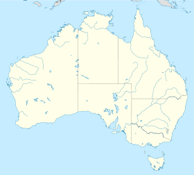
Goodwood ist ein Stadtteil von Adelaide im australischen Bundesstaat South Australia.
Goodwood liegt etwa 4 km südöstlich von Adelaides Stadtmitte, gehört administrativ zur City of Unley und grenzt an die Royal Adelaide Showgrounds. Es verfügt über ein Einkaufsviertel und eine Reihe von Kirchen. An Veranstaltungsorten in Goodwood ist vor allem das Capri Theatre bekannt. Die Postleitzahl ist 5034.
Goodwood hat eine Eisenbahnanbindung an der Noarlunga-Centre- und der Belair-Linie.
Einzelnachweise
- ↑ Australian Bureau of Statistics (25. Oktober 2007): Goodwood (State Suburb) (Englisch). 2006 Census QuickStats. Abgerufen am 13. Februar 2011.
Wikimedia Foundation.
Schlagen Sie auch in anderen Wörterbüchern nach:
Goodwood, South Australia — Infobox Australian Place | type = suburb name = Goodwood city = Adelaide state = sa caption = est = lga = City of Unley postcode = 5034 pop = 2,728 (2006 census) [Census 2006 AUS|id =SSC41666|name=Goodwood (State Suburb)|accessdate=2008 07 17|… … Wikipedia
Millswood, South Australia — Millswood Adelaide, South Australia Millswood Crescent, looking towards the south west … Wikipedia
Marion, South Australia — Marion Adelaide, South Australia Retail outlets on Marion Road Population: 3,62 … Wikipedia
Unley, South Australia — Infobox Australian Place | type = suburb name = Unley city = Adelaide state = sa lga = City of Unley postcode = 5061 pop = 3,585 (2006 census) [Census 2006 AUS|id =SSC42746|name=Unley (State Suburb)|accessdate=2008 07 17| quick=on] 3,427 (2001… … Wikipedia
Malvern, South Australia — Malvern Adelaide, South Australia Population: 2,718 (2006 Census)[1] Postcode: 5061 … Wikipedia
Rail transport in South Australia — South Australia was the first colony in Australia to build a railway line. It was a horse drawn tramway from the port of Goolwa on the Murray River to an ocean harbour at Port Elliot in 1854. Today the state has RailGauge|1600 broad gauge… … Wikipedia
List of schools in South Australia — Government Schools Anangu and Aboriginal schoolsAboriginal Preschools and Kindergartens*Kalaya Children s Centre, Queenstown, South Australia *Kaurna Plains, Elizabeth, South Australia **Preschool School **Child CareAnangu schoolsLocated in the… … Wikipedia
Clarence Park, South Australia — Clarence Park Adelaide, South Australia Churchill Avenue, looking south towards Cross Road … Wikipedia
Goodwood — may refer to:Places: * Goodwood, Leicestershire, England * Goodwood, South Australia, Australia * Goodwood, Tasmania, Australia * Goodwood, Cape Town, South Africa * Goodwood, West Sussex, EnglandStructures: * Goodwood House, West Sussex, England … Wikipedia
Westbourne Park, South Australia — Infobox Australian Place | type = suburb name = Westbourne Park city = Adelaide state = South Australia caption = lga = City of Mitcham postcode = 5041 pop = 2,608 (2006 census) est = area = 0.9 propval =… … Wikipedia
 Australien
 South Australia