Amherstview

Amherstview
Amherstview
Lage in Ontario
Amherstview (Ontario)
Amherstview
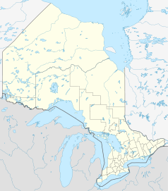
Amherstview
Staat: Kanada
Provinz: Ontario
Koordinaten: 44° 13′ N, 76° 39′ W44.221791666667-76.648655555556Koordinaten: 44° 13′ N, 76° 39′ W
Fläche: 340,02 km²
Einwohner: 15.062 (Stand: 2006)
Bevölkerungsdichte: 44,3 Einw./km²
Zeitzone: Eastern Time (UTC−5)
Webpräsenz: www.loyalisttownship.ca/

Amherstview ist ein Ort in der Provinz Ontario und liegt westlich von Collins Bay. Es leben etwa 6.000 Menschen dort und Amherstview ist ein Vorort von Kingston. Amherstview bekam seinen Namen durch die direkt südlich im Ontariosee gelegenen Insel Amherst.

Der Ort liegt nahe dem östlichen Ende des Loyalist Parkway, einer Strecke des Highway 33, welche am Ontariosee entlangführt. Der Ort befindet sich in einem Gebiet, wo viele Untertanen des Vereinigten Königreiches siedelten.

Obwohl Collins Bay ein Teil Kingstons war, als die Grenzen der Stadt am 1. Januar 1998 nach Osten hin erweitert wurden, und Westwärts zur Frontenac County Line, ist Amherstview Teil eines angrenzenden Countiys - der Loyalist Township, Lennox und Addington County in Ontario.

Amherstview wird durch den Coronation Boulevard von Collins Bay getrennt, eine kleine Anliegerstrasse, an seiner östlichsten Ausbreitung. An der westlichen Seite ist es lediglich durch die Lennox & Addington County Road begrenzt. Außerdem besteht eine beachtliche Distanz zwischen Bath, der nächsten Ortschaft, die diese Straße berührt. Im Norden ist der Taylor-Kidd Boulevard die Grenze.


Wikimedia Foundation.

Игры ⚽ Поможем решить контрольную работу

Schlagen Sie auch in anderen Wörterbüchern nach:

  • Amherstview Jets — Hockey team team = Amherstview Jets logosize = 125px city = Amherstview, Ontario league = Empire B Junior C Hockey League founded = 1989 arena = Henderson Recreation Centre colours = Green, Black, and White coach = Mike Budarick GM = Mike… …   Wikipedia

  • Loyalist, Ontario — Loyalist   Township   Main street in Bath Motto: A Loyal Three Made Stronger In One …   Wikipedia

  • Empire B Junior C Hockey League — The Empire B Junior C Hockey League is a Junior C ice hockey league in Ontario, Canada, sanctioned by the Ontario Hockey Association. :Eastern Ontario Junior C Hockey League 1989 1996:Empire B Junior C Hockey League 1996 to PresentHistoryFormed… …   Wikipedia

  • Ontario Highway 33 — Highway 33 …   Wikipedia

  • Napanee Raiders — City Napanee, Ontario …   Wikipedia

  • Kingston, Ontario — Kingston   City   Kingston City Skyline from Fort Henry Hill Nickname(s): Limestone City …   Wikipedia

  • Highway 33 (Ontario) — Infobox road province=ON type=Hwy route=33 marker alternate name= Loyalist Parkway maint=the Ministry of Transportation length km=68.4 length ref=Ministry of Transportation of Ontario, [http://www.raqsa.mto.gov.on.ca/techpubs/TrafficVolumes.nsf/tv… …   Wikipedia

  • Gordon Downie — performing in Ottawa, Ontario Background information Born February 6, 1964 (1964 02 06) (age 47) A …   Wikipedia

  • Limestone District School Board — LDSB redirects here. For the airport in Croatia with that ICAO code, see Bol Airport. Limestone District School Board (LDSB) Board office location Limestone Education Centre, 220 Portsmouth Avenue, Kingston, Ontario Communities served Kingston,… …   Wikipedia

  • Clarence Schmalz Cup — The Clarence Schmalz Cup is the Ontario Hockey Association s Junior C ice hockey championship and championship trophy. The tournament to determine the winner of the Cup is commonly called the All Ontario Championships. The leagues that compete… …   Wikipedia

Share the article and excerpts

Direct link
Do a right-click on the link above
and select “Copy Link”