- Amity (New York)
-
Amity 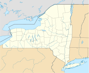

Amity Lage in New YorkBasisdaten Staat: Vereinigte Staaten Bundesstaat: New York County: Koordinaten: 42° 14′ N, 78° 2′ W42.226944444444-78.031944444444422Koordinaten: 42° 14′ N, 78° 2′ W Zeitzone: Eastern Standard Time (UTC−5) Einwohner: 2245 (Stand: 2000) Bevölkerungsdichte: 25,1 Einwohner je km² Fläche: 89,7 km² (ca. 35 mi²)
davon 89,4 km² (ca. 35 mi²) LandHöhe: 422 m FIPS: 36-02011 GNIS-ID: 0978676 Amity ist eine Stadt im Allegany County, New York, Vereinigte Staaten. Während der Volkszählung im Jahr 2000 hatte die Stadt 2.245 Einwohner. Der Name Amity bedeutet Freundschaft.
Inhaltsverzeichnis
Geschichte
Gegründet wurde die Stadt 1830 aus zwei Stadtteilen (Angelica und Scio), wobei die ersten Siedler sich bereits 1804 niederließen.
Geographie
Die Stadt umfasst 89,7 km², davon sind 89,5 km² Landmasse und 0,2 km² Wasser.
Der Genesee River fließt in nördlicher Richtung durch die Stadt.
Demographie
Die 2.245 Einwohner leben in 885 Haushalten und 601 Familien. Die Bevölkerungsdichte beträgt 25,1 Einwohner/km².
Söhne und Töchter der Stadt
Hamilton Ward, Kongreßmann und Richter.
Trivia
Die Stadt wurde durch den Film „Der weiße Hai“ bekannt. Tatsächlich liegt Amity, New York jedoch nicht an der Küste. Die im Film gezeigte Insel Amity Island ist rein fiktiv, die Dreharbeiten fanden auf Martha’s Vineyard statt.[1]
Weblinks
Quellen
Kategorie:- Ort in New York

Wikimedia Foundation.