Kornica

Kornica
Kornica

Wappen fehlt
Hilfe zu Wappen

Kornica (Bosnien und Herzegowina)
Paris plan pointer b jms.svg
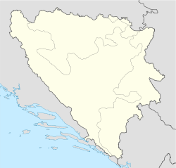
Basisdaten
Staat: Bosnien und Herzegowina
Entität: Republika Srpska
Gemeinde: Bosanski Šamac
Koordinaten: 44° 57′ N, 18° 25′ O44.95277777777818.423333333333146Koordinaten: 44° 57′ 10″ N, 18° 25′ 24″ O
Höhe: 146 m. i. J.
Einwohner: 881
Struktur und Verwaltung
Bürgermeister:  ? (?)


Kornica ist ein Dorf in Bosnien und Herzegowina, das sich in der Verbandsgemeinde Bosanski Šamac in der Republika Srpska befindet. Im Jahre 1991 von annähernd 900 Bürgern bewohnt, war im Verlauf der Jugoslawienkriege nahezu die gesamte Bevölkerung gezwungen zu fliehen.

Bislang sind ausschließlich ältere Bürger nach Kornica zurückgekehrt.

Weblinks


Wikimedia Foundation.

Игры ⚽ Нужно решить контрольную?

Schlagen Sie auch in anderen Wörterbüchern nach:

  • Kórnica — Hilfe zu Wappen …   Deutsch Wikipedia

  • Kornica — is a village in Bosnia and Herzegovina in the Republika Srpska entity s municipality of Šamac.HistoryAlmost the entire population was forced to flee in the process of the Yugoslavia wars. The former village inhabitants are distributed in the… …   Wikipedia

  • Kornica — 44° 57′ 10″ N 18° 25′ 24″ E / 44.9528, 18.4233 …   Wikipédia en Français

  • Kornica, Poland — Infobox Settlement name = Kornica settlement type = Village total type = image shield = subdivision type = Country subdivision name = POL subdivision type1 = Voivodeship subdivision name1 = Świętokrzyskie subdivision type2 = County subdivision… …   Wikipedia

  • Nowa Kornica —   Village   …   Wikipedia

  • Gmina Stara Kornica — Infobox Settlement name = Gmina Stara Kornica other name = Stara Kornica Commune settlement type = Gmina total type = Total image shield = subdivision type = Country subdivision name = POL subdivision type1 = Voivodeship subdivision name1 =… …   Wikipedia

  • Stara Kornica — Original name in latin Stara Kornica Name in other language Kornica Stara, Stara Kornica, SteraKornica, Стара Корница State code PL Continent/City Europe/Warsaw longitude 52.18183 latitude 22.93752 altitude 161 Population 1088 Date 2010 09 05 …   Cities with a population over 1000 database

  • Czeberaki, Masovian Voivodeship — For other places with the same name, see Czeberaki (disambiguation). Czeberaki   Village   …   Wikipedia

  • Dubicze —   Village   …   Wikipedia

  • Nowe Szpaki —   Village   …   Wikipedia

Share the article and excerpts

Direct link
Do a right-click on the link above
and select “Copy Link”