- Lumbayanague
-
Municipality of Lumbayanague Lage von Lumbayanague in der Provinz Lanao del Sur 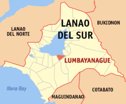
Basisdaten Bezirk: Autonomous Region in Muslim Mindanao Provinz: Lanao del Sur Barangays: 22 Distrikt: 2. Distrikt von Lanao del Sur PSGC: 153636000 Einkommensklasse: unbekannt (1-6) Haushalte: 2008 Zensus 1. Mai 2000Einwohnerzahl: 21.717 Zensus 1. August 2007Koordinaten: 7° 47′ N, 124° 17′ O7.7833333333333124.28333333333Koordinaten: 7° 47′ N, 124° 17′ O Postleitzahl: 9306 Bürgermeister: Jamal Langlang Asum Offizielle Webpräsenz: Lumbayanague Geographische Lage auf den Philippinen 

Lumbayanague Lumbayanague ist eine philippinische Stadtgemeinde in der Provinz Lanao del Sur. Nach dem Zensus vom 1. Mai 2000 hat sie 12.835 Einwohner in 2008 Haushalten.
Baranggays
Lumbayanague ist politisch in 22 Baranggays unterteilt.
- Bagoaingud
- Balaigay
- Bualan
- Cadingilan
- Casalayan
- Dala (Dalama)
- Dilimbayan
- Cabuntungan
- Lamin
- Diromoyod
- Kabasaran (Pob.)
- Nanagun
- Mapantao-Balangas
- Miniros
- Pantaon
- Pindolonan
- Pitatanglan
- Poctan
- Singcara
- Wago
- Cadayonan
- Cadingilan A
Städte und Stadtgemeinden in der Provinz Lanao del SurStädte: Marawi City
Stadtgemeinden: Bacolod-Kalawi | Balabagan | Balindong | Bayang | Binidayan | Buadiposo-Buntong | Bubong | Bumbaran | Butig | Calanogas | Ditsaan-Ramain | Ganassi | Kapai | Kapatagan | Lumba-Bayabao | Lumbaca-Unayan | Lumbatan | Lumbayanague | Madalum | Madamba | Maguing | Malabang | Marantao | Marogong | Masiu | Mulondo | Pagayawan | Piagapo | Picong | Poona Bayabao | Pualas | Saguiaran | Sultan Dumalondong | Tagoloan II | Tamparan | Taraka | Tubaran | Tugaya | Wao
Wikimedia Foundation.
Schlagen Sie auch in anderen Wörterbüchern nach:
Lumbayanague — Original name in latin Lumbayanague Name in other language Lumbayanague State code PH Continent/City Asia/Manila longitude 7.7825 latitude 124.28 altitude 802 Population 0 Date 2011 07 31 … Cities with a population over 1000 database
Lumbayanague, Lanao del Sur — Lumbayanague is a municipality in the province of Lanao del Sur, Philippines. According to the 2000 census, it has a population of 12,835 people in 2,008 households.BarangaysLumbayanague is politically subdivided into 22 barangays. * Bagoaingud * … Wikipedia
Saguiaran, Lanao del Sur — Saguiaran is a 4th class municipality in the province of Lanao del Sur, Philippines. According to the 2000 census, it has a population of 22,636 people in 3,074 households. It is a town just outside Marawi City. Saguiaran is located at the end of … Wikipedia
PH-LAS — Lage von Lanao del Sur Lanao del Sur ist eine Provinz im Zentralteil der Insel Mindanao auf den Philippinen. Lanao del Sur gehört zum Bezirk ARMM, der Autonomous Region in Muslim Mindanao. Die Hauptstadt der Provinz liegt am Lake Lanao und heißt… … Deutsch Wikipedia
Saguiaran — Municipality of Saguiaran Lage von Saguiaran in der Provinz Lanao del Sur Basisdaten Bezirk … Deutsch Wikipedia
Lanao del Sur — Infobox Philippine province name = Lanao del Sur sealfile = Ph seal lanao del sur.png region = Autonomous Region in Muslim Mindanao (ARMM) capital = Marawi City founded = 1959 pop2000 = 800,162 pop2000rank = 29th largest popden2000 = 207… … Wikipedia
Ditsaan-Ramain, Lanao del Sur — Ditsaan Ramain is a 4th class municipality in the province of Lanao del Sur, Philippines. According to the 2000 census, it has a population of 19,157 people in 2,682 households. Barangays Ditsaan Ramain is politically subdivided into 35 barangays … Wikipedia
Maguing, Lanao del Sur — Maguing is a 3rd class municipality in the province of Lanao del Sur, Philippines. According to the 2000 census, it has a population of 18,095 people in 2,734 households. Contents 1 Barangays 2 History 3 … Wikipedia
Malabang, Lanao del Sur — Malabang is a 4th class municipality in the province of Lanao del Sur, Philippines. According to the 2000 census, it has a population of 33,177 people in 4,883 households. Contents 1 Municipality Mayor Anwar Balindong 2 History … Wikipedia
Marantao, Lanao del Sur — Marantao is a 3rd class municipality in the province of Lanao del Sur, Philippines. According to the 2000 census, it has a population of 24,647 people in 3,598 households. Barangays Marantao is politically subdivided into 34 barangays. Bacayawan… … Wikipedia
Lumbayanague


18+
© Academic, 2000-2024
- Kontaktieren Sie uns: Unterstützung, Werbung
Wörterbücher Export, schritte mit PHP, Joomla, Drupal, WordPress, MODx.