Pweto

Pweto
Pweto
Pweto (Demokratische Republik Kongo)
Pweto
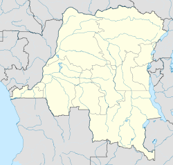
Pweto
Basisdaten
Staat Demokratische Republik Kongo
Provinz Haut-Katanga
Höhe 918 m
Einwohner 20.000 (2006)
ISO 3166-2 CD
-8.477777777777828.9

Pweto ist eine 918 m hoch gelegene Stadt mit 20.000 Einwohnern (2006) am Nordwestufer des Mwerusees in der Provinz Haut-Katanga der Demokratischen Republik Kongo.

Pweto lebt wie jeder Ort am Mwerusee von der Fischerei und liegt wie jeder Ort auf kongolesischer Seite isoliert ohne befahrbare Wege ins Inland. Jeder Handel findet über den See statt. Mit UN-Mitteln wurde 2004 ein Markt gebaut, aber die entscheidenden Handelsplätze sind Nchelenge und Kashikishi in Sambia. Einziger Kontaktpunkt zum Inland ist die ungeteerte 1.200 m Flugpiste. Eine weitere Erwerbsquelle ist die Landwirtschaft. Die Häuser hier sind aus einem soliden Bambusgerüst gebaut und mit Gras gedeckt. Es gibt keine Trinkwasserversorgung und keinen Strom.

Nach Westen erhebt sich das Mitumba-Gebirge, das wie ein gigantischer Riegel zwischen See und Kongobecken liegt. Direkt vor dem Ort ist der Ausfluss des Luvua, dessen reißender Sog hier den Seespiegel um einige Meter absenkt. Nach Norden und Osten breitet sich eine fruchtbare Ebene aus, die jedoch weitgehend zu Sambia gehört.

Noch 2006 dominieren Flüchtlinge die Stadt. 10.000 von ihnen werden hier von UNHCR versorgt.

Weblinks


Wikimedia Foundation.

Игры ⚽ Нужно сделать НИР?

Schlagen Sie auch in anderen Wörterbüchern nach:

  • Pweto — Territoire de Pweto Administration Pays  Congo, republique démocratique !République démocratique du Congo …   Wikipédia en Français

  • Bataille de Pweto — Informations générales Date novembre 2000 4 décembre 2000 Lieu République démocratique du Congo Issue Victoire des rebelles Belligérants …   Wikipédia en Français

  • Lake Mweru — Southern end of the lake from space, June 1993 (false color) Coordinates …   Wikipedia

  • Luapula Province border dispute — This article deals mainly with a disputed area on the border of Zambia, in Luapula Province.Where it all began 1894 treatyZambia s formal northern frontier boundary was legally signed in the Anglo Belgian Treaty of 1894, long after the 1884… …   Wikipedia

  • Rally for Congolese Democracy–Goma — The Rally for Congolese Democracy–Goma (RCD Goma) was a faction of the RCD (Rassemblement Congolais pour la Démocratie, or Rally for Congolese Democracy), a rebel movement based in Goma, Democratic Republic of the Congo (DRC) during the Second… …   Wikipedia

  • Moero-See — Mwerusee, Lac Moero Die Luapulaauen mit dem südlichen Mwerusee und der Insel Kilwa (Orbit, 1993) Geographische Lage …   Deutsch Wikipedia

  • Moerosee — Mwerusee, Lac Moero Die Luapulaauen mit dem südlichen Mwerusee und der Insel Kilwa (Orbit, 1993) Geographische Lage …   Deutsch Wikipedia

  • Mweru-See — Mwerusee, Lac Moero Die Luapulaauen mit dem südlichen Mwerusee und der Insel Kilwa (Orbit, 1993) Geographische Lage …   Deutsch Wikipedia

  • Chiefdoms and sectors of the Democratic Republic of the Congo — This list is incomplete; you can help by expanding it. Democratic Republic of the Congo …   Wikipedia

  • Congolese Solidarity for Democracy — (Solidarité Congolaise pour la Démocratie SCODE) is a political party in the Democratic Republic of the Congo. It was founded by Jean Claude Muyambo.[1] In the run up to the November 2011 presidential elections, in June 2011 a fight broke out in… …   Wikipedia

Share the article and excerpts

Direct link
Do a right-click on the link above
and select “Copy Link”