Dolbenmaen

Dolbenmaen
Dolbenmaen
Dolbenmaen (Wales)
Dolbenmaen
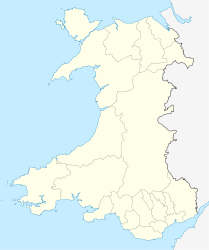
Dolbenmaen
Basisdaten
Staat Vereinigtes Königreich
Landesteil Wales
Unitary Authority Gwynedd
Einwohner 1.300 (2001)
ISO 3166-2 GB-GWN
52.968-4.228

Dolbenmaen ist eine Ortschaft und Großgemeinde im County Gwynedd, Wales, die wie auch Criccieth ein Zentrum des früheren Cantrefs Eifionydd war. Im Jahr 1239 endete die Funktion als Hauptort des Cantrefs.

Die Großgemeinde umfasst außer Dolbenmaen noch sieben andere Orte und hat 1.300 Einwohner (Census von 2001).[1] Zwischen Dolbenmaen und Beddgelert liegt der Berg Moel Hebog im Snowdonia-Nationalpark.

Bildergalerie

Weblinks

Einzelnachweise

  1. Office for National Statistics : Census 2001 : Parish Headcounts : Gwynedd eingesehen am 13. Januar 2010

Wikimedia Foundation.

Игры ⚽ Поможем написать реферат

Schlagen Sie auch in anderen Wörterbüchern nach:

  • Dolbenmaen — Coordinates: 52°58′05″N 4°13′41″W / 52.968°N 4.228°W / 52.968; 4.228 …   Wikipedia

  • Criccieth — Coordinates: 52°55′01″N 4°14′11″W / 52.91697°N 4.23626°W / 52.91697; 4.23626 …   Wikipedia

  • Glaslyn Rural District — infobox historic subdivision Name= Glaslyn HQ= Status= Rural District Start= 1894 End= 1934 Replace= Gwyrfai Rural District, Lleyn Rural District, Criccieth Urban District, Portmadoc Urban District Civic= Glaslyn was a rural district in the… …   Wikipedia

  • Criccieth Castle — Part of Gwynedd Criccieth, North Wales …   Wikipedia

  • Aberdaron — Coordinates: 52°48′29″N 4°42′36″W / 52.808°N 4.710°W / 52.808; 4.710 …   Wikipedia

  • Bangor University — Prifysgol Bangor Motto Welsh: Gorau Dawn Deall ( The Best Gift is Knowledge ) Latin: Mortis felix et dominus Established 1884 …   Wikipedia

  • Bardsey Island — Coordinates: 52°45′40″N 4°47′05″W / 52.76107°N 4.78469°W / 52.76107; 4.78469 …   Wikipedia

  • Dolgellau — Coordinates: 52°44′N 3°53′W / 52.74°N 3.88°W / 52.74; 3.88 …   Wikipedia

  • Aberdyfi — Coordinates: 52°32′40″N 4°02′40″W / 52.54438°N 4.0444°W / 52.54438; 4.0444 …   Wikipedia

  • Nasareth — Coordinates: 53°01′35″N 4°16′47″W / 53.02631°N 4.27978°W / 53.02631; 4.27978 …   Wikipedia

Share the article and excerpts

Direct link
Do a right-click on the link above
and select “Copy Link”