- Gülalan
-
Gülalan 
Hilfe zu Wappen

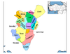
Basisdaten Provinz (il): Denizli Landkreis (ilçe): Buldan Koordinaten: 38° 6′ N, 28° 47′ O38.09914166666728.785377777778700Koordinaten: 38° 5′ 57″ N, 28° 47′ 7″ O Höhe: 700 m Einwohner: 335[1] (2010) Telefonvorwahl: (+90) 258 Postleitzahl: 20400 Kfz-Kennzeichen: 20 Struktur und Verwaltung (Stand: 2010) Muhtar: İrfan Saltıker[2] Gülalan ist ein Dorf im Landkreis Buldan der türkischen Provinz Denizli. Gülalan liegt etwa 58 km nordwestlich der Provinzhauptstadt Denizli und 18 km nordwestlich von Buldan. Gülalan hatte laut der letzten Volkszählung 347 Einwohner (Stand Ende Dezember 2010).
Einzelnachweise
- ↑ Türkisches Institut für Statistik, abgerufen 16. Juni 2011
- ↑ Yerelnet.org, abgerufen 16. Juni 2011
 Ortschaften im Landkreis Buldan
Städte/Kleinstädte: Buldan | Yenicekent
Dörfer: Aktaş | Alacaoğlu | Alandız | Beyler | Boğazçiftlik | Bostanyeri | Bozalan | Bölmekaya | Çamköy | Çatak | Derbent | Dımbazlar | Doğan | Gülalan | Hasanbeyler | Kadıköy | Karaköy | Kaşıkcı | Kırandamı | Kovanoluk | Kurudere | Mahmutlu | Oğuz | Sarımahmutlu | Süleymanlı | Türlübey | Yayla | Yeniçam
Wikimedia Foundation.
Schlagen Sie auch in anderen Wörterbüchern nach:
Bilecik — is the provincial capital of Turkey s Bilecik Province.Along with its districts, it is the birthplace of the Osmanlı dynasty, whose members founded the Ottoman Empire.The town is famous for its numerous restored Turkish houses. It is increasingly … Wikipedia
Nabran — Municipality Atlant leisure facility in Nabran … Wikipedia
Digahoba — Municipality … Wikipedia
Mürsəlliqışlaq — Coordinates: 41°26′N 48°49′E / 41.433°N 48.817°E / 41.433; 48.817 … Wikipedia
Qaraqurdlu — Infobox Settlement name =Qaraqurdlu settlement type=Municipality native name = pushpin pushpin mapsize =300 subdivision type = Country subdivision name = flag|Azerbaijan subdivision type1 = Rayon subdivision name1 =Khachmaz leader title = leader… … Wikipedia
Maşioba — Coordinates: 41°28′N 48°45′E / 41.467°N 48.75°E / 41.467; 48.75 … Wikipedia
Nağıoba — Coordinates: 41°36′N 48°48′E / 41.6°N 48.8°E / 41.6; 48.8 … Wikipedia
Düztahiroba — Coordinates: 41°44′N 48°33′E / 41.733°N 48.55°E / 41.733; 48.55 … Wikipedia
Mirzəməmmədqışlaq — For the nearby municipality and village formerly of the same name, see Hacıəlibəy. Coordinates: 41°22′36″N 48°42′21″E / 41.37667°N 48.70583°E … Wikipedia
Aşağı Zeyid — Municipality … Wikipedia
Gülalan


18+
© Academic, 2000-2024
- Kontaktieren Sie uns: Unterstützung, Werbung
Wörterbücher Export, schritte mit PHP, Joomla, Drupal, WordPress, MODx.