- Liste australischer Leuchttürme und Feuerschiffe
-
Diese Liste enthält Leuchttürme und Feuerschiffe in Australien.
An der 25.760 km langen Küstenlinie Australiens[1] befinden sich über 350 Leuchttürme und Navigationshilfen[2] und im Inland gibt es den Point-Malcolm-Leuchtturm, den einzigen im australischen Inland befindlichen Leuchtturm.[3]
Der erste Leuchtturm, der in Australien erbaut wurde, war das Macquarie Lighthouse, ein aufgestelltes hölzernes Dreibein mit einem Signalfeuer aus Kohle.[2][4] Die letzte von Menschen bediente Befeuerung fand in dem australischen Leuchtturm Maatsuyker Island Lighthouse auf Maatsuyker Island, vor der Südküste von Tasmaniens statt. Die Befeuerung wurde im Jahr 1996 automatisiert.[2]
Inhaltsverzeichnis
Management
Die meisten Leuchttürme und Leuchtschiffe in Australien werden von der Australian Maritime Safety Authority (AMSA) gemeinsam mit den örtlich zuständigen Stellen betrieben. Sie sind für die Leuchttürme und die sie umgebenden Parks verantwortlich, obwohl die AMSA normalerweise lediglich für die Befeuerung zuständig ist.
In New South Wales werden die Leuchttürme und Parks vom Department of Environment, Climate Change and Water oder New South Wales Department of Lands[5] und im Northern Territory einige Leuchttürme von der Port Corporation in Darwin betrieben.[6] In South Australia sind einige Stationen durch das Department for Environment and Heritage verwaltet.[7] und in Tasmanien betreibt der Tasmania Parks and Wildlife Service zahlreiche Leuchttürme.[8] In Victoria leisten hauptsächlich die Port of Melbourne Corporation im Gebiet von Melbourne und die Victorian Regional Channels Authority Unterstützung[9], da die meisten Parks durch die Verwaltung der Parks Victoria betrieben werden.[10] Ferner werden in Western Australia einige denkmalgeschützte Stationen vom Department of Environment and Conservation unterhalten.
Leuchttürme nach Bundesländern
Jervis Bay Territory
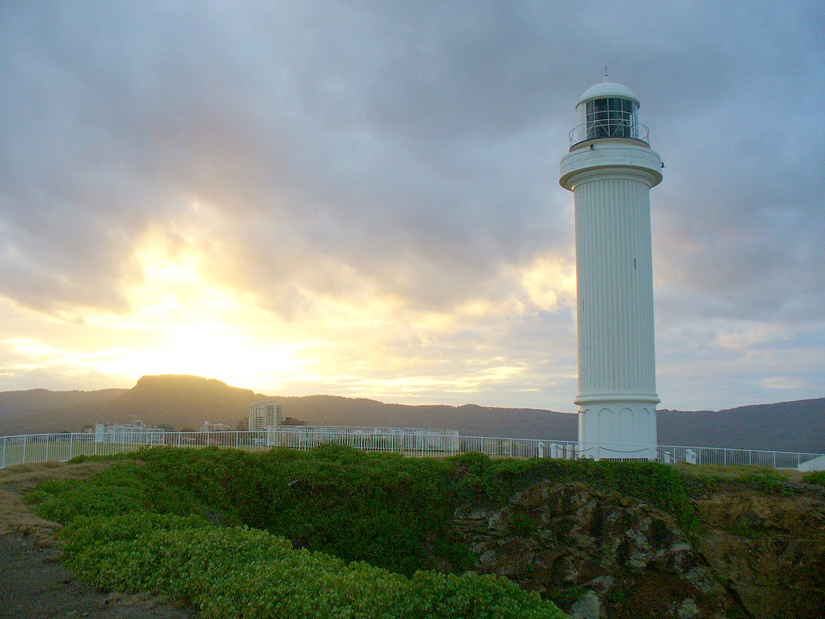
Ort Name Bild Koordinaten Errichtet Automatisiert deaktiviert Bemerkungen Jervis Bay Village Cape St George Lighthouse 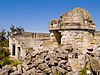
35° 9′ 7″ S, 150° 45′ 42″ O-35.15184150.76154 1860 1889 zerstört[11] heute denkmalgeschützt New South Wales
In New South Wales gibt es verschiedene Leuchttürme, die etwa um dieselbe Zeit von den gleichen Architekten mit ähnlichem Design entworfen wurden und daher ein vergleichbares Design zeigen. Diese sind:
- Wollongong Breakwater Lighthouse und Warden Head Light, gebaut 1872-1873 und durch Edward O. Moriarty initiiert
- Crowdy Head Light, Fingal Head Light, Clarence River Light (das Original ist nun abgebaut), Tacking Point Lighthouse und Richmond River Light, 1878 entworfen von James Barnet
- Point-Perpendicular-Leuchtturm (1899), Cape Byron Light (1901) und Norah Head Light (1903), entworfen von Charles Assinder Harding
- Bradleys Head Light (1905) und Robertson Point Light (1910)
- The "Disney Castles", Grotto Point Light, Parriwi Head Light, Vaucluse Bay Range Front Light und Vaucluse Bay Range Rear Light, gebaut 1910-1911 von Maurice Festu
- The "Wedding Cakes", Eastern Channel Pile Light und Western Channel Pile Light 1924 gebaut
Ort Name Bild Koordinaten Errichtet Automatisiert Deaktiviert Bemerkungen Balgowlah Heights Grotto Point Light 
33° 49′ 4″ S, 151° 15′ 41″ O-33.8177151.2615 1911 aktiv Ballina Richmond River Light 
28° 52′ 1″ S, 153° 35′ 30″ O-28.867153.5918 1866 1920 aktiv Bradleys Head Bradleys Head Light 
33° 51′ 13″ S, 151° 14′ 48″ O-33.8536151.2467 1905 aktiv Burrewarra Point Burrewarra Point Light 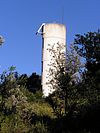
35° 50′ 2″ S, 150° 14′ 1″ O-35.8339150.2336 1974 1974 aktiv Solarbetrieb[12] Cape Byron Cape Byron Light 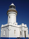
28° 38′ 19″ S, 153° 38′ 11″ O-28.63854153.6364 1901 aktiv Cremorne Point Robertson Point Light 
33° 50′ 55″ S, 151° 13′ 59″ O-33.8487151.233 1910 aktiv Crowdy Head Crowdy Head Light 
31° 50′ 36″ S, 152° 45′ 13″ O-31.84344152.7536 1878 1928 aktiv Culburra Beach Crookhaven Heads Light 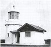
34° 53′ 57″ S, 150° 46′ 13″ O-34.89914150.77024 1882 aktiv Solarbetrieb[13] Fingal Head Fingal Head Light 
28° 12′ 0″ S, 153° 34′ 15″ O-28.2153.5708 1872 1920 aktiv Fort Denison Fort Denison Light 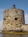
33° 51′ 17″ S, 151° 13′ 34″ O-33.8546151.226 1913 aktiv Green Cape Green Cape Lighthouse 
37° 15′ 41″ S, 150° 2′ 57″ O-37.2614150.0493 1883 1983 1997 mit Solarbetrieb wieder aufgestellt[14] Kiama Kiama Light 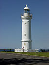
34° 40′ 18″ S, 150° 51′ 45″ O-34.6718150.8626 1887 1920 aktiv Kurnell Cape Bailey Light 
34° 2′ 7″ S, 151° 13′ 20″ O-34.0352151.2222 1950 aktiv Montague Island Montague Island Light 
36° 15′ 7″ S, 150° 13′ 35″ O-36.252150.2264 1881 1986 aktiv Solarbetrieb[15] Nelson Bay Nelson Head Light 
32° 42′ 37″ S, 152° 9′ 41″ O-32.7104152.1614 1872 1984 2003 Newcastle Nobbys Head Light 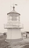
32° 55′ 7″ S, 151° 47′ 54″ O-32.9185151.7984 1854 1935 aktiv Norah Head Norah Head Light 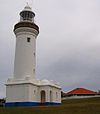
33° 16′ 54″ S, 151° 34′ 35″ O-33.2816151.5764 1903 1995 aktiv Palm Beach Barrenjoey Lighthouse 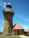
33° 34′ 48″ S, 151° 19′ 47″ O-33.5801151.3298 1855 1932 aktiv Mosman Parriwi Head Light 33° 48′ 44″ S, 151° 14′ 47″ O-33.8121151.2463 1911 aktiv Point Perpendicular Point-Perpendicular-Leuchtturm 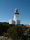
35° 5′ 38″ S, 150° 48′ 16″ O-35.0939150.8044 1899 1993 wieder als durch Solarenergie betriebenen Turm aufgebaut[16] Point Stephens Point Stephens Light 
32° 44′ 49″ S, 152° 12′ 5″ O-32.747152.2014 1862 1989 aktiv Solarbetrieb[17] Shark Island Shark Island Light 
33° 51′ 23″ S, 151° 15′ 26″ O-33.8565151.2572 1913 aktiv Smoky Cape Smoky Cape Lighthouse 
30° 55′ 23″ S, 153° 5′ 16″ O-30.923153.0877 1891 1988 aktiv Solitary Islands North Solitary Island Light 
29° 55′ 29″ S, 153° 23′ 23″ O-29.9246153.3897 1975 aktiv Fiberglassstruktur, Solarbetrieb[18] Solitary Islands South Solitary Island Light 
30° 12′ 24″ S, 153° 16′ 3″ O-30.2067153.2674 1880 1975 aktiv Solarbetrieb[19] Seal Rocks Sugarloaf Point Light 
32° 26′ 27″ S, 152° 32′ 21″ O-32.4409152.5392 1875 1987 aktiv mit außen angeleger Treppe[20] Sydney CLS-4 Carpentaria 
33° 52′ 12″ S, 151° 12′ 1″ O-33.86997151.200264 1918 1985 Feuerschiff; befindet sich am Australian National Maritime Museum[21] Sydney Harbour Eastern Channel Pile Light 
33° 50′ 30″ S, 151° 16′ 18″ O-33.8418151.2718 1924 aktiv Sydney Harbour Western Channel Pile Light 33° 50′ 16″ S, 151° 15′ 46″ O-33.8379151.2629 1924 aktiv Port Macquarie Tacking Point Lighthouse 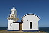
31° 28′ 31″ S, 152° 56′ 14″ O-31.4754152.9372 1879 1919 aktiv Ulladulla Warden Head Light 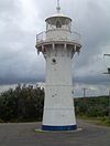
35° 21′ 56″ S, 150° 29′ 27″ O-35.3655150.4909 1873 1920 aktiv Batteriebetrieb, wieder aufgebaut[22] Vaucluse Macquarie Lighthouse 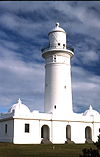
33° 51′ 14″ S, 151° 17′ 6″ O-33.8539151.2851 1793 1976 aktiv Australiens erster Leuchtturm[4] Vaucluse Vaucluse Bay Range Front Light 33° 50′ 58″ S, 151° 16′ 26″ O-33.8495151.2739 1884 aktiv Vaucluse Vaucluse Bay Range Rear Light 33° 51′ 30″ S, 151° 16′ 22″ O-33.8582151.2729 1884 aktiv Watsons Bay Hornby Lighthouse 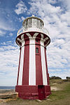
33° 50′ 1″ S, 151° 16′ 51″ O-33.8335151.2809 1858 1933 aktiv Wollongong Wollongong Breakwater Lighthouse 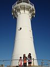
34° 25′ 11″ S, 150° 54′ 24″ O-34.4196150.9067 c.1870 1974 [23] Wollongong Wollongong Head Lighthouse 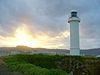
34° 25′ 19″ S, 150° 54′ 35″ O-34.4219150.9097 1936 1936 aktiv Yamba Clarence River Light 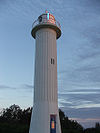
29° 25′ 57″ S, 153° 21′ 50″ O-29.4324153.3639 1866 1920 aktiv Batteriebetrieb[24] Northern Territory
Die meisten Leuchttürme im Northern Territory wurden vom Commonwealth Lighthouse Service während des "Golden Age of Australian Lighthouses" (deutsch: Goldene Zeit der australischen Leuchttürme), zwischen 1913 und 1920 gebaut. Dies sind das Cape Don Light, East Vernon Light, Emery Point Light, Cape Hotham Light und Cape Fourcroy.[25]
Von diesen fünf Leuchttürmen, können drei als "Geschwister" verstanden warden: Cape Hotham Light, Emery Point Light und Cape Fourcroy Light. Sie sind als weiße quadratisch geformte skelettierte Türme identifizierbar und sie haben die gleiche Lichtcharateristik, die alle 15 Sekunden einen Lichtblitz ausstrahlt. (Fl.(3) 15s).[26]
Ort Name Bild Koordinaten Errichtet Automatisiert Deaktiviert Bemerkungen Cobourg Peninsula Cape Don Light 
11° 18′ 28″ S, 131° 45′ 55″ O-11.30786131.76515 1917 1983 aktiv Solarbetrieb[27] Cape Fourcroy Cape Fourcroy Light 11° 47′ 51″ S, 130° 1′ 28″ O-11.79747130.02434 aktiv Clarence Strait Cape Hotham Light 
12° 2′ 47″ S, 131° 17′ 22″ O-12.04644131.28946 1928 aktiv East Vernon Island East Vernon Light 
12° 4′ 38″ S, 131° 5′ 43″ O-12.07722131.09531 1928 aktiv Larrakeyah Barracks Emery Point Light 
12° 27′ 14″ S, 130° 48′ 56″ O-12.45382130.81555 1900 aktiv Cox Peninsula Point Charles Light 
12° 23′ 21″ S, 130° 37′ 50″ O-12.38929130.63068 1893 1933 aktiv überstand den Cyclone Tracy;[28] Solarbetrieb[29] Queensland
Die meisten Leuchttürme in Queensland wurden in Kleinserien hergestellt:
- Zwei Leuchttürme sind, mit vorfabrizierten Segmenten aus Gusseisen mit Bolzen verbunden, aufgestellt worden: Sandy Cape Light und Bustard Head Light.[30]
- Acht Leuchttürme bestehen aus einem aus Hartholzrahmem, der mit Wellblech verkleidet ist: Little Sea Hill Light, Grassy Hill Light, Goods Island Light, Bay Rock Light, Old Caloundra Light, North Point Hummock Light (abgebaut), Gatcombe Head Light (abgebaut) und Bulwer Island Light.[31]
- Sieben Betontürme wurden zwischen 1964 und 1979 errichtet: Cape Capricorn Light, New Caloundra Light, Point Danger Light, New Burnett Heads Light, Fitzroy Island Light, Point Cartwright Light und Archer Point Light.[31]
Ort Name Bild Koordinaten Errichtet Automatisiert Deaktiviert Bemerkungen Cooktown Archer Point Light 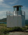
15° 35′ 37″ S, 145° 19′ 43″ O-15.5936145.3285 1883 1979 aktiv Townsville Bay Rock Light 
19° 7′ 0″ S, 146° 45′ 10″ O-19.1168146.7529 1886 1930 c.1992 [32][33] Booby Island Booby Island Light 
10° 36′ 15″ S, 141° 54′ 36″ O-10.6042141.91 1890 1991 aktiv Generatorbetrieb[34] Bulwer Island Bulwer Island Light 
27° 28′ 53″ S, 153° 1′ 36″ O-27.4815153.0266 1912 1983 nicht am Originalplatz aufgestellt[35] Burnett Heads New Burnett Heads Light 24° 45′ 30″ S, 152° 24′ 45″ O-24.7582152.4126 1971 1971 aktiv Burnett Heads Old Burnett Heads Light 
24° 45′ 49″ S, 152° 24′ 33″ O-24.7637152.4091 1873 1932 1971 Bustard Head Bustard Head Light 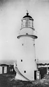
24° 1′ 20″ S, 151° 45′ 52″ O-24.0223151.7644 1869 1985 aktiv Caloundra New Caloundra Light 
26° 48′ 5″ S, 153° 8′ 15″ O-26.8015153.1374 1968 1969 1997 Caloundra Old Caloundra Light 
26° 48′ 6″ S, 153° 8′ 15″ O-26.8016153.1374 1896 1942 1968 Cape Bowling Green Cape Bowling Green Light 
19° 19′ 34″ S, 147° 25′ 32″ O-19.3262147.4256 1874 1920 aktiv Original versetzt[36] Cape Capricorn Cape Capricorn Light 23° 29′ 11″ S, 151° 14′ 10″ O-23.4863151.2361 1875 aktiv Cape Cleveland Cape Cleveland Light 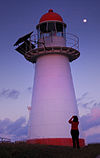
19° 10′ 58″ S, 147° 0′ 55″ O-19.1829147.0154 1879 aktiv Cape Moreton Cape Moreton Light 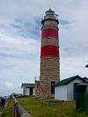
27° 1′ 55″ S, 153° 27′ 57″ O-27.0319153.4659 1857 aktiv Cleveland New Cleveland Point Light 
27° 30′ 37″ S, 153° 17′ 21″ O-27.51018153.28909 1976 aktiv Cleveland Old Cleveland Point Light 
27° 30′ 37″ S, 153° 17′ 20″ O-27.5102153.289 1847 1976 1969 wurde mit Laserlicht experimentiert[37] Cooktown Grassy Hill Light 
15° 27′ 38″ S, 145° 15′ 19″ O-15.4606145.2553 1886 1927 aktiv Comboyuro Point Comboyuro Point Light 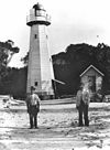
27° 3′ 42″ S, 153° 21′ 45″ O-27.06164153.36263 1874 1954 1960 zusammengebrochen[38] Cowan Cowan Point Cowan Cowan Point Light 
27° 8′ 12″ S, 153° 21′ 46″ O-27.13655153.36282 1873 1950[39] Abgebaut[40] Creal Reef Creal Reef Light 20° 32′ 2″ S, 150° 22′ 50″ O-20.533973150.38051 1985[41] aktiv Curtis Island Sea Hill Light 
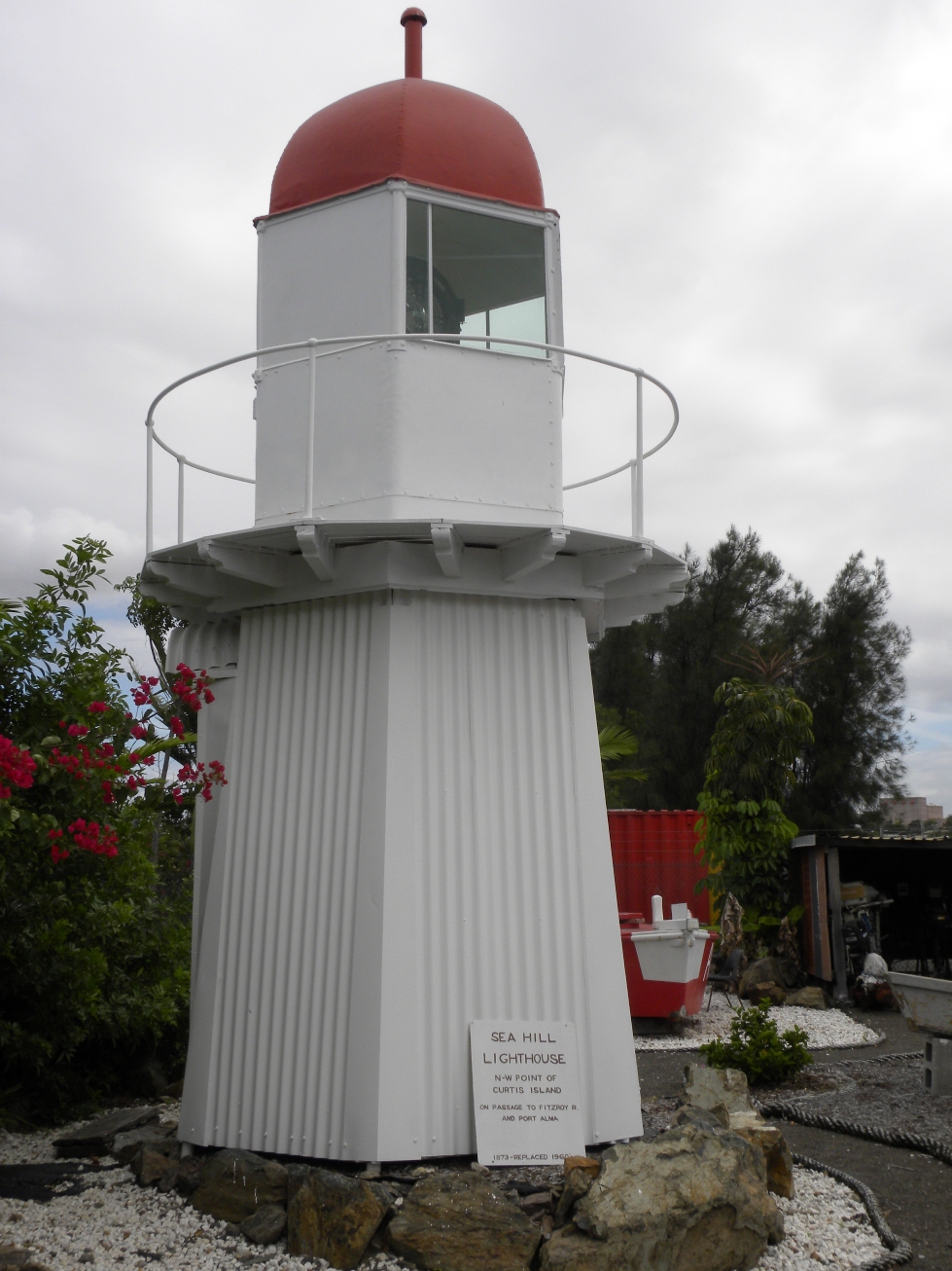
23° 29′ 27″ S, 150° 58′ 49″ O-23.490931150.980414 1876 2006 erster Leuchtturm, der sich nun im Gladstone Maritime Museum befindet.[42] Dent Island Dent Island Light 
20° 22′ 9″ S, 148° 55′ 44″ O-20.3692148.9289 1879 1987 aktiv Double Island Point Double Island Point Light 
25° 56′ 10″ S, 153° 11′ 27″ O-25.9362153.1907 1884 1992 aktiv Eborac Island Eborac Island Lighthouse 
10° 40′ 56″ S, 142° 32′ 1″ O-10.682116142.533649 aktiv Fitzroy Island Fitzroy Island Light 16° 55′ 34″ S, 146° 0′ 7″ O-16.9261146.002 1943 1992 Flat Top Island Flat Top Island Light 
21° 9′ 41″ S, 149° 14′ 47″ O-21.1615149.2464 1879 1920 2007 Sandy Cape Sandy Cape Light 
24° 43′ 48″ S, 153° 12′ 31″ O-24.7299153.2086 1870 1991 aktiv Goods Island Goods Island Light 
10° 33′ 55″ S, 142° 8′ 58″ O-10.5654142.1494 1886 aktiv Lady-Elliot-Insel Lady Elliot Island Light 
24° 6′ 53″ S, 152° 42′ 42″ O-24.1146152.7116 1873 aktiv Low Island Low Isles Light 
16° 23′ 2″ S, 145° 33′ 35″ O-16.384145.5598 1878 1993 aktiv Moreton Bay Moreton Bay Pile Light 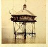
27° 18′ 39″ S, 153° 12′ 37″ O-27.3109153.2104 1884[43] 1952[44] 1966-1967[45] Struktur wurde 1949 zerstört[45] North Reef North Reef Light 
23° 11′ 8″ S, 151° 54′ 13″ O-23.1855151.9037 1878 1978 aktiv Pine Islet Pine Islet Light 
21° 39′ 27″ S, 150° 13′ 0″ O-21.6575150.2166 1885 1985 wieder aufgestellt, es handelt sich um den letzten mit Keroson betriebenen Leuchtturm der Welt[46] Mooloolaba Point Cartwright Light 
26° 40′ 47″ S, 153° 8′ 18″ O-26.6797153.1384 1978 1978 aktiv Point Lookout Point Lookout Light 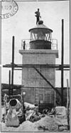
27° 25′ 54″ S, 153° 32′ 25″ O-27.4316153.5404 1932 aktiv Point Danger Point Danger Light 
28° 9′ 54″ S, 153° 33′ 3″ O-28.165153.5507 1971 1971 aktiv Experimente mit Laserlicht in 1971[47] Townsville Wharton Reef Light 19° 15′ 36″ S, 146° 49′ 18″ O-19.2599146.8217 1915 1915 1990 nicht am Ursprungsort[48] Wyborn Reef Wyborn Reef Light 
10° 49′ 9″ S, 142° 46′ 30″ O-10.819185142.77493 1938[49] aktiv South Australia
Ort Name Bild Koordinaten Errichtet Automatisiert Deaktiviert Bemerkungen Althorpe Island Althorpe Island Lighthouse 35° 22′ 17″ S, 136° 51′ 37″ O-35.3715136.8603 1879 1991 aktiv Dieselbetrieb[50] Beachport Cape Martin Lighthouse 
37° 29′ 22″ S, 140° 0′ 45″ O-37.4895140.0125 1960 aktiv Cape Banks Cape Banks Lighthouse 37° 53′ 53″ S, 140° 22′ 35″ O-37.898140.3763 1883 1928 aktiv Cape Borda Cape Borda Lighthouse 
35° 45′ 10″ S, 136° 35′ 37″ O-35.7528136.5937 1858 1989 aktiv Cape Donnington Cape Donnington Lighthouse 34° 43′ 35″ S, 135° 59′ 38″ O-34.7265135.9939 1878 aktiv Cape du Couedic Cape du Couedic Lighthouse 
36° 3′ 28″ S, 136° 42′ 18″ O-36.0579136.7049 1909 1957 aktiv Cape Jaffa Cape Jaffa Lighthouse 
36° 50′ 9″ S, 139° 50′ 46″ O-36.8359139.8462 1872 1973 verschraubt; befindet sich nicht am Originalplatz[51] Cape Jervis Cape Jervis Lighthouse 35° 36′ 13″ S, 138° 5′ 40″ O-35.6037138.0945 1871 1972 aktiv Cape Spencer Cape Spencer Lighthouse 
35° 17′ 56″ S, 136° 52′ 58″ O-35.2988136.8827 1950 1975 aktiv Cape St Albans Cape St Albans Lighthouse 35° 48′ 13″ S, 138° 7′ 29″ O-35.8036138.1248 1908 1908 aktiv Cape Willoughby Cape Willoughby Lighthouse 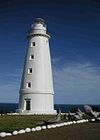
35° 50′ 34″ S, 138° 7′ 58″ O-35.8428138.1327 1852 1974 2003 erster Leuchtturm in South Australia[52] Corny Point Corny Point Lighthouse 
34° 53′ 47″ S, 137° 0′ 37″ O-34.8965137.0104 1882 1920 aktiv Marino Marino Rocks Navigational Aid -35.0536138.5117 1962 1962 aktiv Penguin Island Penguin Island Lighthouse 37° 29′ 52″ S, 140° 0′ 49″ O-37.4979140.0136 1878 1918 1960 aufgegeben[53] Point Lowly Point Lowly Lighthouse 32° 59′ 59″ S, 137° 47′ 7″ O-32.9996137.7853 1883 1973 1993 Point Malcolm Point Malcolm Lighthouse 35° 30′ 32″ S, 139° 11′ 27″ O-35.5089139.1909 1878 1931 Australiens einziger Leuchtturm, der sich im Inland befindet; reaktiviert[3][54] Port Adelaide Port Adelaide Lighthouse 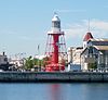
34° 50′ 33″ S, 138° 30′ 15″ O-34.8424138.5042 1869 1901 nicht am Ursprungsort, an Samstagen in Betrieb[54][55] Port Macdonnell Cape Northumberland Lighthouse 38° 3′ 23″ S, 140° 40′ 3″ O-38.0563140.6674 1882 1990 aktiv Port Macdonnell Old Macdonnell Lighthouse 38° 3′ 23″ S, 140° 40′ 3″ O-38.0563140.6674 1859 1881 zerstört[56] Robe Robe Lighthouse 
37° 9′ 51″ S, 137° 0′ 37″ O-37.1643137.0104 1972 1972 aktiv South Neptune Island South Neptune Island Lighthouse 35° 20′ 15″ S, 136° 7′ 4″ O-35.3375136.1177 1901 c.1990 aktiv Neuer Turm[57] Tipara Reef Tipara Reef Screw Pile 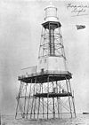
33° 55′ 47″ S, 137° 37′ 35″ O-33.9297137.6263 1877 1995 nicht am Ursprungsort[58] Troubridge Hill Troubridge Hill Lighthouse 35° 9′ 59″ S, 137° 38′ 27″ O-35.1663137.6408 1980 1980 aktiv Troubridge Island Troubridge Island Lighthouse 
35° 7′ 1″ S, 137° 49′ 39″ O-35.117137.8276 1856 1981 2001 vom Verfall bedroht[59] West Cape West Cape Lighthouse 35° 14′ 39″ S, 136° 49′ 27″ O-35.2442136.8241 1980 1980 aktiv gebaut aus Edelstahl[60] Wonga Shoal Wonga Shoal Lighthouse 
34° 49′ 24″ S, 138° 26′ 15″ O-34.8233138.4376 1901 1912 zerstört[61] Tasmanien
Ort Name Bild Koordinaten Errichtet Automatisiert Deaktiviert Bemerkungen Bluff Hill 41° 0′ 32″ S, 144° 36′ 36″ O-41.009144.6101 1982 1982 aktiv Cape Bruny Cape Bruny Lighthouse 43° 29′ 28″ S, 147° 8′ 33″ O-43.491147.1424 1838 1996 Cape Forrestier Cape Forrestier Lighthouse 42° 7′ 0″ S, 148° 21′ 32″ O-42.1167148.3589 1971 demontiert[8] Cape Sorell Cape Sorell Lighthouse 42° 11′ 52″ S, 145° 10′ 9″ O-42.1978145.1693 1899 aktiv Cape Tourville Cape Tourville Lighthouse 42° 7′ 21″ S, 148° 20′ 34″ O-42.1226148.3427 1971 1971 aktiv Cape Wickham 39° 35′ 19″ S, 143° 56′ 34″ O-39.5885143.9429 1861 1918 aktiv Currie Harbour Currie Lighthouse 39° 55′ 45″ S, 143° 50′ 32″ O-39.9293143.8422 1880 aktiv deaktiviert von 1989 - 1995[62] Deal Island Deal Island Lighhouse 
39° 29′ 39″ S, 147° 19′ 21″ O-39.4943147.3225 1848 1921 1992 Australiens höchster Leuchtturm[63] Eddystone Point 40° 59′ 35″ S, 148° 20′ 52″ O-40.9931148.3478 1889 aktiv Goose Island Goose Island Lighthouse 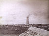
40° 18′ 42″ S, 147° 48′ 5″ O-40.3116147.8013 1846 1931 aktiv Hells Gate Bonnet Island Lighthouse 42° 13′ 24″ S, 145° 13′ 19″ O-42.2232145.2219 1892 1910 aktiv Hells Gate Entrance Island Lighthouse 
42° 12′ 39″ S, 145° 12′ 55″ O-42.2108145.2154 1892 1910 aktiv Highland Bluff (neu) 40° 44′ 19″ S, 145° 17′ 24″ O-40.7386145.2901 aktiv Highland Bluff (alt) 40° 45′ 59″ S, 145° 17′ 55″ O-40.7663145.2985 1924 Iron Pot Iron Pot Lighthouse 
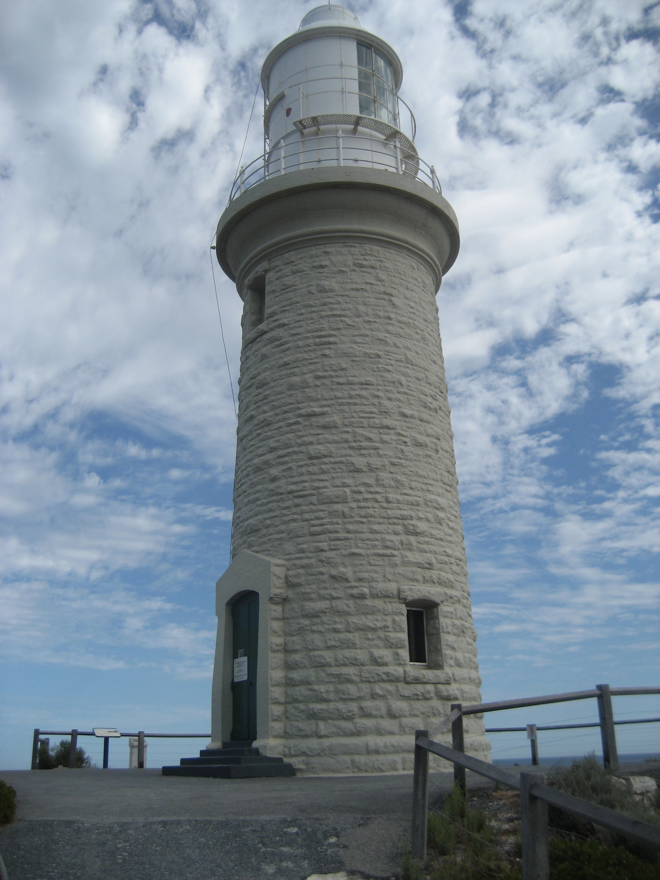
43° 3′ 31″ S, 147° 25′ 2″ O-43.0587147.4172 1832 aktiv Tasmaniens erster Leuchtturm[64] Low Head Low Head Lighthouse 41° 3′ 19″ S, 146° 47′ 20″ O-41.0553146.7889 1833 1995 aktiv Tasmanien zweiter Leuchtturm[65] Low Head Middle Channel Lighthouse 41° 4′ 47″ S, 146° 48′ 27″ O-41.0797146.8074 1882 1955 aktiv Low Head She Oak Point Lighthouse 41° 4′ 40″ S, 146° 48′ 14″ O-41.0777146.804 1882 1955 aktiv Maatsuyker Island Maatsuyker Island Lighthouse 
43° 39′ 25″ S, 146° 16′ 17″ O-43.657146.2714 1891 1996 Letzter bemannter Leuchtturm und Australiens südlichster[66][67] Mersey Bluff 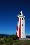
41° 9′ 31″ S, 146° 21′ 19″ O-41.1587146.3554 1889 1920 aktiv Point Home Lookout Point Home Lookout Lighthouse 42° 33′ 4″ S, 147° 57′ 13″ O-42.5512147.9537 1971 1971 aktiv Rocky Cape 40° 51′ 16″ S, 145° 30′ 30″ O-40.8545145.5083 1968 1968 aktiv Round Hill Point 41° 3′ 54″ S, 145° 57′ 42″ O-41.065145.9618 1923 1980 aktiv Sandy Cape 41° 25′ 18″ S, 144° 44′ 54″ O-41.4217144.7484 1953 aktiv Swan Island 40° 43′ 40″ S, 148° 7′ 32″ O-40.7277148.1256 1845 1985 aktiv Table Cape Table Cape Lighthouse 
40° 56′ 47″ S, 145° 43′ 44″ O-40.9465145.729 1888 1920 aktiv Tasman Island Tasman Island Lighthouse 
43° 14′ 22″ S, 148° 0′ 18″ O-43.2395148.0051 1906 1976 aktiv West Point 40° 56′ 34″ S, 144° 36′ 50″ O-40.9428144.6139 1916 1982 Zerstört[68] Victoria
Ort Name Bild Koordinaten Errichtet Automatisiert Deaktiviert Bemerkungen Aireys Inlet Split Point Lighthouse 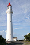
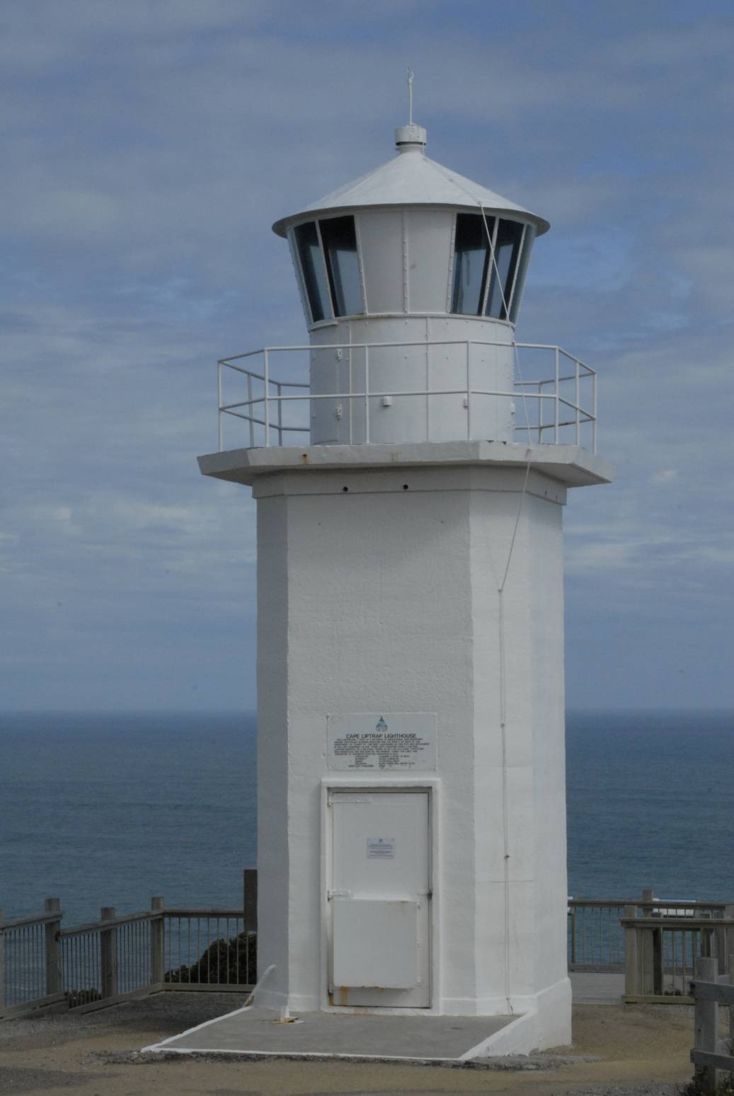
38° 28′ 5″ S, 144° 6′ 16″ O-38.468144.1044 1891 1919 aktiv Cape Liptrap Cape Liptrap Lighthouse 
38° 54′ 8″ S, 145° 55′ 0″ O-38.9021145.9167 1913 1913 aktiv Cape Nelson Cape Nelson Lighthouse 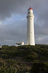
38° 25′ 52″ S, 141° 32′ 32″ O-38.431141.5423 1884 1995 aktiv Cape Otway Cape Otway Lighthouse 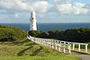
38° 51′ 24″ S, 143° 30′ 42″ O-38.8568143.5118 1848 1994 Wieder aufgestellt mit einem Solarbetriebr[69] Cape Schanck Cape Schanck Lighthouse 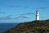
38° 29′ 34″ S, 144° 53′ 10″ O-38.4927144.8862 1859 aktiv Citadel Island Citadel Island Lighthouse 39° 6′ 51″ S, 146° 14′ 12″ O-39.1143146.2367 1913 1982 Solarbetrieb Cliffy Island Cliffy Island Lighthouse 
38° 57′ 2″ S, 146° 42′ 20″ O-38.9506146.7056 1884 1971 aktiv Solarbetrieb[70] Gabo Island Gabo Island Lighthouse 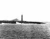
37° 34′ 7″ S, 149° 55′ 1″ O-37.5687149.9169 1853 1993 aktiv Solarbetrieb[71] Gellibrand Shoal Gellibrand Pile Light 37° 52′ 43″ S, 144° 54′ 53″ O-37.8785144.9147 1906 1976 Zerstört[72] Griffiths Island Griffiths Island Lighthouse 
38° 23′ 27″ S, 142° 15′ 19″ O-38.3909142.2552 1853 aktiv mit Windenergie betrieben[73] Lady Bay Lower Lady Bay Lower Lighthouse 38° 23′ 27″ S, 142° 29′ 7″ O-38.3907142.4854 1854 aktiv Lady Bay Upper Lady Bay Upper Lighthouse 38° 23′ 25″ S, 142° 29′ 7″ O-38.3903142.4854 1859 aktiv nicht am Ursprungsort[74] McCrae Eastern Lighthouse 38° 20′ 54″ S, 144° 55′ 40″ O-38.3483144.9279 1854 1994 Point Hicks Point Hicks Lighthouse 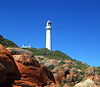
37° 48′ 6″ S, 149° 16′ 31″ O-37.8018149.2753 1890 aktiv Point Lonsdale Point Lonsdale Lighthouse 
38° 17′ 31″ S, 144° 36′ 50″ O-38.2919144.6139 1863 aktiv Portland Whaler's Bluff Lighthouse 38° 20′ 14″ S, 141° 36′ 33″ O-38.3373141.6091 1889 aktiv Portland Portland Bay Lighthouse 38° 21′ 15″ S, 141° 37′ 11″ O-38.3542141.6198 1859 1889 Port Melbourne Port Melbourne Front Light 37° 50′ 30″ S, 144° 55′ 45″ O-37.8417144.9293 1924 Port Melbourne Port Melbourne Rear Light 37° 50′ 14″ S, 144° 55′ 46″ O-37.8371144.9294 1924 aktiv Port Phillip South Channel Pile Light 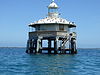
38° 20′ 19″ S, 144° 49′ 7″ O-38.3386144.8186 1874 1985 wieder aufgestellt und rekativiert[75] Port Phillip West Channel Pile Light 38° 11′ 34″ S, 144° 45′ 23″ O-38.1927144.7563 1881 aktiv Queenscliff Queenscliff High Light 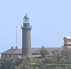
38° 16′ 17″ S, 144° 39′ 42″ O-38.2715144.6618 1843 aktiv Gebaut aus Bluestone[76] Queenscliff Queenscliff Low Light 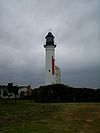
38° 16′ 25″ S, 144° 39′ 33″ O-38.2737144.6593 1854 aktiv nicht am Ursprungsort[77] Williamstown Williamstown Lighthouse 
37° 52′ 0″ S, 144° 54′ 45″ O-37.8668144.9126 1840 1934 1987 Befeuerung deaktiviert; Signalisierung aktiv[78] Wilsons Promontory Wilsons Promontory Lighthouse 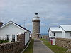
39° 7′ 48″ S, 146° 25′ 27″ O-39.1299146.4242 1859 1975 aktiv liegt am weitestens südlich des Hauptlandes[79] Western Australia
Ort Name Bild Koordinaten Errichtet Automatisiert deaktiviert Bemerkungen Adele Island 15° 30′ 36″ S, 123° 9′ 27″ O-15.5101123.1574 1951 aktiv Arthur Head Arthur Head Lighthouse 32° 3′ 24″ S, 115° 44′ 24″ O-32.0566115.74 1851 1902 Abgebaut[80] Bessieres Island Lighthouse 21° 38′ 10″ S, 115° 6′ 42″ O-21.6362115.1118 1913 aktiv Breaksea Island Breaksea Island Lighthouse 35° 3′ 51″ S, 118° 3′ 26″ O-35.0642118.0573 1858 aktiv Bunburry Casuarina Point Lighthouse 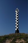
33° 19′ 9″ S, 115° 37′ 59″ O-33.3191115.633 1870 aktiv Caffarelli Island Caffarelli Island Lighthouse 16° 2′ 46″ S, 123° 17′ 9″ O-16.0461123.2858 1967 aktiv Cape Bossut Cape Bossut Lighthouse 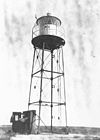
18° 42′ 49″ S, 121° 37′ 22″ O-18.7137121.6227 1913 c.1980 abgebaut Cape Leeuwin Cape Leeuwin Lighthouse 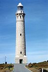
34° 22′ 30″ S, 115° 8′ 10″ O-34.375115.1362 1896 1992 aktiv Cape Leveque Cape Leveque Lighthouse 
16° 23′ 42″ S, 122° 55′ 42″ O-16.3949122.9282 1911 aktiv Cape Naturaliste Cape Naturaliste Lighthouse 
34° 22′ 30″ S, 115° 8′ 10″ O-34.375115.1362 1873 1978 aktiv 1907 von einem Kugelblitz getroffen>ref>http://www.lighthouse.net.au/lights/WA/Cape%20Naturaliste/Cape%20Naturaliste.htm</ref> Carnarvon Babbage Island Lighthouse 24° 52′ 34″ S, 113° 37′ 51″ O-24.876113.6309 1965 aktiv Cave Point Cave Point Lighthouse 35° 7′ 13″ S, 117° 53′ 56″ O-35.1202117.899 1976 1994 [81] Dirk Hartog Island Cape Inscription Lighthouse 
25° 28′ 54″ S, 112° 58′ 19″ O-25.4818112.972 1910 1917 aktiv East Island East Island Lighthouse 16° 54′ 9″ S, 122° 11′ 52″ O-16.9024122.1979 1968 aktiv Eclipse Island Eclipse Island Lighthouse 35° 10′ 56″ S, 117° 53′ 5″ O-35.1821117.8847 1926 1976 aktiv wiederaufgestellt mit Befeuerung[82] Escape Island Escape Island Lighthouse 30° 20′ 0″ S, 114° 59′ 11″ O-30.3334114.9864 1930 aktiv Fremantle North Mole Lighthouse 
32° 3′ 14″ S, 115° 43′ 28″ O-32.0538115.7245 1906 aktiv Fremantle South Mole Lighthouse 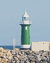
32° 3′ 21″ S, 115° 43′ 57″ O-32.0558115.7325 1903 aktiv Gantheaume Point Gantheaume Point Lighthouse 17° 58′ 27″ S, 122° 10′ 39″ O-17.9741122.1775 1905 1922 aktiv Guilderton Guilderton Lighthouse 31° 20′ 22″ S, 115° 29′ 32″ O-31.3394115.4921 1983 1983 aktiv Hillarys 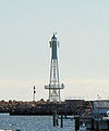
31° 49′ 25″ S, 115° 44′ 1″ O-31.8235115.7336 1986 aktiv Jarman Island Jarman Island Lighthouse 20° 39′ 31″ S, 117° 13′ 3″ O-20.6585117.2174 1888 1917 1985 [83] Legendre Island Legendre Island Lighthouse 20° 21′ 30″ S, 116° 50′ 34″ O-20.3584116.8427 1927 1989 aktiv Geraldton Moore Point Lighthouse 28° 46′ 58″ S, 114° 34′ 45″ O-28.7827114.5793 1878 1985 aktiv Mosman Park Buckland Hill Lighthouse 32° 1′ 1″ S, 115° 45′ 39″ O-32.01708115.76097 c.1970 aktiv North West Cape North West Cape Light 
21° 48′ 56″ S, 114° 9′ 12″ O-21.8156114.1534 1967 aktiv ein Rundfunkturm[84] Pelsart Island Pelsart Island Lighthouse 28° 59′ 7″ S, 113° 57′ 44″ O-28.9854113.9623 1974 aktiv Point Cloates Point Cloates Lighthouse 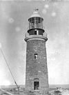
22° 42′ 32″ S, 113° 40′ 51″ O-22.709113.6808 1910 1933 1936 Ruine, denkmalgeschützt[85] Point King Point King Lighthouse 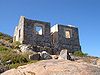
35° 2′ 7″ S, 117° 55′ 8″ O-35.0354117.9189 1858 1911 Ruine, denkmalgeschützt[86] Quobba Point Quobba Point Light 24° 28′ 47″ S, 113° 25′ 5″ O-24.4797113.4181 1950 aktiv Rottnest Island Bathurst Lighthouse 
31° 59′ 21″ S, 115° 32′ 26″ O-31.9893115.5406 1900 1986 aktiv Rottnest Island Wadjemup Lighthouse 
32° 0′ 26″ S, 115° 30′ 15″ O-32.0072115.5041 1851 1986 aktiv Australiens erster Leuchtturm mit routierender Befeuerung[87] Woodman Point Woodman Light 
32° 7′ 51″ S, 115° 46′ 11″ O-32.1309115.7697 1902 1955 aktiv Registrierung
Die Leuchttürme und Leuchtschiffe Australien sind in der National Geospatial-Intelligence Agency (List of Lights publication 111)[88] und auch beim United Kingdom Hydrographic Office Admiralty List of Lights & Fog Signals (Volume K) registriert.[89] Die ARLHS World List of Lights listet diese Leuchttürme unter der Kennzeichung "AUS".[90]
Im The Lighthouse Directory sind die Leuchttürme nach folgenden Gebieten registriert:
- Coral Sea Islands Territory[91]
- New South Wales, einschließlich Cape St George Lighthouse, das sich im Jervis Bay Territory befindet.[5]
- Northern Territory[6]
- Ostküste von Queensland ab Townsville südwärts[42]
- Entlegenes Queensland[92]
- South Australia[7]
- Tasmanien[8]
- Victoria[10]
- Western Australia[93]
Eine weitere Registrierung findet sich bei der Lighthouses of Australia Inc., die die Leuchttürme nach den australischen Bundesländern listet:[94]
- Western Australia[95]
- Northern Territory[96]
- South Australia[97]
- Queensland[98]
- New South Wales[99]
- Victoria[100]
- Tasmanien[101]
Eine weiteres Register existiert bei den Australian Lighthouses, eine Internetseite, die die Leuchttürme alphabetisch auflistet.[102] and a list by state.[103]
Eine Liste der Leuchttürme findet sich bei SeaSide Lights, die die Leuchttürme nach Staaten gliedert:[104]
- Western Australia[105]
- Northern Territory[106]
- South Australia[107]
- Queensland[108]
- New South Wales[109]
- Victoria[110]
- Tasmanien[111]
Der Ordnung halber muss ein aktiver australischer Leuchtturm schließlich in einem Verzeichnis, dem The Lighthouse Directory, Lighthouses of Australia Inc. oder SeaSide Lights eingetragen sein. Weitere Listen nehmen auch Stationen auf, die schwerlich als Leuchttürme bezeichnet werden können.[112], denn historische Leuchttürme sind manchmal registriert, sofern sie auch in anderen verfügbaren Listen genannt werden.
Weblinks
- Lighthouses Australia Inc. Eine Non-Profitorganisation, die weitergestellte Ziele in der Darstellung von australischen Leuchttürmen verfolgt
- West Australian Lighthouse Website
Einzelnachweise
- ↑ Australia. CIA World Factbook. Abgerufen am 26. August 2010.
- ↑ a b c Australian lighthouses - Australia's Culture Portal. cultureandrecreation.gov.au. Abgerufen am 26. August 2010.
- ↑ a b The Point Malcolm Lighthouse (Englisch). Lighthouses of South Australia. Lighthouses of Australia Inc. Abgerufen am 19. August 2010.
- ↑ a b Macquarie Lighthouse, Australiens erster Leuchtturm (Englisch). Lighthouses of New South Wales. Lighthouses of Australia Inc. Abgerufen am 6. Oktober 2011.
- ↑ a b Russ Rowlett: Lighthouses of Australia: New South Wales. The Lighthouse Directory. University of North Carolina at Chapel Hill. Abgerufen am 6. Oktober 2011.
- ↑ a b Russ Rowlett: Lighthouses of Australia: Northern Territory. The Lighthouse Directory. University of North Carolina at Chapel Hill. Abgerufen am 6. Oktober 2011.
- ↑ a b Russ Rowlett: Lighthouses of Australia: South Australia. The Lighthouse Directory. University of North Carolina at Chapel Hill. Abgerufen am 6. Oktober 2011.
- ↑ a b c Russ Rowlett: Lighthouses of Australia: Tasmania. The Lighthouse Directory. University of North Carolina at Chapel Hill. Abgerufen am 6. Oktober 2011.
- ↑ Role of VRCA. regionalchannels.vic.gov.au. Abgerufen am 26. August 2010.
- ↑ a b Russ Rowlett: Lighthouses of Australia: Victoria. The Lighthouse Directory. University of North Carolina at Chapel Hill. Abgerufen am 6. Oktober 2011.
- ↑ The Ill-Fated Cape St George Lighthouse (Englisch). Lighthouses of New South Wales. Lighthouses of Australia Inc. Abgerufen am 6. Oktober 2011. durch Zielübungen australischer Kriegsschiffe zerstört,
- ↑ Burrewarra Point Lighthouse bei der Batemans Bay (Englisch). Lighthouses of New South Wales. Lighthouses of Australia Inc. Abgerufen am 6. Oktober 2011.
- ↑ Crookhaven Heads Lighthouse (Englisch). Lighthouses of New South Wales. Lighthouses of Australia Inc. Abgerufen am 6. Oktober 2011.
- ↑ Steve Merson: Light the coast like a street with lamps. In: Lighthouses of Australia Inc Bulletin. July/August 2004.
- ↑ Montague Island Lighthouse (Englisch). Lighthouses of New South Wales. Lighthouses of Australia Inc. Abgerufen am 6. Oktober 2011.
- ↑ Point Perpendicular Lighthouse an der Jervis Bay (Englisch). Lighthouses of New South Wales. Lighthouses of Australia Inc. Abgerufen am 6. Oktober 2011.
- ↑ Point Stephens Lighthouse (Englisch). Lighthouses of New South Wales. Lighthouses of Australia Inc. Abgerufen am 6. Oktober 2011.
- ↑ Ian Clifford: South & North Solitary Islands Trip Report. In: Lighthouses of Australia Inc Bulletin. Februar 2000.
- ↑ South Solitary Lighthouse (Englisch). Lighthouses of New South Wales. Lighthouses of Australia Inc. Abgerufen am 6. Oktober 2011.
- ↑ Sugarloaf Point Lighthouse (Englisch). Lighthouses of New South Wales. Lighthouses of Australia Inc. Abgerufen am 6. Oktober 2011.
- ↑ Russ Rowlett: Lighthouses of Australia: Queensland’s East Coast. The Lighthouse Directory. University of North Carolina at Chapel Hill. Abgerufen am 6. Oktober 2011. liegt vor dem Australian Maritime Museum, Sydney
- ↑ Warden Head Lighthouse bei Ulladulla (Englisch). Lighthouses of New South Wales. Lighthouses of Australia Inc. Abgerufen am 6. Oktober 2011.
- ↑ Wollongong Breakwater Lighthouse (Englisch). Lighthouses of New South Wales. Lighthouses of Australia Inc. Abgerufen am 6. Oktober 2011.
- ↑ Clarence River Lighthouse bei Yamba (Englisch). Lighthouses of New South Wales. Lighthouses of Australia Inc. Abgerufen am 6. Oktober 2011.
- ↑ Michael B. Komesaroff: The Golden Age of Australian Lighthouses. In: The Victorian Historical Journal. 48, Mai 1977. reprinted in : The Golden Age of Australian Lighthouses. In: Lighthouses of Australia Inc Bulletin. September 2003.
- ↑ List of Lights, Pub. 111, The West Coasts of North and South America (Excluding Continental U.S.A. and Hawaii), Australia, Tasmania, New Zealand, and the Islands of the North and South Pacific Oceans. S.187-188. Abgerufen am 18. September 2011.
- ↑ Cape Don Lighthouse (Englisch). Lighthouses of Northern Territory. Lighthouses of Australia Inc. Abgerufen am 26. August 2010.
- ↑ Mike Foley (1987): Point Charles Lighthouse and the Military Occupation of the Cox Peninsula (PDF). Northern Territory Library Service. Abgerufen am 6. Oktober 2011.
- ↑ Point Charles Lighthouse (Englisch). Lighthouses of Northern Territory. Lighthouses of Australia Inc. Abgerufen am 26. August 2010.
- ↑ Australia Heritage Places Inventory: Sandy Cape Lightstation. Abgerufen am 18. September 2011.
- ↑ a b Queensland Heritage Register: Caloundra Lighthouses. Queensland Environmental Protection Agency. Abgerufen am 22. September 2011. (englisch)
- ↑ Bay Rock Lighthouse (Englisch). Lighthouses of Queensland. Lighthouses of Australia Inc. Abgerufen am 6. Oktober 2011., das im Townsville Maritime Museum aufgestellt wurde.
- ↑ The Bay Rock Light House - Maritime Museum of Townsville. townsvillemaritimemuseum.org.au. Abgerufen am 26. August 2010.
- ↑ Booby Island Lighthouse (Englisch). Lighthouses of Queensland. Lighthouses of Australia Inc. Abgerufen am 6. Oktober 2011. 240V
- ↑ LIGHTHOUSES. maritimemuseum.com.au. Abgerufen am 26. August 2010.
- ↑ On the waterfront. anmm.gov.au. Abgerufen am 26. August 2010.
- ↑ http://www.lighthouse.net.au/lights/QLD/Cleveland%20Point/Cleveland%20Point.htm möglicherweise der erste Leuchtturm, bei dem mit Lasern experimentiert wurde, allerdings word das Point Danger Light seit 1971 offiziell als der erste Leuchtturm mict Laserlicht genannt
- ↑ Richard Walding: Moreton Island RAN7 Indicator Loop Station and Fort Cowan Cowan. indicatorloops.com. Abgerufen am 20. Februar 2011.
- ↑ Queensland Heritage Register: Signal Station (former). Queensland Environmental Protection Agency. Abgerufen am 22. September 2011. (englisch)
- ↑ Gelistet im Australia Heritage Places Inventory: Booby Island Lightstation. Abgerufen am 18. September 2011.
- ↑ Creal Reef Light, QLD, AN424-01
- ↑ a b Russ Rowlett: Lighthouses of Australia: Queensland’s East Coast. The Lighthouse Directory. University of North Carolina at Chapel Hill. Abgerufen am 6. Oktober 2011.
- ↑ Annual Report on Harbours and Lighthouses. 22. November 1884. Abgerufen am 6. Oktober 2011.
- ↑ Notice to Mariners No. 12 of 1952. 10. Dezember 1952. Abgerufen am 6. Oktober 2011.
- ↑ a b The Moreton Bay Pile Light (Englisch). Lighthouses of Queensland. Lighthouses of Australia Inc. Abgerufen am 6. Oktober 2011.
- ↑ Pine Islet Lighthouse (Englisch). Lighthouses of Queensland. Lighthouses of Australia Inc. Abgerufen am 6. Oktober 2011. befindet sich in Mackay, wo es nicht als Leuchtturm verwendet wird.
- ↑ http://www.lighthouse.net.au/lights/QLD/Point%20Danger/Point%20Danger.htm
- ↑ Wharton Reef Lighthouse (Englisch). Lighthouses of Queensland. Lighthouses of Australia Inc. Abgerufen am 6. Oktober 2011.
- ↑ Wyborn Reef Light, QLD, AN299-01. Aids to Navigation Schedule Issue 14. Australian Maritime Safety Authority (14. Mai 2006). Abgerufen am 6. Oktober 2011.
- ↑ The Althorpe Island Lighthouse (Englisch). Lighthouses of South Australia. Lighthouses of Australia Inc. Abgerufen am 19. August 2010.
- ↑ The Cape Jaffa Lighthouse (Englisch). Lighthouses of South Australia. Lighthouses of Australia Inc. Abgerufen am 19. August 2010. mit Kerosin betrieben, allerdings nicht in Funktion
- ↑ Searle, Garry: Cape Willoughby SeaSide Lights. Abgerufen am 22. September 2011 (englisch)
- ↑ The old Penguin Island Lighthouse (Englisch). Lighthouses of South Australia. Lighthouses of Australia Inc. Abgerufen am 19. August 2010.
- ↑ a b http://www.unc.edu/~rowlett/lighthouse/sa.htm
- ↑ Searle, Garry: Port Adelaide SeaSide Lights. Abgerufen am 22. September 2011 (englisch) Dieser Leuchtturm stand ursprünglich an der Mündung des Port River in Port Adelaide. Er wurde 1901 nach South Neptune Island verbracht, anschließend erneut zurückgebracht, wo er bis 1985 stand. Der alte Turm wurde im South Australian Maritime Museum aufgestellt.
- ↑ The Cape Northumberland Lighthouse (Englisch). Lighthouses of South Australia. Lighthouses of Australia Inc. Abgerufen am 30. August 2010.
- ↑ The South Neptune Island Lighthouse (Englisch). Lighthouses of South Australia. Lighthouses of Australia Inc. Abgerufen am 19. August 2010. Der ursprüngliche Turm wurde nach Adelaide gebracht (vergleiche Hinweis zum Port Adelaide Lighthouse)
- ↑ Shipwrecks and sea rescue: Lighthouses. samemory.sa.gov.au. Abgerufen am 26. August 2010.
- ↑ Troubridge Island Lighthouse (Englisch). Lighthouses of South Australia. Lighthouses of Australia Inc. Abgerufen am 19. August 2010.
- ↑ Searle, Garry: West Cape. SeaSide Lights. Abgerufen am 22. September 2011. (englisch)
- ↑ Searle, Garry: Wonga Shoal. SeaSide Lights. Abgerufen am 22. September 2011. (englisch) wurde durch ein Segelschiff zerstört, wobei zwei Leuchtturmwärter ertranken.
- ↑ Currie Harbour Lighthouse (Englisch). Lighthouses of Tasmania. Lighthouses of Australia Inc. Abgerufen am 6. Oktober 2011.
- ↑ Deal Island Lighthouse in der Bass Strait (Englisch). Lighthouses of Tasmania. Lighthouses of Australia Inc. Abgerufen am 6. Oktober 2011. befindet sich auf einer Höhe von 305 Metern, 1992 deaktiviert.
- ↑ The Iron Pot Lighthouse (Englisch). Lighthouses of Tasmania. Lighthouses of Australia Inc. Abgerufen am 19. August 2010.
- ↑ Low Head Lighthouse (Englisch). Lighthouses of Tasmania. Lighthouses of Australia Inc. Abgerufen am 16. Januar 2011.
- ↑ The Maatsuyker Island Lighthouse (Englisch). Lighthouses of Tasmania. Lighthouses of Australia Inc. Abgerufen am 19. August 2010.
- ↑ Australian Lighthouses. lighthouses.net.au. Abgerufen am 26. August 2010. seit 1995 ohne Leuchtturmwärter.
- ↑ Deborah Taylor: Tasmanian Expedition Report: (Part 1 of 4). In: Lighthouses of Australia Inc Bulletin. Mai 1999. abgerufen am 19. August 2010
- ↑ The Cape Otway Lighthouse (Englisch). Lighthouses of Victoria. Lighthouses of Australia Inc. Abgerufen am 19. August 2010.
- ↑ Cliffy Island Lighthouse (Englisch). Lighthouses of Victoria. Lighthouses of Australia Inc. Abgerufen am 19. August 2010.
- ↑ The Gabo Island Lighthouse (Englisch). Lighthouses of Victoria. Lighthouses of Australia Inc. Abgerufen am 19. August 2010.
- ↑ Point Gellibrand Lightships & Pile Light (Englisch). Lighthouses of Victoria. Lighthouses of Australia Inc. Abgerufen am 19. August 2010. Durch ein Schiff zerstört
- ↑ The Griffiths Island Lighthouse (Englisch). Lighthouses of Victoria. Lighthouses of Australia Inc. Abgerufen am 19. August 2010.
- ↑ Lady Bay Upper Lighthouse (Englisch). Lighthouses of Victoria. Lighthouses of Australia Inc. Abgerufen am 19. August 2010.
- ↑ http://www.lighthouse.net.au/lights/VIC/South%20Channel%20Pile%20Light/South%20Channel%20Pile%20Light.htm
- ↑ Black Lighthouse at Fort Queenscliff (Englisch). Lighthouses of Victoria. Lighthouses of Australia Inc. Abgerufen am 19. August 2010.
- ↑ Parks Victoria: South Channel Pile Light page. parkweb.vic.gov.au. Abgerufen am 26. August 2010.
- ↑ The Williamstown Lighthouse and Timeball Tower (Englisch). Lighthouses of Victoria. Lighthouses of Australia Inc. Abgerufen am 19. August 2010.
- ↑ The Wilsons Promontory Lighthouse (Englisch). Lighthouses of Victoria. Lighthouses of Australia Inc. Abgerufen am 19. August 2010. Südlichster Leuchtturm des Kontinents Australien.
- ↑ Lighthouses of Western Australia - Arthur Head. members.upnaway.com. Abgerufen am 29. August 2010. abgebaut 1905
- ↑ Russ Rowlett: Lighthouses of Australia: Western Australia. The Lighthouse Directory. University of North Carolina at Chapel Hill. Abgerufen am 6. Oktober 2011. inaktiv (?)
- ↑ The Eclipse Island Lighthouse (Englisch). Lighthouses of Western Australia. Lighthouses of Australia Inc. Abgerufen am 6. Oktober 2011. Laternenraum entfernt, Solarbetrieb
- ↑ Jarman Island Lighthouse/Jarman%20Island Jarman Island Lighthouse.htm {{{3}}} (Englisch). Lighthouses of Western Australia. Lighthouses of Australia Inc. Abgerufen am 6. Oktober 2011.
- ↑ North West Cape Light on Tower 11. members.upnaway.com. Abgerufen am 29. August 2010. mit Tower 11 der United States Naval Communication Station Harold E. Holt
- ↑ Das Point Cloates Lighthouse bei Ningaloo (Englisch). Lighthouses of Western Australia. Lighthouses of Australia Inc. Abgerufen am 6. Oktober 2011. 1936 aufgegeben
- ↑ Point King Lighthouse Albany WA Conservation Plan (PDF). Abgerufen am 6. Oktober 2011.
- ↑ http://www.lighthouse.net.au/lights/WA/Rottnest%20Main/Rottnest%20Main.htm
- ↑ List of Lights, Pub. 111, The West Coasts of North and South America (außer USA und Hawaii), Australien, Tasmanien, Neuseeland und den Inseln im Nord- und Südpazifik. Abgerufen am 18. September 2011.
- ↑ Admiralty List Of Lights And Fog Signals vol. K Indian and Pacific Oceans, South of the Equator. United Kingdom Hydrographic Office 2010/2011
- ↑ Australia. ARLHS. Amateur Radio Lighthouse Society. Abgerufen am 6. Oktober 2011.
- ↑ Russ Rowlett: Lighthouses of Australia: Coral Sea Islands Territory. The Lighthouse Directory. University of North Carolina at Chapel Hill. Abgerufen am 6. Oktober 2011.
- ↑ Russ Rowlett: Lighthouses of Australia: Queensland’s Far North. The Lighthouse Directory. University of North Carolina at Chapel Hill. Abgerufen am 6. Oktober 2011.
- ↑ Russ Rowlett: Lighthouses of Australia: Western Australia. The Lighthouse Directory. University of North Carolina at Chapel Hill. Abgerufen am 6. Oktober 2011.
- ↑ Lighthouses of Australia
- ↑ Lighthouses of West Australia
- ↑ Lighthouses of Northern Territory
- ↑ Lighthouses of South Australia
- ↑ Lighthouses of Queensland
- ↑ Lighthouses of New South Wales
- ↑ Lighthouses of Victoria
- ↑ Lighthouses of Tasmania
- ↑ Australian Lighthouses listed A to Z. lighthouses.net.au. Abgerufen am 26. August 2010.
- ↑ Australian Lighthouses listed by state. lighthouses.net.au. Abgerufen am 26. August 2010.
- ↑ Searle, Garry: Lighthouses of Australia SeaSide Lights. Abgerufen am 22. September 2011 (englisch)
- ↑ Searle, Garry: List of Lighthouses - WA SeaSide Lights. Abgerufen am 22. September 2011 (englisch)
- ↑ Searle, Garry: List of Lighthouses - NT SeaSide Lights. Abgerufen am 22. September 2011 (englisch)
- ↑ Searle, Garry: List of Lighthouses - SA SeaSide Lights. Abgerufen am 22. September 2011 (englisch)
- ↑ Searle, Garry: List of Lighthouses - QLD SeaSide Lights. Abgerufen am 22. September 2011 (englisch)
- ↑ Searle, Garry: List of Lighthouses - NSW SeaSide Lights. Abgerufen am 22. September 2011 (englisch)
- ↑ Searle, Garry: List of Lighthouses - VIC SeaSide Lights. Abgerufen am 22. September 2011 (englisch)
- ↑ Searle, Garry: List of Lighthouses - TAS SeaSide Lights. Abgerufen am 22. September 2011 (englisch)
- ↑ Ein Beispiel ist der Brush Island Light, der eine kleine Hütte aus Beton mit einer automatisierten Lampe an ihrer Spitze darstellt, die nicht The Lighthouse Directory registriert ist, während es die Lighthouses of Australia Inc. und SeaSide Lights es wie auch Australian Lighthouses, List of Lights, Admiralty List of Lights & Fog Signals und ARLHS World List of Lights nennt,
Kategorien:- Leuchtturm in Australien
- Liste (Bauwerke)


Wikimedia Foundation.