- Padronelo
-
Padronelo Wappen Karte 
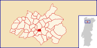
Basisdaten Region: Norte Unterregion: Tâmega Distrikt: Porto Concelho: Amarante Koordinaten: 41° 15′ N, 8° 3′ W41.256395-8.053187Koordinaten: 41° 15′ N, 8° 3′ W Einwohner: 904 (Stand: 2001) Fläche: 2,5 km² Bevölkerungsdichte: 362 Einwohner pro km² Politik Adresse der Gemeindeverwaltung: Junta de Freguesia de Padronelo
Lugar da Devesa
4600-703 PadroneloPadronelo ist eine Gemeinde im Nordwesten Portugals.
Padronelo gehört zum Kreis Amarante im Distrikt Porto, besitzt eine Fläche von 2,5 km² und hat 905 Einwohner (Stand: 2001).[1]
Einzelnachweise
- ↑ Daten zu Padronelo. alea.pt, abgerufen am 12. Juni 2011 (englisch).
Weblinks
- Karte der Freguesia Padronelo beim Instituto Geográfico do Exército
- Information zu Padronelo. amarante.pt, abgerufen am 12. Juni 2011 (portugiesisch).
 Freguesias im Concelho Amarante
Aboadela | Aboim | Ansiães | Ataíde | Bustelo | Canadelo | Candemil | Carneiro | Carvalho de Rei | Cepelos | Chapa | Fregim | Freixo de Baixo | Freixo de Cima | Fridão | Gatão | Gondar | Jazente | Lomba | Louredo | Lufrei | Madalena | Mancelos | Oliveira | Olo | Padronelo | Real | Rebordelo | Salvador do Monte | Sanche | Santa Cristina de Figueiró | Santiago de Figueiró | São Gonçalo | São Simão de Gouveia | Telões | Travanca | Várzea | Vila Caiz | Vila Chã do Marão | Vila Garcia
Wikimedia Foundation.
Schlagen Sie auch in anderen Wörterbüchern nach:
IP4 — Este artículo trata sobre la carretera perteneciente a la Red de Itinerarios Principales de Portugal. Para otros usos de este término, véase IP4 (desambiguación). Itinerario Principal IP4 Portugal … Wikipedia Español
Autoroute portugaise A4 — Autoroute Porto Quintanilha A 4 Longueur 88 km (223 km) De Matosinhos Intersections … Wikipédia en Français
Районы округа Порту — … Википедия
Падронелу — Район Падронелу Padronelo Герб … Википедия
Monuments of Portugal — The Monuments of Portugal were constructed throughout the Portuguese territory, and date back to the period of pre historic settlement of occupation. Subsequently, the region that is today Portugal has been colonized by many civilizations, which… … Wikipedia
List of postal codes in Portugal — Aveiro districtMealhada municipality*3050 Antes *3050 Barcouço *3050 Casal Comba *3050 Luso *3050 Mealhada *3050 Pampilhosa *3050 Vacariça *3050 Ventosa do BairroMurtosa municipality*3870 Bunheiro *3870 Monte *3870 Murtosa *3870 TorreiraOliveira… … Wikipedia
Amarante — Wappen Karte … Deutsch Wikipedia
Ansiães — Wappen Karte … Deutsch Wikipedia
Ataíde — Wappen Karte … Deutsch Wikipedia
Bustelo (Amarante) — Bustelo Wappen Karte … Deutsch Wikipedia
Padronelo


18+
© Academic, 2000-2024
- Kontaktieren Sie uns: Unterstützung, Werbung
Wörterbücher Export, schritte mit PHP, Joomla, Drupal, WordPress, MODx.