- Ungra
-
Ungra
Galt
Ugra
Hilfe zu WappenBasisdaten Staat: Rumänien Historische Region: Siebenbürgen Kreis: Brașov Koordinaten: 45° 59′ N, 25° 16′ O45.98388888888925.263888888889450Koordinaten: 45° 59′ 2″ N, 25° 15′ 50″ O Zeitzone: OEZ (UTC+2) Höhe: 450 m Fläche: 67,38 km² Einwohner: 2.036 (2002) Bevölkerungsdichte: 30 Einwohner je km² Postleitzahl: 507240 Telefonvorwahl: (+40) 02 68 Kfz-Kennzeichen: BV Struktur und Verwaltung (Stand: 2008) Gemeindeart: Gemeinde Gliederung: Ungra, Dăișoara Bürgermeister: Traian Stanciu (PSD) Postanschrift: Strada Principală, nr. 189
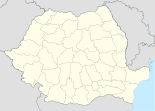
loc. Crizbav, jud. Brașov, RO–507240Ungra (deutsch Galt, såksesch Gelt, ungarisch Ugra) ist eine Gemeinde in Siebenbürgen am Fluss Alt im Kreis Brașov (Kronstadt), Rumänien.
Weblinks
Gemeinden im Kreis BrașovApața | Augustin | Bod | Bran | Budila | Bunești | Cața | Cincu | Comăna | Cristian | Crizbav | Drăguș | Dumbrăvița | Feldioara | Fundata | Hălchiu | Hărman | Hârseni | Hoghiz | Holbav | Homorod | Jibert | Lisa | Măieruș | Mândra | Moieciu | Ormeniș | Părău | Poiana Mărului | Prejmer | Racoș | Recea | Sâmbăta de Sus | Sânpetru | Șercaia | Șinca | Șinca Nouă | Șoarș | Tărlungeni | Teliu | Ticușu | Ucea | Ungra | Vama Buzăului | Viștea | Voila | Vulcan
Wikimedia Foundation.
Schlagen Sie auch in anderen Wörterbüchern nach:
Ungra — Commune … Wikipedia
Ungra — Original name in latin Ungra Name in other language Ungra State code RO Continent/City Europe/Bucharest longitude 45.98333 latitude 25.26667 altitude 452 Population 1983 Date 2012 06 12 … Cities with a population over 1000 database
Ungra, Braşov — Ungra is a commune in Braşov County, Romania.Ungra is located in Transylvania, near Rupea town. In Ungra there is a medieval Saxon church from XIII century and many old medieval houses. The village culture is very diverse, with many Romanian and… … Wikipedia
Comuna Ungra — Admin ASC 2 Code Orig. name Comuna Ungra Country and Admin Code RO.09.42156 RO … World countries Adminstrative division ASC I-II
Shinzo — マシュランボー (Mushrambo) Genre Adventure, Drama, Fantasy, Science Fiction … Wikipedia
Sigurður Kári Kristjánsson — (born May 9, 1973) is an Icelandic Member of Parliament for the Independence Party ( Sjálfstæðisflokkurinn ).Kristjánsson graduated with a law degree from the University of Iceland in 1998. He was chairman of The National Youth Organisation of… … Wikipedia
Doddakallahalli, Tumkur — Doddakalahalli (Kannada: ದೊಡ್ಡಕಲ್ಲಹಳ್ಳಿ) is a village in Kunigal taluk of Tumkur district of the Indian state of Karnataka. The name of the village is derived from the rocky landscape kallu meaning stone in Kannada. According to the 2001 census,… … Wikipedia
Mudigere, Tumkur — Mudigere is a village in Gubbi taluk in the Tumkur district in the Indian state of Karnataka. Contents 1 Geography 2 Demographics 3 Industry 4 … Wikipedia
Nittur — village … Wikipedia
Коммуны Брашова — В состав жудеца Брашов входит 48 коммун: Коммуны жудеца Брашов … Википедия


