Cottonwood (Arizona)

Cottonwood (Arizona)
Cottonwood
Yavapai County incorporated areas Cottonwood highlighted.svg
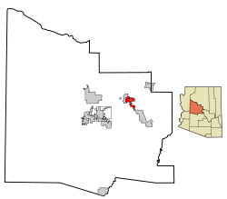
Lage im County und in Arizona
Basisdaten
Staat: Vereinigte Staaten
Bundesstaat: Arizona
County:

Yavapai County

Koordinaten: 34° 44′ N, 112° 1′ W34.73-112.021010Koordinaten: 34° 44′ N, 112° 1′ W
Zeitzone: Mountain Standard Time (UTC−7)
Einwohner: 11.171 (Stand: 2006)
Bevölkerungsdichte: 404,7 Einwohner je km²
Fläche: 27,7 km² (ca. 11 mi²)
davon 27,6 km² (ca. 11 mi²) Land
Höhe: 1010 m
Postleitzahl: 86326
Vorwahl: +1 928
FIPS: 04-16410
GNIS-ID: 0027993
Bürgermeister: Diane Joens

Cottonwood ist eine US-amerikanische Stadt in Arizona im Yavapai County. Sie hat etwa 10.400 Einwohner (Stand 2004) auf einer Fläche von 27,6 km². Durch Cottonwood verläuft die Arizona State Route 89A, an der auch die Arizona State Route 260 beginnt.


Wikimedia Foundation.

Игры ⚽ Нужен реферат?

Schlagen Sie auch in anderen Wörterbüchern nach:

  • Cottonwood, Arizona —   City   Location in Yavapai County and the state of Arizona …   Wikipedia

  • Cottonwood (Arizona) — Pour les articles homonymes, voir Cottonwood. Cottonwood est une ville située dans le comté de Yavapai dans l État de l Arizona aux États Unis. Selon l estimation du Bureau de Recensement, la population y était de 11 171 habitants en 2006.… …   Wikipédia en Français

  • Cottonwood — may refer to: Contents 1 Plants 2 Places 3 People 4 See also Plants Hibiscus tiliaceus, a flowering shrub o …   Wikipedia

  • Cottonwood — ist die englische Bezeichnung für mehrere in Nordamerika heimische Pappel Arten (Populus, Sektion Aegiros), unter anderem die Kanadische Schwarz Pappel. In Einzelfällen ist die Übersetzung Baumwollbaum zu lesen, die in anderen Quellen jedoch den… …   Deutsch Wikipedia

  • Cottonwood High School (Arizona) — Cottonwood High School was the high school in the town of Cottonwood, Arizona. It was open from 1948 to 1958, when it was consolidated into Mingus Union High School. The mascot was the Red Devils. Categories: Arizona school stubsDefunct schools… …   Wikipedia

  • Cottonwood (disambiguation) — Cottonwood is a type of poplar tree.There are also several places in the United States named Cottonwood:*Cottonwood, Alabama *Cottonwood, Arizona *Cottonwood, California *Cottonwood, Colorado *Cottonwood, Idaho *Cottonwood, Minnesota *Cottonwood …   Wikipedia

  • Arizona State Highway 89A — Karte …   Deutsch Wikipedia

  • Arizona State Route 260 — Basisdaten Gesamtlänge:  217 mi/350 km Anfangspunkt:  …   Deutsch Wikipedia

  • Arizona State Route 89A — Karte …   Deutsch Wikipedia

  • Cottonwood — Cottonwood, AZ U.S. city in Arizona Population (2000): 9179 Housing Units (2000): 4427 Land area (2000): 10.669469 sq. miles (27.633796 sq. km) Water area (2000): 0.000000 sq. miles (0.000000 sq. km) Total area (2000): 10.669469 sq. miles… …   StarDict's U.S. Gazetteer Places

Share the article and excerpts

Direct link
Do a right-click on the link above
and select “Copy Link”