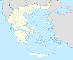
Anavryto

Anavryto
Anavryto
Αναβρυτό
Anavryto (Griechenland)
Bluedot.svg
Basisdaten
Staat: Griechenland
Region: Peloponnes
Regionalbezirk: Arkadien
Gemeinde: Megalopoli
Geographische Koordinaten: 37° 20′ N, 22° 14′ O37.340222.2345Koordinaten: 37° 20′ N, 22° 14′ O
Höhe ü. d. M.: 670 m
Einwohner: 96 (2001)

Anavryto, auch Anavrito (griechisch Αναβρυτό (n. sg.)), ist eine Ortschaft im Gemeindebezirk Falesia der Gemeinde Megalopoli in Griechenland. Sie besteht aus den Dörfern Anavryto und Kato Anavryto und hat 96 Einwohner (Stand: 2001).

Einwohnerentwicklung

Einwohnerentwicklung
Jahr Einwohner Einwohner von Anavryto Einwohner von Kato Anavryto
1920 469 - -
1981 86 - -
1991 116 83 33
2001 60 36

Weblinks


Wikimedia Foundation.

Игры ⚽ Нужен реферат?

Schlagen Sie auch in anderen Wörterbüchern nach:

  • Anavryto — (Greek, Modern: Αναβρυτό), also Anavrito, older forms: n is a community divided into two villages, Ano Anavryto which is on the western part of mount Tsiberou, and Kato Anavryto on the other side of the valley, west of Anavryto.DistanceDistance… …   Wikipedia

  • Falaisia — Gemeinde Falesia Δήμος Φαλαισίας (Φαλαισία) DEC …   Deutsch Wikipedia

  • Routsi — (Greek, Modern: Ρούτσι, Ancient/Katharevousa: on), older form Routsion is a village and is in the eastern part of the municipality of Falaisia. Distance from Megalopolis is 11 km SE. The nearby communities and villages are Perivolia to the NW,… …   Wikipedia

  • List of settlements in the Arcadia prefecture — This is a list of settlements in the prefecture of Arcadia, Greece. Contents 1 A–B 2 C–D 3 E–F 4 G–I …   Wikipedia

  • Falaisia — Infobox Greek Dimos name = Falaisia name local = Φαλαισία periph = Peloponnese prefec = Arcadia province = population = 3229 population as of = 2001 population ref = pop dens = area = elevation = 758 lat deg = 37 lat min = 17 lat hem = N lon deg …   Wikipedia

  • Anemodouri — (Greek, Modern: Ancient/Katharevousa: on from anemos wind), older form o and on is a village located on the northwestern slopes of Tsiberou in eastern Falaisia in the southwestern part of the prefecture of Arcadia, Greece. Anemodouri is linked by …   Wikipedia

  • Falesia — Stadtgemeinde Falesia (1997–2010) Δήμος Φαλαισίας (Φαλαισία) …   Deutsch Wikipedia

  • Filiates — Φιλιάτες Location …   Wikipedia

  • Mallota, Greece — Mallota Μαλλωτά Location …   Wikipedia

  • Voutsara — or Voutsaras (Greek: Βουτσαράς) is a Greek village in the Arcadia prefecture located around 10 km southeast of Megalopoli, 8 km east from the nearest interchange with the GR 7/E65 (Kalamata Megalopoli Tripoli) east of Leontari and 60 km from… …   Wikipedia

Share the article and excerpts

Direct link
Do a right-click on the link above
and select “Copy Link”