- Kongsvingerbanen
-
Oslo–Kongsvinger–Furumoen 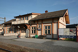 Bahnhof Skarnes
Streckenlänge: 115 km Spurweite: 1435 mm (Normalspur) Legende
Oslotunnel (1980) 
0,27 Oslo S (1854) 
Hovedbanen 20,95 Lillestrøm (1854) 
Hovedbanen/Gardermobanen 
zum Industriegebiet Lillestrøm 
24,40 Tuen (1931) 27,58 Nerdrum (1931) 29,11 Fetsund (1862) 
Glåma 29,91 Svingen (1931) 
34,19 Guttersrud (1931) 37,53 Sørumsand (1892) 
Urskog-Hølandsbanen 41,98 Blaker (1862) 45,11 Rånåsfoss (1918) 46,87 Auli (1974) 48,87 Haga (1862) 53,38 Bodung (1913) 58,46 67,17 Seterstøa (1862) 73,35 Disenå (1865) 79,24 Skarnes (1862) 87,22 Sander (1862) 92,37 Galterud (1864) 100,28 Kongsvinger (1862) Solørbanen 
107,15 Granli (1898) 112,46 Åbogen (1865) 122,15 Matrand (1865) 
127,27 Skotterud (1865) 
Vestmarkabanen 
133,08 Magnor (1865) 
135,65 Furumoen (1932) 
Värmlandsbanan nach Stockholm Die Kongsvingerbane (dt. Kongsvingerbahn) ist eine Eisenbahnstrecke in Norwegen, welche von Lillestrøm nach Kongsvinger führt. Die Strecke wurde am 3. Oktober 1862 eröffnet und ist damit Norwegens älteste Normalspurbahn. Mit der zur Kongsvingerbane gerechneten Grensebane (dt. Grenzbahn) via Furumoen (Grenzübergang) ist sie bei Charlottenberg mit dem schwedischen Eisenbahnnetz verknüpft. Im Bahnhof Kongsvinger zweigt die Solørbane nach Elverum ab.
Die Strecke ist inklusive Grensebane 115 km lang und wurde im Jahr 1951 elektrifiziert.
Die wichtigsten Halte entlang der Kongsvingerbane sind Fetsund, Sørumsand, Årnes, Skarnes und Kongsvinger. Von Oslo aus verkehren auf der Strecke Lokalzüge der NSB bis Kongsvinger, Züge von Värmlandstrafik nach Karlstad und Züge der SJ nach Stockholm. Früher verkehrten auch Züge der Betreiber Linx und Kungspilen.
Weblinks
 Commons: Kongsvingerbanen – Sammlung von Bildern, Videos und Audiodateien
 Eisenbahnstrecken in Norwegen
Haupt-/Nebenbahnen: Alnabanen | Arendalsbanen | Askerbanen | Bergensbanen | Bratsbergbanen | Brevikbanen | Dalane–Suldallinjen | Dovrebanen | Drammenbanen | Flåmsbana | Gardermobanen | Gjøvikbanen | Hortenlinjen | Hovedbanen | Indre Østfoldbanen | Jevnakerbanen | Jærbanen | Kirkenes–Bjørnevatnbanen (reakt.) | Kongsvingerbanen | Loenga–Alnabrulinjen | Meråkerbanen | Nordlandsbanen | Ofotbanen | Randsfjordbanen | Raumabanen | Rørosbanen | Skøyen–Filipstadlinjen | Solørbanen | Spikkestadlinjen | Stavnebanen | Sørlandsbanen | Vestfoldbanen | Østfoldbanen
Museumsbahnen: Krøderbanen | Nesttun–Osbanen | Rjukanbanen | Setesdalsbanen | Thamshavnbanen | Urskog–Hølandsbanen | Valdresbanen | Gamle Vossebanen
Stillgelegte Bahnen: Askim–Solbergfosslinjen | Flekkefjordbanen | Grimstadbanen | Hardangerbanen | Havnebanen | Holmestrand–Vittingfossbanen | Kragerøbanen | Lierbanen | Lillesand–Flaksvandbanen | Namsosbanen | Numedalsbanen | Røykenvikbanen | Setesdalsbanen | Skreiabanen | Sperillbanen | Sulitjelmabanen | Tinnosbanen | Treungenbanen | Tønsberg–Eidsfossbanen | Vestmarkabanen | Ålgårdbanen
Wikimedia Foundation.
Schlagen Sie auch in anderen Wörterbüchern nach:
Bahnstrecke Oslo S–Kongsvinger — Kongsvingerbanen Streckenlänge: 115 km Spurweite: 1435 mm (Normalspur) Legende … Deutsch Wikipedia
Grensebane — Kongsvingerbanen Streckenlänge: 115 km Spurweite: 1435 mm (Normalspur) Legende … Deutsch Wikipedia
Disenå Station — Coordinates: 60°12′32″N 11°38′32″E / 60.20902°N 11.64232°E / 60.20902; 11.64232 … Wikipedia
Kongsvinger Line — Infobox rail line name = Kongsvinger Line nativename = Kongsvingerbanen caption = type = Railway system = Norwegian railway status = start = Lillestrøm Station end = Charlottenberg Station stations = 20 open = 1862 close = owner = Norwegian… … Wikipedia
Kongsvinger Station — Infobox Norwegian station name = Kongsvinger caption = locale = Kongsvinger municipality = Kongsvinger line = Kongsvingerbanen Solørbanen distance = 100.28 km elevation = 148.1 m asl coordinates = coord|60|11|15|N|12|0|13|E|type:railwaystation… … Wikipedia
Årnes Station — Infobox Norwegian station name = Årnes caption = locale = Årnes municipality = Nes line = Kongsvingerbanen distance = 58.46 km elevation = 127.1 m coordinates = start = October 3, 1862 architect = platforms = 2 owner = operator = Norges… … Wikipedia
Seterstøa Station — Infobox Norwegian station name = Seterstøa caption = locale = Seterstøa municipality = Nes line = Kongsvingerbanen distance = 67.17 km elevation = 135.4 m coordinates = start = October 3, 1862 architect = platforms = 2 owner = operator = Norges… … Wikipedia
Skarnes Station — Infobox Norwegian station name = Skarnes caption = locale = Skarnes municipality = Sør Odal line = Kongsvingerbanen distance = 79.24 km elevation = 138.0 m coordinates = start = October 3, 1862 architect = platforms = 1 owner = operator = Norges… … Wikipedia
Sander Station — Infobox Norwegian station name = Sander caption = locale = Sander municipality = Sør Odal line = Kongsvingerbanen distance = 87.22 km elevation = 141.7 m coordinates = start = October 3, 1862 architect = platforms = 2 owner = operator = Norges… … Wikipedia
Nerdrum Station — Nerdrum Location Place Fetsund Municipality Fet Line(s) Kongsvingerbanen Distance 24.43 km Service … Wikipedia
Kongsvingerbanen

18+
© Academic, 2000-2024
- Kontaktieren Sie uns: Unterstützung, Werbung
Wörterbücher Export, schritte mit PHP, Joomla, Drupal, WordPress, MODx.