- Pike County (Indiana)
-
Verwaltung US-Bundesstaat: Indiana Verwaltungssitz: Petersburg Adresse des
Verwaltungssitzes:County Courthouse
801 Main Street
Petersburg, IN 47567-1249Gründung: 21. Dezember 1816 Gebildet aus: Gibson County
Perry CountyVorwahl: 001 812 Demographie Einwohner: 12.837 (2000) Bevölkerungsdichte: 14,8 Einwohner/km² Geographie Fläche gesamt: 883 km² Wasserfläche: 13 km² Karte 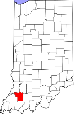
Website: www.pikecountyin.org Pike County[1] ist ein County im Bundesstaat Indiana der Vereinigten Staaten von Amerika. Der Verwaltungssitz (County Seat) ist Petersburg.
Inhaltsverzeichnis
Geografie
Das County liegt im Südwesten von Indiana, ist im Westen etwa 35 km von Illinois, im Süden etwa 60 km von Kentucky entfernt und hat eine Fläche von 883 Quadratkilometern, wovon 13 Quadratkilometer Wasserfläche sind. Es grenzt im Uhrzeigersinn an folgende Countys: Daviess County, Dubois County, Warrick County, Gibson County und Knox County.
Geschichte
Pike County wurde am 21. Dezember 1816 aus Teilen des Gibson County und des Perry County gebildet. Benannt wurde es nach Zebulon Pike, einem Forschungsreisenden, der Pikes Peak entdeckte.
Demografische Daten
Historische Einwohnerzahlen Census Einwohner ± in % 1820 1472 — 1830 2475 70 % 1840 4769 90 % 1850 7720 60 % 1860 10.078 30 % 1870 13.779 40 % 1880 16.383 20 % 1890 18.544 10 % 1900 20.486 10 % 1910 19.684 -4 % 1920 18.684 -5 % 1930 16.361 -10 % 1940 17.045 4 % 1950 14.995 -10 % 1960 12.797 -10 % 1970 12.281 -4 % 1980 13.465 10 % 1990 12.509 -7 % 2000 12.837 3 % Vor 1900[2] 1900–1990[3]
Nach der Volkszählung im Jahr 2000 lebten im Pike County 12.837 Menschen in 5.119 Haushalten und 3.680 Familien. Die Bevölkerungsdichte betrug 15 Einwohner pro Quadratkilometer. Ethnisch betrachtet setzte sich die Bevölkerung zusammen aus 99,10 Prozent Weißen, 0,10 Prozent Afroamerikanern, 0,12 Prozent amerikanischen Ureinwohnern, 0,14 Prozent Asiaten, 0,04 Prozent Bewohnern aus dem pazifischen Inselraum und 0,10 Prozent aus anderen ethnischen Gruppen; 0,39 Prozent stammten von zwei oder mehr Ethnien ab. 0,58 Prozent der Bevölkerung waren spanischer oder lateinamerikanischer Abstammung.
 Alterspyramide für das Pike County
Von den 5.119 Haushalten hatten 30,6 Prozent Kinder unter 18 Jahre, die mit ihnen im Haushalt lebten. 59,8 Prozent waren verheiratete, zusammenlebende Paare, 8,4 Prozent waren allein erziehende Mütter und 28,1 Prozent waren keine Familien. 24,9 Prozent waren Singlehaushalte und in 11,8 Prozent lebten Menschen mit 65 Jahren oder darüber. Die Durchschnittshaushaltsgröße betrug 2,47 und die durchschnittliche Familiengröße lag bei 2,94 Personen.
23,9 Prozent der Bevölkerung waren unter 18 Jahre alt, 7,7 Prozent zwischen 18 und 24, 28,2 Prozent zwischen 25 und 44 Jahre. 24,9 Prozent zwischen 45 und 64 und 15,3 Prozent waren 65 Jahre alt oder älter. Das Durchschnittsalter betrug 39 Jahre. Auf 100 weibliche Personen kamen 99,9 männliche Personen. Auf 100 Frauen im Alter von 18 Jahren und darüber kamen 96,8 Männer.
Das jährliche Durchschnittseinkommen eines Haushalts betrug 34.759 US-Dollar, das Durchschnittseinkommen der Familien 41.420 USD. Männer hatten ein Durchschnittseinkommen von 31.967 USD, Frauen 20.970 USD. Der Pro-Kopf-Einkommen betrug 16.217 USD. 5,1 Prozent der Familien und 8,0 Prozent der Bevölkerung lebten unterhalb der Armutsgrenze. [4]
Siehe auch
Einzelnachweise
- ↑ GNIS-ID: 450381. Abgerufen am 22. Februar 2011 (englisch).
- ↑ U.S. Census Bureau - Census of Population and Housing. Abgerufen am 15. März 2011
- ↑ Auszug aus Census.gov. Abgerufen am 16. Februar 2011
- ↑ Pike County, Indiana, Datenblatt mit den Ergebnissen der Volkszählung im Jahre 2000 bei factfinder.census.gov.

Liste der Countys in Indiana
Adams | Allen | Bartholomew | Benton | Blackford | Boone | Brown | Carroll | Cass | Clark | Clay | Clinton | Crawford | Daviess | DeKalb | Dearborn | Decatur | Delaware | Dubois | Elkhart | Fayette | Floyd | Fountain | Franklin | Fulton | Gibson | Grant | Greene | Hamilton | Hancock | Harrison | Hendricks | Henry | Howard | Huntington | Jackson | Jasper | Jay | Jefferson | Jennings | Johnson | Knox | Kosciusko | LaGrange | Lake | LaPorte | Lawrence | Madison | Marion | Marshall | Martin | Miami | Monroe | Montgomery | Morgan | Newton | Noble | Ohio | Orange | Owen | Parke | Perry | Pike | Porter | Posey | Pulaski | Putnam | Randolph | Ripley | Rush | St. Joseph | Scott | Shelby | Spencer | Starke | Steuben | Sullivan | Switzerland | Tippecanoe | Tipton | Union | Vanderburgh | Vermillion | Vigo | Wabash | Warren | Warrick | Washington | Wayne | Wells | White | Whitley
Wikimedia Foundation.
Schlagen Sie auch in anderen Wörterbüchern nach:
Pike County, Indiana — Infobox U.S. County county = Pike County state = Indiana founded year = 1817 founded date = seat wl = Petersburg largest city wl = city type = town area total sq mi = 341 area total km2 = 883 area land sq mi = 336 area land km2 = 871 area water… … Wikipedia
National Register of Historic Places listings in Pike County, Indiana — Location of Pike County in Indiana This is a list of the National Register of Historic Places listings in Pike County, Indiana. This is intended to be a complete list of the properties and districts on the National Register of Historic Places in… … Wikipedia
Clay Township, Pike County, Indiana — Clay Township Township Location in Pike County … Wikipedia
Marion Township, Pike County, Indiana — Marion Township Township Location in Pike County … Wikipedia
Monroe Township, Pike County, Indiana — Monroe Township Township Location in Pike County … Wikipedia
Jefferson Township, Pike County, Indiana — Infobox Settlement official name = Jefferson Township settlement type = Township nickname = motto = imagesize = image caption = image mapsize = map caption = mapsize1 = map caption1 = subdivision type = Country subdivision name = United States… … Wikipedia
Lockhart Township, Pike County, Indiana — Infobox Settlement official name = Lockhart Township settlement type = Township nickname = motto = imagesize = image caption = image mapsize = map caption = mapsize1 = map caption1 = subdivision type = Country subdivision name = United States… … Wikipedia
Logan Township, Pike County, Indiana — Infobox Settlement official name = Logan Township settlement type = Township nickname = motto = imagesize = image caption = image mapsize = map caption = mapsize1 = map caption1 = subdivision type = Country subdivision name = United States… … Wikipedia
Madison Township, Pike County, Indiana — Infobox Settlement official name = Madison Township settlement type = Township nickname = motto = imagesize = image caption = image mapsize = map caption = mapsize1 = map caption1 = subdivision type = Country subdivision name = United States… … Wikipedia
Patoka Township, Pike County, Indiana — Infobox Settlement official name = Patoka Township settlement type = Township nickname = motto = imagesize = image caption = image mapsize = map caption = mapsize1 = map caption1 = subdivision type = Country subdivision name = United States… … Wikipedia
Pike County (Indiana)


18+
© Academic, 2000-2024
- Kontaktieren Sie uns: Unterstützung, Werbung
Wörterbücher Export, schritte mit PHP, Joomla, Drupal, WordPress, MODx.