- Gucha District
-
Gucha District Basisdaten Einwohner
- Bevölkerungsdichte460.939 Einw. [1]
697 Einw./km²Fläche 661 km² Koordinaten 0° 14′ N, 34° 16′ O0.2333333333333334.266666666667Koordinaten: 0° 14′ N, 34° 16′ O 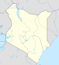

Gucha District Politik Provinz Nyanza Der Gucha District ist ein Distrikt in der Provinz Nyanza in Kenia. Die Hauptstadt des Distrikts ist Ogembo.
Der Distrikt ist in die Divisionen Etago, Kenyenya, Nyacheki, Nyamache, Nyamarambe, Ogembo und Sameta unterteilt.
Inhaltsverzeichnis
Infrastruktur
In Ogembo befindet sich das Gucha District Hospital mit 50 Betten.[2]
Religion
Der Distrikt gehört zum Bistum Kisii der Römisch-katholischen Kirche. In der Division Etago besteht seit 1992 die Pfarrei St. Thomas Aposde.[3]
Weblinks
Einzelnachweise
- ↑ statoids.com, abgerufen am 31. Oktober 2010.
- ↑ ehealth.or.ke, abgerufen am 1. April 2011.
- ↑ Homepage der römisch-katholischen Kirche in Kenia, abgerufen am 1. April 2011.
 Distrikte in Kenia
Central Province: Kiambu | Kirinyaga | Maragua | Murang’a | Nyandarua | Nyeri | Thika
Coast Province: Kilifi | Kwale | Lamu | Malindi | Mombasa | Taita-Taveta | Tana River
Eastern Province: Embu | Isiolo | Kitui | Machakos | Makueni | Marsabit | Mbeere | Meru Central | Meru North | Meru South | Moyale | Mwingi | Tharaka
North-Eastern Province: Garissa | Ijara | Wajir | Mandera
Nyanza Province: Bondo | Gucha | Homa Bay | Kisii Central | Kisumu | Kuria | Migori | Nyamira | Nyando | Rachuonyo | Siaya | Suba
Rift Valley Province: Baringo | Bomet | Buret | Kajiado | Keiyo | Kericho | Koibatek | Laikipia | Marakwet | Nakuru | Nandi | Narok | Samburu | Trans Mara | Trans-Nzoia | Turkana | Uasin Gishu | West Pokot
Western Province: Bungoma | Busia | Butere/Mumias | Kakamega | Lugari | Mount Elgon | Teso | Vihiga
Nairobi: Nairobi
Wikimedia Foundation.
Schlagen Sie auch in anderen Wörterbüchern nach:
Gucha District — is a district in Nyanza Province, western Kenya. It is also known by the name: South Kisii District or Ogembo District. Its population is approximately 461,000 (as of 1999) [1]. Its district headquarters are at Ogembo which houses more than a… … Wikipedia
Gucha District — Admin ASC 2 Code Orig. name Gucha District Country and Admin Code KE.07.7667668 KE … World countries Adminstrative division ASC I-II
Gucha — may refer to:*Gucha River, a river in Kenya *Gucha District, in western Kenya*English transcription for Guča, a town in western Serbia, with ist yearly **Gucha Festival, the trumpet festival [http://www.gucha.com/] **Gucha!, the 2006 film… … Wikipedia
Gucha River — Gucha River, referred to River Kuja by Luo community starts from the highlands of Nyamira District passing through the heart of Gucha District running west into Lake Victoria. Streams, as it runs across the Gusii Land come together and one of… … Wikipedia
Kisii Central District — Basisdaten Einwohner Bevölkerungsdichte 491.786 Einw. 758 Einw./km² Fläche 649 km² Koordinaten … Deutsch Wikipedia
Kisii District — is one of the twelve districts of Nyanza Province in southwest Kenya, and is divided into five local authorities and eleven administrative districts. The district capital is Kisii. The district is mostly hilly and is dissected by rivers flowing… … Wikipedia
Meru South District — Basisdaten Einwohner Bevölkerungsdichte 205.451 Einw. 188 Einw./km² Fläche 1093 km² Koordinaten … Deutsch Wikipedia
Murang’a District — Basisdaten Einwohner Bevölkerungsdichte 348.304 Einw. [1] 375 Einw./km² Fläche 930 km² Koordinaten … Deutsch Wikipedia
Bondo District — Basisdaten Einwohner Bevölkerungsdichte 238.780 Einw. [1] 242 Einw./km² Fläche 987 km² Koordinaten … Deutsch Wikipedia
Siaya District — Basisdaten Einwohner Bevölkerungsdichte 480.184 Einw. [1] 316 Einw./km² Fläche 1520 km² Koordinaten … Deutsch Wikipedia
Gucha District

18+
© Academic, 2000-2024
- Kontaktieren Sie uns: Unterstützung, Werbung
Wörterbücher Export, schritte mit PHP, Joomla, Drupal, WordPress, MODx.