- Marsabit District
-
Marsabit District Basisdaten Einwohner
- Bevölkerungsdichte121.478 Einw.
2 Einw./km²Fläche 61.296 km² Koordinaten 2° 19′ N, 37° 58′ O2.316666666666737.966666666667Koordinaten: 2° 19′ N, 37° 58′ O 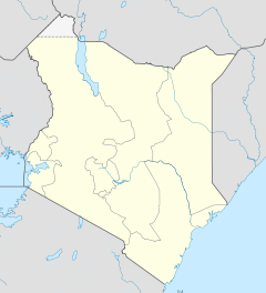

Marsabit District Politik Provinz Eastern  Lage des Marsabit Districts in Kenia
Der Marsabit District ist ein Bezirk in der Provinz Eastern in Kenia. Die Hauptstadt ist Marsabit. Im Distrikt lebten 1999 121.487 Menschen auf 61.296 km².[1] Bis 1995 bildeten der Marsabit District und der Moyale District einen Bezirk.[2] Der Marsabit District ist nach dem Turkana District der zweitgrößte Bezirk Kenias und nimmt mehr als 10 % der Fläche des gesamten Landes ein. Im Westen grenzt der Bezirk an den Turkana-See. Marsabit District gliedert sich in die Divisionen Central, Gadamoji, Laisamis, Maikona, Loiyangalani und North Horr auf. Am Mount Marsabit liegt der 1550 km² große Marsabit-Nationalpark.
Das Klima im Bezirk ist arid, nur 10 % der Fläche gilt als landwirtschaftlich nutzbar. Im Jahr 2003 lebten 45 % der Einwohner unterhalb der Armutsgrenze, 90 % der Bevölkerung hat keinen direkten Zugang zu sauberem Wasser. Mehr als 80 % der Bevölkerung sind des Lesens und Schreibens nicht mächtig.[3]
Wirtschaft
Die Menschen im Marsabit District leben hauptsächlich von der Viehzucht. Dabei werden hauptsächlich Zebus, Ziegen und Schafe gezüchtet. Auf den wenigen landwirtschaftlich nutzbaren Flächen werden neben Mais Bohnen und Getreide angebaut, außerdem Kaffeebohnen, Kath und Hülsenfrüchte. Am Turkana-See wird Fischfang betrieben.
Gesundheitswesen
Der Bezirk verfügt über das Marsabit District Hospital mit 86 Betten in der Hauptstadt Marsabit.[4] Mehr als 20 % der Kinder waren im Jahr 2003 untergewichtig, 8,6 % der Kinder versterben vor ihrem 5. Geburtstag.[3]
Einzelnachweise
- ↑ statoids.com, abgerufen am 23. Juni 2011.
- ↑ Bill Derman, Rie Odgaard, Espen Sjarstaad: Conflicts over land and water. Michigan State University Press, 2007, ISBN 978-1-86914-129-5. hier online bei books.google, abgerufen am 24. Juni 2011.
- ↑ a b Marsabit District bei kenyafoodsecurity.org, abgerufen am 24. Juni 2011.
- ↑ Eintrag auf ehealth.or.ke, abgerufen am 24. Juni 2011.
 Distrikte in Kenia
Central Province: Kiambu | Kirinyaga | Maragua | Murang’a | Nyandarua | Nyeri | Thika
Coast Province: Kilifi | Kwale | Lamu | Malindi | Mombasa | Taita-Taveta | Tana River
Eastern Province: Embu | Isiolo | Kitui | Machakos | Makueni | Marsabit | Mbeere | Meru Central | Meru North | Meru South | Moyale | Mwingi | Tharaka
North-Eastern Province: Garissa | Ijara | Wajir | Mandera
Nyanza Province: Bondo | Gucha | Homa Bay | Kisii Central | Kisumu | Kuria | Migori | Nyamira | Nyando | Rachuonyo | Siaya | Suba
Rift Valley Province: Baringo | Bomet | Buret | Kajiado | Keiyo | Kericho | Koibatek | Laikipia | Marakwet | Nakuru | Nandi | Narok | Samburu | Trans Mara | Trans-Nzoia | Turkana | Uasin Gishu | West Pokot
Western Province: Bungoma | Busia | Butere/Mumias | Kakamega | Lugari | Mount Elgon | Teso | Vihiga
Nairobi: Nairobi
Wikimedia Foundation.
Schlagen Sie auch in anderen Wörterbüchern nach:
Marsabit District — District Coordinates … Wikipedia
Marsabit — Basisdaten Einwohner 30.000 Einw. Koordinaten … Deutsch Wikipedia
Marsabit Airport — IATA: RBT – ICAO: HKMB … Wikipedia
Marsabit National Park — Marsabit National Reserve … Wikipedia
Marsabit — is a town in northern Kenya, located 170 km east of the center of the East African Rift at 37°58 E, 2°19 N (37.97°E, 2.32 N). It is located in the Eastern Province and is almost surrounded by the Marsabit National Park and Reserve. It serves … Wikipedia
Mount Marsabit — Satellite image of Marsabit Elevation 1,707 m (5,600 ft) … Wikipedia
Turkana District — is an administrative district in the Rift Valley Province of Kenya. Turkana is the northwesternmost district in Kenya. It has an international border with three countries: Uganda, Sudan and Ethiopia. Its neighbouring districts in Kenya are West… … Wikipedia
Mbeere District — Cumulative rainfall at Masinga dam, Kenya. Mbeere District is an administrative district in the Eastern Province of Kenya. Its capital town is Siakago. The district has a population of 170,950 and an area of 2,093 km².[1] … Wikipedia
Mombasa District — District … Wikipedia
Mount Elgon District — (Mt. Elgon District) is an administrative district in the Western Province of Kenya. Its capital town is Kapsokwony. Contents 1 Geography and demographics 2 Government 3 Parliamentary representation … Wikipedia
Marsabit District


18+
© Academic, 2000-2024
- Kontaktieren Sie uns: Unterstützung, Werbung
Wörterbücher Export, schritte mit PHP, Joomla, Drupal, WordPress, MODx.