- Mt. Natib
-
Mount Natib 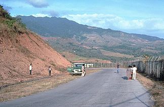
Blick auf den Mt. Natib
Höhe 1.253 m Lage Insel Luzon, Philippinen Gebirge Zambales-Bergen,Philippinische Kordilleren Geographische Lage 14° 42′ 43″ N, 120° 24′ 4″ O14.711944444444120.401111111111253Koordinaten: 14° 42′ 43″ N, 120° 24′ 4″ O 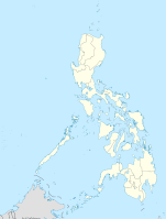

Typ Schichtvulkan Gestein Andesit, Dazit Der Mount Natib ist ein erloschener Schichtvulkan, der eine Höhe von 1.253 Meter über dem Meeresspiegel erreicht. Er liegt in den Zambales-Bergen, am nördlichen Ende der Bataan Halbinsel im Bataan Natural Park, südlich des Pinatubo Vulkans. Im Gipfelbereich des Natib erstreckt sich eine 6x7 km große Caldera und die kleinere Pasukulan Caldera.
Ein Ausbruch des Natib ist nicht bekannt, es wird jedoch vermutet das der letzte Ausbruch sich im späten Pleistozän oder der frühen Holozän ereignet hatte, eine genauere Untersuchung und Datierung steht noch aus. Im Bereich des Natib befinden sich mit den Mamot-, Tigulangin-, Uyong- und Paipit Springs mehrere Thermalquellen, deren Wassertemperatur zwischen 30 und 56° Celsius beträgt.
Der Natib wird vom „Philippine Institute of Volcanology and Seismology“ als „potenziell aktiv“ eingestuft.
Weblinks
- Mt. Natib im Global Volcanism Program der Smithsonian Institution (englisch)
- https://sites.google.com/a/bataan.gov.ph/tourism/mt-natib
- Philippine Institute of Volcanology and Seismology: http://volcano.phivolcs.dost.gov.ph/update_VMEPD/Volcano/VolcanoList/natib.htm
Kategorien:- Eintausender
- Berg in Asien
- Berg auf den Philippinen
- Schichtvulkan


Wikimedia Foundation.