- Senohrad
-
Senohrad
Wappen Karte 
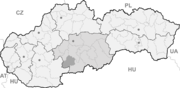

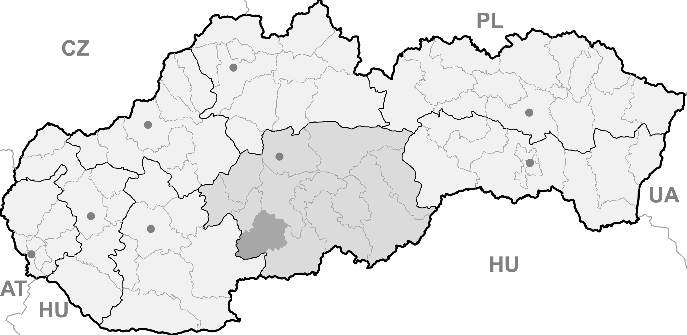
Senohrad BasisdatenKraj: Banskobystrický kraj Okres: Krupina Region: Poiplie Fläche: 15,200 km² Einwohner: 768 (31. Dez. 2010) Bevölkerungsdichte: 50,53 Einwohner je km² Höhe: 592 m n.m. Postleitzahl: 962 43 Telefonvorwahl: 0 45 Geographische Lage: 48° 21′ N, 19° 12′ O48.357519.197222222222592Koordinaten: 48° 21′ 27″ N, 19° 11′ 50″ O Kfz-Kennzeichen: KA Gemeindekennziffer: 518751 StrukturGemeindeart: Gemeinde Verwaltung (Stand: November 2011)Bürgermeister: Oľga Bartková Adresse: Obecný úrad Senohrad
č. 151
962 43 SenohradWebpräsenz: www.senohrad.sk Gemeindeinformation
auf portal.gov.skStatistikinformation
auf statistics.skSenohrad (bis 1927 slowakisch „Senohrady“; ungarisch Szénavár – bis 1892 Szenograd) ist ein Ort und eine Gemeinde in der Mitte der Slowakei, mit 768 Einwohnern (Stand 31. Dezember 2010) und liegt im Okres Krupina, einem Kreis des Banskobystrický kraj. Der Name des Ortes bedeutet wörtlich „Heuburg“.
Inhaltsverzeichnis
Geographie
Senohrad liegt im Hochland Krupinská planina im nach Süden verlaufenden Tal des Baches Litava, auf einer Höhe von 592 m n.m. und liegt gleich neben dem Militärgelände Lešť. Das Ortszentrum ist 15 Kilometer von Krupina und 31 Kilometer von Zvolen entfernt.
Der Regionalzugehörigkeit nach gehört Senohrad zur Landschaft Hont.
Geschichte
Auf dem Gemeindegebiet gibt es Funde aus der Römer-Zeit (2./3. Jahrhundert). Der Ort selbst wurde zum ersten Mal 1135 als Zenerag erwähnt, 1262 dann als Senograd. 1779 brach im Ort ein vernichtendes Feuer aus, das die ganze Ortschaft verwüstete. Die Bevölkerung beschäftigte sich mit Landwirtschaft, Schaf- und Viehzucht, zudem gab es auch einige Schmiede.
Bauwerke
- barocke römisch-katholische Kirche aus dem Jahr 1768
- barocke Kapelle aus dem Jahr 1748
Persönlichkeiten
- Andrej Kmeť, slowakischer Botaniker, Ethnograph und Geologe, war im Ort tätig
Gemeinden im Okres KrupinaBzovík | Cerovo | Čabradský Vrbovok | Čekovce | Devičie | Dolné Mladonice (Untermladunitz) | Dolný Badín (Unterbadin) | Domaníky | Drážovce (Dahowitz) | Drienovo | Dudince (Dudintze) | Hontianske Moravce | Hontianske Nemce (Nemtze) | Hontianske Tesáre (Dessir) | Horné Mladonice (Obermladunitz) | Horný Badín (Oberbadin) | Jalšovík | Kozí Vrbovok | Kráľovce-Krnišov | Krupina (Karpfen) | Lackov | Ladzany (Lasan) | Lišov | Litava | Medovarce (Medowaritz) | Rykynčice (Ruckinschitz) | Sebechleby (Siebenbrot) | Selce | Senohrad | Sudince (Sedimitz) | Súdovce (Sudowatz) | Terany (Terin) | Trpín | Uňatín | Zemiansky Vrbovok | Žibritov
Wikimedia Foundation.
Schlagen Sie auch in anderen Wörterbüchern nach:
Senohrad — (Village) Administration Pays Slovaquie … Wikipédia en Français
Senohrad — is a village and municipality in the Krupina District of the Banská Bystrica Region of Slovakia … Wikipedia
Banská Bystrica Region — Geobox | Region name = Banská Bystrica other name = category = Region image caption = image caption = symbol = symbol type = Coat of arms etymology = official name = motto = nickname = country = Slovakia country state = region = district =… … Wikipedia
Dudince — Coordinates: 48°10′00″N 18°52′58″E / 48.1666667°N 18.88278°E / 48.1666667; 18.88278 … Wikipedia
Krupina District — Infobox Slovak district subject name = Krupina District region district slovak region = Banská Bystrica Region population = 22,841 (2001) prefix = ? area = 585 car plate = KA image location = Okres krupina.png Krupina District ( okres Krupina )… … Wikipedia
Cerovo — Krupina in the Banská Bystrica Region Cerovo (earlier Čerové, Čerowo; Hungarian: Ceri) is a village and municipality in the Krupina District of the Banská Bystrica Region of Slovakia. History The village was first … Wikipedia
Devičie — Krupina in the Banská Bystrica Region Devičie (Hungarian: Devicse) is a village and municipality in the Krupina District of the Banská Bystrica Region of Slovakia. History Settlements from the Bronze Age … Wikipedia
Dolné Mladonice — Krupina in the Banská Bystrica Region Dolné Mladonice (Hungarian: Alsólégénd) is a village and municipality in the Krupina District of the Banská Bystrica Region of Slovakia. History In historical record … Wikipedia
Dolný Badín — Krupina in the Banská Bystrica Region Dolný Badín (Hungarian: Alsóbágyon, earlier Alsóbadin) is a village and municipality in the Krupina District of the Banská Bystrica Region of Slovakia. History The area of the village … Wikipedia
Domaníky — A view of Domaníky Krupina in the Banská Bystrica Region … Wikipedia
Senohrad

18+
© Academic, 2000-2024
- Kontaktieren Sie uns: Unterstützung, Werbung
Wörterbücher Export, schritte mit PHP, Joomla, Drupal, WordPress, MODx.